


125 Things to do near Norris Geyser Basin, Wyoming 82190
first prev 1 2 3 4 5 6 7 next lastShowing results within 50 miles Distance miles of Norris Geyser Basin, Wyoming 82190, USA City, Zip, or Address

Heart Lake Trail
Grant Village, Yellowstone National Park
28.7 miles SThe trail is very clear and leads to a moderate eight mile hike to Heart Lake. This hike has many possibilities. Day hikers need to push their time to make sure they are on the trail early to allow...
Backpack, Camp, Hike, Hot Springs 10.1 mi
Sky Rim Trail to Sheep Mountain
Big Sky, Montana
29.3 miles NWSky Rim Trail to Sheep Mountain is a challenging hike with stunning and famous views. This 10 mile out-and-back trail starts at Dailey Creek Trailhead (WK1). The trail follows Dailey Creek over...
Backpack, Hike
Targhee Creek Trail
Island Park, Idaho
30.1 miles WSpecial attractions along the trail include five alpine lakes amid the mountains, abundant wildlife, wildflowers, and great scenic views of the mountains and valley floor. The Targhee...
Mountain Bike
Daly Creek
Gallatin Gateway, Montana
30.8 miles NWDaly Creek Trail is a 5.2 mile out and back trail located near Gallatin Gateway, Montana and is good for all skill levels. The trail is primarily used for hiking and is accessible from May until...
Hike 0.6-1.5 mi
Trout Lake and Buck Lake
Tower Junction, Yellowstone National Park
30.9 miles NEThe Trout Lake trail is a steep 1/2-mile trail through a Douglas fir forest which leads to the lake. Trout Lake is also known to be called Fish Lake and Soda Butte Lake .The most difficult...
Hike 0.1 mi
Lewis Lake Campground
Grant Village, Yellowstone National Park
30.9 miles SLewis Lake is located in the southern part of Yellowstone National Park. It is 4 miles southeast of Shoshone Lake. Lewis Lake offers a plethora great water activities. This lake offers...
Camp, Canoe, Kayak
Big Springs
Island Park, Idaho
31.5 miles SWThere's also a great little walking trail along the river with placards that tell about the ecosystem and history of the area. There's about a 1/2 mile that's paved and then a 1/2 mile...
Camp, Hike
Pebble Creek Campground
Northeast Entrance, Yellowstone National Park
31.8 miles NEPebble Creek is a popular campground for fishermen and those seeking a more quiet and smaller campground in Yellowstone National Park. The campsites can fill very early, so get there before 11 AM...
Camp 3.3 mi
Avalanche Peak Trail
Cody, Wyoming
32.7 miles SEAvalanche Peak Trail is a 4 mile trail to the peak of Avalanche Mountain. This is considered difficult because hikers will climb 2,100 feet in 2 miles. It is recommended that hikers bring...
Hike
Cabin Creek
West Yellowstone, Montana
32.9 miles WStarts out as a nice, buff trail. After a mile or two, there are a lot of tough creek crossings and when I rode it in 2010 there were a lot of trees down. This was from a recent...
Mountain Bike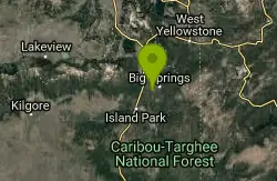
Boundary Trail
Island Park, Idaho
33.6 miles SWBoundary Trail, (Trail #272 and #244) is a 37 mile loop trail that allows stock travel, mountain bike, motorcycle and ATV travel. This trail can be reached by several trailheads,...
Mountain Bike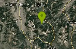
Little Wapiti
Gallatin Gateway, Montana
35.6 miles NWThe climb is partially double track. The descent is narrow, at times rocky, singletrack. Gorgeous views. At 9,000 plus feet...wolf tracks, too.
Mountain Bike
Sheep Creek Trail
36.4 miles W
The trail has a few interesting spots (rocks, roots, etc.), but mostly it's pretty simple and straightforward. A pretty good climb, especially the last few hundred yards to the lake....
Mountain Bike
Upper Coffee Pot Campground
Island Park, Idaho
36.4 miles SWUpper Coffeepot Campground stretches along a floatable section of Henry's Fork of the Snake River. A mixed growth lodgepole pine forest provides partial shade and summer wildflowers are...
Camp, Canoe
Coffee Pot Rapids Trail
Island Park, Idaho
36.5 miles SWHiker and fisherman parking is available at the campground entrance. Coffee Pot Rapids trail is 2.2 miles in length, is a non-motorized trail that follows the Henry's Fork of the Snake...
Mountain Bike
Mile Creek Trail
36.5 miles W
It is important to note that Mile Creek Trail is part of the Continental Divide Trail system, so it connects to other trails of various difficulties. Mile Creek Trail itself is a great...
Mountain Bike
Divide Road
Island Park, Idaho
37.2 miles WDivide Road criss-crosses the Continental Divide between Montana and Idaho. I have ridden it three times and didn't see a soul each time. I saw lots of deer and elk. There are bears...
Mountain Bike
Sawtell Peak Trail
Island Park, Idaho
38.4 miles WThis trail offers great views of the valley floor, mountain peaks and wildlife. source: fs.usda.gov
Mountain Bike 4.2 mi
Lake Marie
Island Park, Idaho
38.4 miles WLake Marie sits on the North slope of Mount Jefferson in Fremont County, Idaho. The trail to get there cuts back and forth across the Idaho Montana border 4 times. Much of the trail is fairly flat...
Backpack, Hike 7.6 mi
Mount Jefferson
Island Park, Idaho
38.4 miles WMount Jefferson, at 10, 203 feet is the highest point in the Centennial Mountains, a small, local range on the border of Idaho and Montana a little west of Yellowstone. These mountains consist of a...
Hike


