


138 Hiking Trails near Dixie Mine
first prev 1 2 3 4 5 6 7 next lastShowing Hiking Trails within 50 miles Distance miles of 14464 E Golden Eagle Blvd, Fountain Hills, AZ 85268, USA City, Zip, or Address

Pinnacle Peak Trail
Scottsdale, Arizona
8.3 miles NWPinnacle Peak is a 3.5 mile out-and-back, moderate hiking trail, that includes rock climbing routes (for experienced climbers), within the Sonoran Desert. This trail, and park, in...
Hike, Horseback, Rock Climb 2.1 mi
Lower Salt River Nature Trail
Fort McDowell, Arizona
8.8 miles SEThe Lower Salt River Nature Trail is a scenic walk to take at the Tonto National Forest. This trail provides stunning views as you walk alongside the Salt River. This rustic trail is older and less...
Camp, Hike
Pima and Dynamite Trail
Scottsdale, Arizona
9.6 miles NWPima and Dynamite is an area with a network of trails for hiking, but more popularly for mountain biking, in North Scottsdale, Arizona. The area feautures a variety of trails for...
Hike, Mountain Bike
Jane Rau Brown's Canyon Trail
Scottsdale, Arizona
9.6 miles NWThe Jane Rau Brown Canyon Trail was named after Jane Rau Brown, one of the pioneers of the McDowell Sonoran Conservancy, for her determination and passion in preserving the desert and the park....
Hike, Horseback, Mountain Bike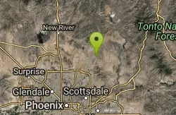
Brown Ranch Trail to Cone Mountain Trail
Scottsdale, Arizona
9.7 miles NWHike near Scottsdale, Arizona
Hike 1.5 mi
The Saddle
Mesa, Arizona
10.2 miles SESaddle trail is an intermediate mountain biking trail that connects to the greater Hawes trail network. The trail is 1.5-2mi long and it offers beautiful views of the neighboring Salt River and Red...
Hike, Mountain Bike 7.5 mi
Hawe's Loop
Mesa, Arizona
10.2 miles SEMost of the trails in the Phoenix metropolitan area were originally built by mountain bikers, and the Hawe's loop trail system and trail are no exeptions. This trail features fantastic...
Hike, Mountain Bike
Desert Trails Bike Park
Mesa, Arizona
12.1 miles SHike and Mountain Bike near Mesa, Arizona
Hike, Mountain Bike 3.6 mi
Charles M. Christiansen Memorial Trail
Phoenix, Arizona
13.0 miles WPhoenix, Arizona is home to some of the best and largest city parks in the country and the Charles M. Christiansen Memorial Trail is a great introduction to this fantastic park system. Also known as...
Hike, Horseback, Mountain Bike 7.1 mi
Trail 100
Phoenix, Arizona
13.0 miles WMountain Bikers and Hikers in Phoenix, Arizona can rejoice in the challenge that is Trail 100. Trail 100, or Charles M. Christensen Memorial Trail, is a little over 14 miles out and back in the...
Hike, Mountain Bike 2.6 mi

L.V. Yates Trail (#8)
Phoenix, Arizona
13.9 miles WThe trail is strewn with large rocks and gulleys from recent torrential rains. Not impassable on foot, but definitely some hike-a-bike areas. Keep in mind there's no ridge hiking...
Hike, Horseback, Mountain Bike
L.V. Yates to "Two Bit" Peak Loop
Phoenix, Arizona
14.0 miles WWell this time of the year there really was not a lot of wild life to see, just to hot. Starting from the 40st trailhead gave me a different view of the preserve. I really enjoyed...
Hike, Horseback
Buckhorn Campground Nature Trail
Apache Junction, Arizona
14.1 miles SECamp and Hike near Apache Junction, Arizona
Camp, Hike 1.0-1.2 mi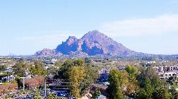
Camelback Mountain
Phoenix, Arizona
14.2 miles SWHiking After Camelback became a park in 1968, TripAdvisor advertised the hikes as one of the top 10 things to do when in Phoenix. Located right in the middle of Phoenix, Scottsdale and...
Hike, Rock Climb 1.5 mi
Moon Rock Loop
Apache Junction, Arizona
14.8 miles SELocated within the larger Usery Mountain Regional Park, the Moon Rock loop is a fast and smooth trail that adds 1.3 miles to the more famous Blevins Trail. Although the Moon Rock loop is not known as...
Hike, Horseback, Mountain Bike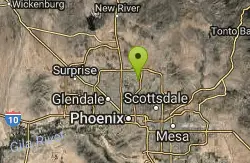
Shadow Mountain Trail
Phoenix, Arizona
14.9 miles WThis particular route trailhead starts at 23rd place and Sweetwater rd it's a great wildlife trail.
Hike 1.9 mi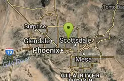
Ruth Hamilton Trail
Phoenix, Arizona
15.1 miles SWHike and Mountain Bike near Phoenix, Arizona
Hike, Mountain Bike 1.7 mi
Levee Trail
Mesa, Arizona
15.1 miles SELocated within the Usery Mountain Regional Park, the Levee trail is named so because it mostly follows the top of levee, running parallel to a large section of the channel trail and a Phoenix...
Hike, Horseback, Mountain Bike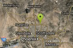
Reach 11 Trail
Phoenix, Arizona
15.1 miles WHike near Phoenix, Arizona
Hike
Crismon Wash Trail
Mesa, Arizona
15.5 miles SEThe Crismon Wash Trail is 1.8 mile trail that is accessible from the south at the Crismon road trailhead. It is also accessible from the Blevins train to the north. There are several...
Hike, Horseback, Mountain Bike


