


138 Hiking Trails near Dixie Mine
first prev 1 2 3 4 5 6 7 next lastShowing Hiking Trails within 50 miles Distance miles of 14464 E Golden Eagle Blvd, Fountain Hills, AZ 85268, USA City, Zip, or Address

Glendale Canal
Glendale, Arizona
24.2 miles WHike, Horseback, and Mountain Bike near Glendale, Arizona
Hike, Horseback, Mountain Bike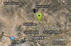
H-1 to H-4 Trails Loop
Glendale, Arizona
24.5 miles WThunderbird Park in Glendale, AZ consists of 5 H-Trails, named so because of the Hedgpeth Hills through which they wind. H-1: One-Way - 5.0 miles H-1a: Loop trail - 2.5 miles - 400...
Hike, Mountain Bike
Old Man Trail
Phoenix, Arizona
24.9 miles SWRanger Office Phone: (602) 262-7393 Hours for all trailhead areas and entrances: 5 a.m. to 7 p.m. (entrance gates close). Trails remain open until 11 p.m.
Hike
Corona Loop
Phoenix, Arizona
25.5 miles SWThis is a good hike, take plenty of water and a map or gps would be a very good ideal. I went up the day after we got over a inch of rain so lot of places were washed out. i looked like...
Hike 2.5 mi
Hidden Valley from Buena Vista Trail
Phoenix, Arizona
25.7 miles SWFor an easily accessible trail, butting right up against Phoenix’s southern border, it is truly surprising how special, quiet and natural the hike through Hidden Valley is! The path...
Hike, Mountain Bike
Corona de Loma Trail
Phoenix, Arizona
25.9 miles SWquick climb to the top of Buena Vista lookout. Great view of the east vally
Hike
Holbert-Hidden Valley-Mormon Trail Shuttle
Phoenix, Arizona
26.2 miles SWHolbert- Hidden Valley- Mormon Trail is a combination trail hike on the north side of South Mountain near Phoenix, Arizona. This trail is approximately 6.5 miles long, and is suitable for...
Hike, Mountain Bike 0.2-5.0 mi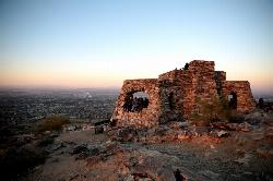
Holbert Trail to Dobbins Lookout
Phoenix, Arizona
26.3 miles SWStart out at the main entrance to South Mountain and make a left past the vistor's center. Go to the end of the road to the beginning of Holbert Trail. Get to the top and make a right to Dobbins...
Hike
Max Delta
Phoenix, Arizona
26.3 miles SWThis trails follows close to San Juan Rd. Part of the trail is rocky while other parts are well just dirt. Max Delta Trail is a 2.7 mile trail within Phoenix, Arizona on the South Mountain...
Hike 0.8-1.0 mi
Kiwanis Trail to Telegraph Pass Lookout
Phoenix, Arizona
27.0 miles SWAn ideal hike to take children on as the distance is short and the elevation gain is not extreme. Avid hikers have opportunities to embark on longer hikes into South Mountain. ... This short hike is...
Hike, Mountain Bike 1.2 mi
Ma-Ha-Tauk Trail
Phoenix, Arizona
27.4 miles SWMa-Ha-Tauk Trail can be found in South Mountain Park in Phoenix. This is a 2.5 mile, out-and-back trail. Aside from a short section of steeper incline in the first part of the hike, this is an...
Hike, Horseback 6.1 mi
Goat Hill via Telegraph Pass Trail
Phoenix, Arizona
27.9 miles SWThe views from the top of Goat Hill are awesome on a clear day as you can enjoy a 360 view. Telegraph Trail is kind of a sidewalk part of the after that a little bit rocky until you reach the summit...
Hike
Telegraph Pass Trail
Phoenix, Arizona
27.9 miles SWTelegraph Pass Trail is a 2.3 mile beginner friendly, out-and-back trail in South Mountain Park in Phoenix. The first third or so of Telegraph Trail is paved, making it wheelchair...
Hike 5.4 mi
Denton Trail #69
Tonto Basin, Arizona
27.9 miles NEFrom FR 421, the trail climbs steadily up the east face of the mountain. Some sections are quite steep. The trail eventually tops out at 5,760 feet elevation and then descends to Big Pine Flat for...
Hike, Mountain Bike
Sunrise Mountain Trail
Peoria, Arizona
28.4 miles WThe Sunrise Mountain Trail can be found within the suburban area of Peoria, Arizona; it is made of up 3 sequential loops; each loop harder than the last. The trail is easy to find, as...
Hike, Mountain Bike
West Wing Mountain Advanced Trail
Peoria, Arizona
28.5 miles WHike near Peoria, Arizona
Hike
Pyramid Trail
Phoenix, Arizona
29.9 miles SWHike near Phoenix, Arizona
Hike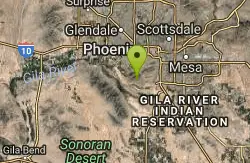
South Mountain Pyramid Trail
Phoenix, Arizona
29.9 miles SWHike near Phoenix, Arizona
Hike 12.6 mi

National Trail
Phoenix, Arizona
30.3 miles SWNational Trail is the gem of South Mountain and home to the infamous Waterfall. It’s a local favorite as well as a destination trail for MTB snowbirds. Like most trails in the Sonoran...
Hike, Mountain Bike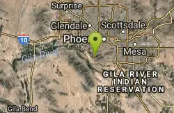
Alta Trail And Bajada Trail
Phoenix, Arizona
30.3 miles SWHike near Phoenix, Arizona
Hike


