


68 Hiking Trails near Driggs Nordic Trail
first prev 1 2 3 4 next lastShowing Hiking Trails within 50 miles Distance miles of 760 E Ross Ave, Driggs, ID 83422, USA City, Zip, or Address
Bear Creek Campground at Palisades
Irwin, Idaho
28.5 miles SPalisades Reservoir is ideal for water skiing in the summer and features many picnic spots and boat docks. The area forest service hosts nine campgrounds containing 181 family units. Boat launch...
Camp, Hike, Horseback, Mountain Bike 3.8 mi
Stinking Springs
Ririe, Idaho
28.9 miles WStinking Springs is a great early to late season trail. Being at the edge of the Big Hole range, it gets spring earlier and winter later than other trails in the range. It's closed from December...
Hike, Mountain Bike
Cave Falls of Yellowstone
Ashton, Idaho
28.9 miles NThis campgrond is situated on the banks of Fall River in Wyoming along the south border of Yellowstone National Park. Cave Falls Campground has 23 single site units and a terrific area for...
Camp, Hike 3.2-47.0 mi
Yellowstone Branch Line Trail
Ashton, Idaho
29.0 miles NYellowstone branch line trail runs from Warm River to the Montana border totaling 39 miles. There are a few places to jump on and off the trail as well as a few smaller trails that branch off of this...
Backpack, Cross-country Ski, Hike, Horseback, Mountain Bike 14.8-30.2 mi
Mr. Bubbles Hot Spring
Old Faithful, Yellowstone National Park
29.1 miles NMr. Bubbles is one of the few places you can actually soak in the thermal waters of Yellowstone National Park. The Bechler area of Yellowstone is one of the best kept secrets of the otherwise densely...
Hike, Hot Springs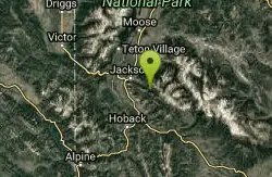
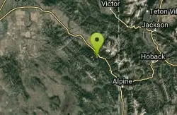
Cache Creek Trial
Jackson, Wyoming
29.3 miles SEHilly terrain with an elevation gain/loss of 850’. Groomed 4.6 miles to Noker Mine Draw on Monday, Wednesday and Friday, generally in the morning. Snowmobiles are allowed on the Cache Creek...
Hike 1.9 mi
Terraced Falls
Grant Village, Yellowstone National Park
30.2 miles NE3.6 mile easy out and back trail. 430 ft Elevation gain. The trailhead is off Ashton-Flagg Ranch Road along Yellowstone's South border. Ashton-Flagg Ranch Road is closed during the winter.
Hike 0.3-0.6 mi
Bear Gulch
Ashton, Idaho
30.6 miles NBear Gulch is an abandoned ski hill out of operation since 1969. While the vegetation is beginning to take over, there's still some great sledding to be had. It's just far enough into the...
Camp, Cross-country Ski, Hike, Sled
Blue Miner Lake
Jackson, Wyoming
31.3 miles EBackpack and Hike near Jackson, Wyoming
Backpack, Hike 0.3-0.6 mi
Cress Creek Nature Trail
Rexburg, Idaho
31.5 miles WMeandering along the scenic South Fork of the Snake River, the beautiful 1¼ mile Cress Creek Nature Trail will lead you on a journey through sagebrush-grass communities, over juniper covered...
Hike 13.2-13.5 mi
Bear Creek Hot Springs
Irwin, Idaho
32.1 miles SBear Creek Hot Springs is a 15 mile out and back trail with a hot spring at the end. The trail is not well marked and is only recommended for very experienced outdoorsmen and primarily used for...
Backpack, Camp, Hike, Horseback, Hot Springs, Mountain Bike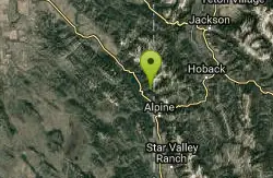
Indian Creek Campground (Palisades)
Irwin, Idaho
32.6 miles SPalisades Reservoir is a picturesque body of water in eastern Idaho on U.S. Highway 26 near the Idaho & Wyoming border and about 25 miles west of Jackson Hole Wyoming. The reservoir is nestled...
Camp, Hike, Horseback, Swim
Mesa Falls
Ashton, Idaho
33.7 miles NUpper Mesa Falls, aka Big Falls, is an absolutely awesome waterfall on the Henrys Fork of the Snake River. The falls drop 114 ft. and measure 300 ft. across. To get to the falls from the parking lot...
Cross-country Ski, Hike, KayakHenry's Fork Green Way (St. Anthony Green Belt)
Saint Anthony, Idaho
33.7 miles NWThis is a great walk along the river. While it is nestled right next to the highway, the closeness and beauty of the river flowing on the other side of the trail more than make up for it. Halfway...
Hike 0.1-2.3 mi
Hidden Valley Trails
Rexburg, Idaho
34.0 miles WRight on the edges of town outside of the Hidden Valley subdivision, you'll find this fun little set of trails that's pretty good for mountain bikes. It is mostly a dirt bike...
Hike, Mountain Bike 17.5 mi
Tear Drop Lake
Ashton, Idaho
34.2 miles NNestled in the Targhee National Forest just off of Ashton's Fish Creek Road, this tear drop shaped lake is a family adventure waiting to happen. The lake isn't very big but it is teeming with...
Camp, Canoe, Hike, Kayak, Mountain Bike, Swim 0.1-0.5 mi
Eagle Park
Rexburg, Idaho
35.7 miles WEagle Park is a little urban oasis. Once you drive in to this cottonwood forest along the river, you may forget that you're still inside Rexburg city limits. You can camp, picnic, throw rocks in...
Camp, Hike, Mountain Bike, Sled
Sheep Falls on Henry's Fork
Island Park, Idaho
35.8 miles NWSheep Falls cascades approximately 25' through a narrow basalt chute on the North Fork of the Snake River near Island Park, Idaho. Compared to nearby Lower and Upper Mesa Falls, that height may...
Hike 1.0-1.3 mi

Lorenzo Bridge
Rexburg, Idaho
38.5 miles WThis is the old site of the Lorenzo Boat Launch, which has moved to the other side of the river a little further downstream. This spot sees very little traffic. There are beautiful, yet...
Airsoft, Hike, Paintball
Lorenzo Boat Ramp
Rigby, Idaho
39.2 miles WHike and Kayak near Rigby, Idaho
Hike, Kayak


