


138 Hiking Trails near Inspiration Point
first prev 1 2 3 4 5 6 7 next lastShowing Hiking Trails within 50 miles Distance miles of Desert Parks, Scottsdale, AZ 85255, USA City, Zip, or Address

Shaw Butte and Charles M Christiansen Loop Trail
Phoenix, Arizona
12.5 miles WWhen you say "North Mountain," I think most Arizonans know where it is or can find it. When you say "Shaw Butte," it seems like you get a lot more questioning glances and "huh?". Shaw...
Hike, Mountain Bike
North Mountain National Trail
Phoenix, Arizona
12.6 miles WNorth Mountain National Trail is a 2.3 mile moderate, loop trail near Phoenix. It's easy to travel on if you go up the paved sections. The inclines are steep in parts, making it a real...
Hike 4.6 mi
Perl Charles Memorial Trail (#1A)
Phoenix, Arizona
12.9 miles SWThis is a technical singletrack loop with some very steep up and down sections located in the Phoenix Mountain Preserves. This trail is for advanced riders who like to bleed and leave their skin on...
Hike, Horseback, Mountain Bike
Arizona Canal Trail
Phoenix, Arizona
13.0 miles SWMulti-purpose canal trails set apart from normal city traffic and noise. The Arizona Canal is one of the many canals used to supply the valley with its water needs (irrigation). These canals were...
Hike, Horseback
Sidewinder, Apache Vista, Ocotillo Loop Trail
Phoenix, Arizona
13.4 miles NWThis is an excellent loop that is very well maintained, well sign posted and if you include the vista summit trail, a moderate work out. Massive Car Park, good restrooms, and plenty of...
Hike, Horseback, Mountain Bike
Ocotillo/Ridgeback/Sidewinder Loop Trail
Phoenix, Arizona
13.4 miles NWGreat moderate loop which includes a summit, great views and Classic Sonoran Desert scenery. Multiple access points and other connecting trails allows for the loop to be changed if...
Hike, Horseback, Mountain Bike 2.1 mi
Lower Salt River Nature Trail
Fort McDowell, Arizona
13.5 miles SEThe Lower Salt River Nature Trail is a scenic walk to take at the Tonto National Forest. This trail provides stunning views as you walk alongside the Salt River. This rustic trail is older and less...
Camp, Hike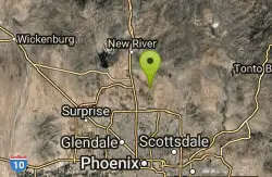
Apache Wash Trail
Phoenix, Arizona
13.5 miles NWStart west on Ocitillo to Ridgeback north till you get to the crossing of Sidewinder then head west. Keep on Sidewinder toil you come to the crossing of Octillio and head east back to...
Hike
Maxine Lakin Nature Trail
Phoenix, Arizona
13.7 miles WHike near Phoenix, Arizona
Hike 1.5 mi
The Saddle
Mesa, Arizona
14.1 miles SESaddle trail is an intermediate mountain biking trail that connects to the greater Hawes trail network. The trail is 1.5-2mi long and it offers beautiful views of the neighboring Salt River and Red...
Hike, Mountain Bike 7.5 mi
Hawe's Loop
Mesa, Arizona
14.1 miles SEMost of the trails in the Phoenix metropolitan area were originally built by mountain bikers, and the Hawe's loop trail system and trail are no exeptions. This trail features fantastic...
Hike, Mountain Bike
Papago to Tempe Town Lake
Phoenix, Arizona
14.4 miles SWThere are many paths that interconnect within Papago park and the nearby Tempe Town Lake. Any of these in combination provide a good walk or bike riding experience with a variety of views. Papago...
Hike
Double Butte Loop Trail
Phoenix, Arizona
14.5 miles SDouble Butte Loop Trail is one of the trails within Papago Park in Phoenix, Arizona. The Double Butte Loop Trail is a natural trail that traverses the circumference of both the small butte...
Hike, Mountain Bike
Crosscut Canal Trail
Tempe, Arizona
14.6 miles SCrosscut Canal Trail is a concrete, sidewalk multi-use trail for walking, biking, wheelchairs, scooters, and skateboards. This two mile long path follows a canal and links Tempe Town Lake to...
Hike 5.8 mi

Go John Trail
Cave Creek, Arizona
15.1 miles NWThe Go John Trail is a 5.8 mile loop trail outside of Cave Creek, Arizona, that is moderately trafficked, used by both hikers and mountain bikers. It is an excellent opportunity to view the desert...
Hike, Horseback, Mountain Bike
Hawk's Nest Trail and Dixie Mountain Loop
Phoenix, Arizona
15.1 miles NWModerate Trail providing access from the Car Park to all other trails. Directly links to Desert Tortoise Trail and Dixie Mountain Loop. Good hiking shoes/boots recommended....
Hike, Horseback, Mountain Bike
Western Vista Trail
Phoenix, Arizona
15.1 miles NWFairly difficult short Trail to one of the summits on the Dixie Mountain Loop. Great views from the top as well as a birds eye view of the gravel pit below.
Hike
Dixie Mountain Loop with Two Summits
Phoenix, Arizona
15.1 miles NWHike, Horseback, and Mountain Bike near Phoenix, Arizona
Hike, Horseback, Mountain Bike
Dixie Summit Trail
Phoenix, Arizona
15.1 miles NWA steep and difficult short trail using many switchbacks to get to the summit. You will be rewarded with spectacular views of the surrounding area.
Hike 2.8 mi
Desert Tortoise
Phoenix, Arizona
15.1 miles NWAt just over a mile long, Desert Tortoise is a doubletrack connector to the Valle Verde Trail. Very good hiking area with a good range of difficulty levels. Starts with a short climb from the...
Hike, Mountain Bike


