


70 Hiking Trails near Osprey Falls Trail
first prev 1 2 3 4 next lastShowing Hiking Trails within 50 miles Distance miles of W7JC+WM Mammoth, Yellowstone National Park, WY, USA City, Zip, or Address
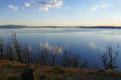
Yellowstone Lake Overlook Trail
Grant Village, Yellowstone National Park
36.5 miles SYellowstone Lake Overlook Trail is a 1.7 mile loop trail that is easy and great for beginner hikers. The trail begins near the West Thumb Geyser Basin Parking Lot and is open in the summer and fall.
Hike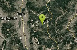
Ousel Falls
Gallatin Gateway, Montana
36.8 miles NWOusel Falls Park Trail is a 1.7 mile out and back trail located near Big Sky, Montana that features a waterfall. The trail is primarily used for hiking and is accessible from May until October.
Hike, Rock Climb, Swim

Big Springs
Island Park, Idaho
39.7 miles SWThere's also a great little walking trail along the river with placards that tell about the ecosystem and history of the area. There's about a 1/2 mile that's paved and then a 1/2 mile...
Camp, Hike 4.8 mi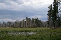
Riddle Lake Hike
Grant Village, Yellowstone National Park
40.3 miles SRiddle Lake hike is a 5 mile roundtrip hike. Riddle Lake is an alluring body of water with a sandy beach. The hiker gets the best of both worlds on this hike. Impressive pine and mountain views,...
Hike 2.1-11.5 mi
Lewis River Channel / Dogshead Loop
Grant Village, Yellowstone National Park
42.8 miles SAnyone who doesn't want to backpack through Yellowstone but is looking to experience the real beauty of Yellowstone will truly love this hike. Walking along the Lewis Channel is one of the...
Canoe, Hike, Kayak 3.3 mi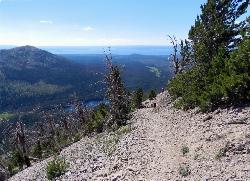
Avalanche Peak Trail
Cody, Wyoming
42.9 miles SEAvalanche Peak Trail is a 4 mile trail to the peak of Avalanche Mountain. This is considered difficult because hikers will climb 2,100 feet in 2 miles. It is recommended that hikers bring...
Hike 6.9 mi
Heart Lake Trail
Grant Village, Yellowstone National Park
43.0 miles SThe trail is very clear and leads to a moderate eight mile hike to Heart Lake. This hike has many possibilities. Day hikers need to push their time to make sure they are on the trail early to allow...
Backpack, Camp, Hike, Hot Springs 4.2 mi
Lake Marie
Island Park, Idaho
43.9 miles SWLake Marie sits on the North slope of Mount Jefferson in Fremont County, Idaho. The trail to get there cuts back and forth across the Idaho Montana border 4 times. Much of the trail is fairly flat...
Backpack, Hike 7.6 mi
Mount Jefferson
Island Park, Idaho
43.9 miles SWMount Jefferson, at 10, 203 feet is the highest point in the Centennial Mountains, a small, local range on the border of Idaho and Montana a little west of Yellowstone. These mountains consist of a...
Hike 5.8 mi
Box Canyon Trail
Island Park, Idaho
48.5 miles SWVarious species of tress and wildflowers can be seen on the trail, as well as songbirds, waterfowl and occasional wildlife. The trail is open for the following uses: Motorcycle Trail Riding, Off...
Hike, Mountain Bike


