


125 Mountain Bike Trails near Dixie Mine
first prev 1 2 3 4 5 6 7 next lastShowing Mountain Bike Trails within 50 miles Distance miles of 14464 E Golden Eagle Blvd, Fountain Hills, AZ 85268, USA City, Zip, or Address
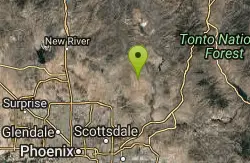
Whiskey Bottle Trail
Scottsdale, Arizona
9.4 miles NThe trail starts off with sandy single-track then starts a gradual ascent up the side of Fraesfield mountain. The trail then sharply increases (total of 800' elevation gain) and becomes...
Mountain Bike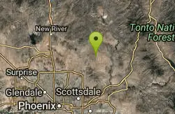
Granite Mountain Loop
Scottsdale, Arizona
9.4 miles NThis is a multi-use trail with hikers and equestrians, but for the most part it is not well-traveled. Much of the trail is single-track and the west side of Granite Mountain has a...
Mountain Bike
Pima and Dynamite Trail
Scottsdale, Arizona
9.6 miles NWPima and Dynamite is an area with a network of trails for hiking, but more popularly for mountain biking, in North Scottsdale, Arizona. The area feautures a variety of trails for...
Hike, Mountain Bike
Jane Rau Brown's Canyon Trail
Scottsdale, Arizona
9.6 miles NWThe Jane Rau Brown Canyon Trail was named after Jane Rau Brown, one of the pioneers of the McDowell Sonoran Conservancy, for her determination and passion in preserving the desert and the park....
Hike, Horseback, Mountain Bike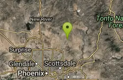
Browns Ranch to Granite Mountain
Scottsdale, Arizona
9.7 miles NWStarts off at a trailhead onto a two track that can be taken to a variety of trails
Mountain Bike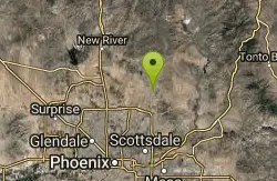
Pima Road and Dynamite Blvd
Scottsdale, Arizona
10.0 miles NWThis is desert highlands and a beautiful part of the Sonoran Desert. (not much left with all the development) There are some jeep trails here and this area is also used by ATV and dirt...
Mountain Bike 1.5 mi
The Saddle
Mesa, Arizona
10.2 miles SESaddle trail is an intermediate mountain biking trail that connects to the greater Hawes trail network. The trail is 1.5-2mi long and it offers beautiful views of the neighboring Salt River and Red...
Hike, Mountain Bike 1.3 mi
Ridge Trail
Mesa, Arizona
10.2 miles SEThe trails within the Hawes loop system were originally built by mountain bikers for mountain bikers, so the trails feature fantastic singletrack that twist and turn for miles. Be warned,...
Mountain Bike 7.5 mi
Hawe's Loop
Mesa, Arizona
10.2 miles SEMost of the trails in the Phoenix metropolitan area were originally built by mountain bikers, and the Hawe's loop trail system and trail are no exeptions. This trail features fantastic...
Hike, Mountain Bike
Desert Trails Bike Park
Mesa, Arizona
12.1 miles SHike and Mountain Bike near Mesa, Arizona
Hike, Mountain Bike 3.6 mi

Charles M. Christiansen Memorial Trail
Phoenix, Arizona
13.0 miles WPhoenix, Arizona is home to some of the best and largest city parks in the country and the Charles M. Christiansen Memorial Trail is a great introduction to this fantastic park system. Also known as...
Hike, Horseback, Mountain Bike 7.1 mi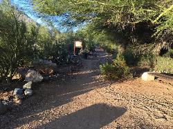
Trail 100
Phoenix, Arizona
13.0 miles WMountain Bikers and Hikers in Phoenix, Arizona can rejoice in the challenge that is Trail 100. Trail 100, or Charles M. Christensen Memorial Trail, is a little over 14 miles out and back in the...
Hike, Mountain Bike
Pass Mountain
Mesa, Arizona
13.1 miles SEMultiple loop options and trails with various degrees of difficulty. Beginners/novices will enjoy Moonrock and Blevins trails while experts will enjoy Pass Mt and the Cat Peaks loops. I...
Mountain Bike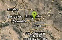
Papago Park Area Mountain Bike Trail
Scottsdale, Arizona
13.5 miles SWMountain Bike near Scottsdale, Arizona
Mountain Bike 4.6 mi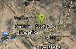
Mystery Loop
Phoenix, Arizona
13.9 miles WThe trail is a nice combination of technical rock trail, washes, and climbs. There is a large network of trails to make the ride longer or shorter depending upon your needs. These trails cross over...
Mountain Bike 2.6 mi
L.V. Yates Trail (#8)
Phoenix, Arizona
13.9 miles WThe trail is strewn with large rocks and gulleys from recent torrential rains. Not impassable on foot, but definitely some hike-a-bike areas. Keep in mind there's no ridge hiking...
Hike, Horseback, Mountain Bike
Usery Mountain Regional Park
Mesa, Arizona
14.7 miles SEThere are many miles of two-way single-track trails in the park at several levels of difficulty. The Pass Mountain Trail should challenge intermediate to advanced riders. The Cat Peaks...
Mountain Bike 1.5 mi
Moon Rock Loop
Apache Junction, Arizona
14.8 miles SELocated within the larger Usery Mountain Regional Park, the Moon Rock loop is a fast and smooth trail that adds 1.3 miles to the more famous Blevins Trail. Although the Moon Rock loop is not known as...
Hike, Horseback, Mountain Bike
Cat Peaks - Blevin - Moonrock
Apache Junction, Arizona
14.9 miles SEFollow Blevins trail 0.6 miles, the entrance to the Moonrock loop will be on your right, marked by a brown sign and arrow. Take this loop (around 1.4 miles) until it returns to Blevin's...
Mountain Bike 1.9 mi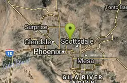
Ruth Hamilton Trail
Phoenix, Arizona
15.1 miles SWHike and Mountain Bike near Phoenix, Arizona
Hike, Mountain Bike


