


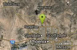
125 Mountain Bike Trails near Dixie Mine
first prev 1 2 3 4 5 6 7 next lastShowing Mountain Bike Trails within 50 miles Distance miles of 14464 E Golden Eagle Blvd, Fountain Hills, AZ 85268, USA City, Zip, or Address
Thunderbird H-1 H-2 H-3 Loop Trail
Glendale, Arizona
23.9 miles WHike and Mountain Bike near Glendale, Arizona
Hike, Mountain Bike 2.3 mi
Hidden Valley Trail Via Mormon Trail
Phoenix, Arizona
24.0 miles SWHidden Valley Trail via Mormon Trail is a 2-4 mile hike, depending on the route you choose to take and how much additional exploring you do. This hike offers a natural rock tunnel, petroglyphs,...
Hike, Mountain Bike
Glendale Canal
Glendale, Arizona
24.2 miles WHike, Horseback, and Mountain Bike near Glendale, Arizona
Hike, Horseback, Mountain Bike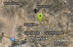
H-1 to H-4 Trails Loop
Glendale, Arizona
24.5 miles WThunderbird Park in Glendale, AZ consists of 5 H-Trails, named so because of the Hedgpeth Hills through which they wind. H-1: One-Way - 5.0 miles H-1a: Loop trail - 2.5 miles - 400...
Hike, Mountain Bike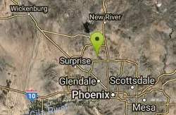
Dixie mountain
Glendale, Arizona
25.3 miles WGreat network of trails including some beginner to intermediate. Connect as many loops as you want to get the desired distance or connect to the north Sonoran preserve via connector...
Mountain Bike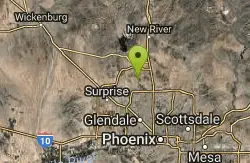
Thunderbird Park
Phoenix, Arizona
25.6 miles WThis trail is very rocky. Bring plenty of water because there is no shaded areas and it gets hot in Arizona. Overall a fun trail. I used a hard tail with a head shock but took it...
Mountain Bike
Sonoran Preserve North
Phoenix, Arizona
25.6 miles WNice rolling single track with many steep sustained climbs and fun flawy downhills. No technical features but good fitness is needed. If you do all the climbs and loops can get in over...
Mountain Bike 2.5 mi
Hidden Valley from Buena Vista Trail
Phoenix, Arizona
25.7 miles SWFor an easily accessible trail, butting right up against Phoenix’s southern border, it is truly surprising how special, quiet and natural the hike through Hidden Valley is! The path...
Hike, Mountain Bike
K-trail & Vortex
Gold Canyon, Arizona
26.1 miles SEThis is definitely a challenging way to ride both the entire K and Vortex trails. They are best ridden from the North to the South but to do this you need to get to the North end of the...
Mountain Bike
Lost Goldmine & Cougar Loop
Gold Canyon, Arizona
26.1 miles SEThis is a short, fun but pretty technical ride. The technical part is the fact that it starts out with a ride on the Lost Goldmine trail which is a very rocky trail built for hiking....
Mountain Bike
Cloudview
Gold Canyon, Arizona
26.1 miles SEThis parking area is used primarily for the very popular Hieroglyphs hiking trail and the Lost Goldmine hiking trail which connects with Peralta Road seven miles to the East. It is also...
Mountain Bike
Holbert-Hidden Valley-Mormon Trail Shuttle
Phoenix, Arizona
26.2 miles SWHolbert- Hidden Valley- Mormon Trail is a combination trail hike on the north side of South Mountain near Phoenix, Arizona. This trail is approximately 6.5 miles long, and is suitable for...
Hike, Mountain Bike
Holy Hill And Gila Monster
Gold Canyon, Arizona
26.8 miles SEThe Holy Hill By-Pass Trail was the newest trail in the Gold Canyon system as of April 2012. The Gila monster trail was listed as still under construction earlier in the year but seemed...
Mountain Bike 0.8-1.0 mi
Kiwanis Trail to Telegraph Pass Lookout
Phoenix, Arizona
27.0 miles SWAn ideal hike to take children on as the distance is short and the elevation gain is not extreme. Avid hikers have opportunities to embark on longer hikes into South Mountain. ... This short hike is...
Hike, Mountain Bike
Secret, Tech & K
Gold Canyon, Arizona
27.9 miles SEFrom the parking lot start riding the main trail by the sign. Ride about 30 feet and then take the single track trail to the right. This is called the Horse Trail and leads to all of...
Mountain Bike 5.4 mi
Denton Trail #69
Tonto Basin, Arizona
27.9 miles NEFrom FR 421, the trail climbs steadily up the east face of the mountain. Some sections are quite steep. The trail eventually tops out at 5,760 feet elevation and then descends to Big Pine Flat for...
Hike, Mountain Bike
Sycamore Trail #68
Tonto Basin, Arizona
28.0 miles NEFrom FR 421, the trail climbs steadily through lower Sonoran Desert and riparian vegetation up the arroyo formed by Sycamore Creek. It turns northward and continues to climb along a...
Mountain Bike
Slate Creek Divide Loop
Phoenix, Arizona
28.3 miles NEVarious routes available - Alternative #1 (From above): 13 Mi. (22 km) Alternative #2 (From above): 10 Mi. (16 km) Loop top half only (Inc. dirt. to 8 from SR 87): 12 Mi. (19 km) Figure eight: 16 Mi....
Mountain Bike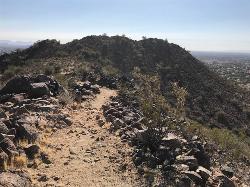
Sunrise Mountain Trail
Peoria, Arizona
28.4 miles WThe Sunrise Mountain Trail can be found within the suburban area of Peoria, Arizona; it is made of up 3 sequential loops; each loop harder than the last. The trail is easy to find, as...
Hike, Mountain Bike
Emery Henderson
Phoenix, Arizona
29.0 miles NWBct(Black Canyon Trail) trail head features paved parking and restrooms. From here you can head south on relatively flat ground, or North, working into the desert hills, on multiuse...
Mountain Bike


