


74 Mountain Bike Trails near North Menan Butte ('R' Mountain)
first prev 1 2 3 4 next lastShowing Mountain Bike Trails within 50 miles Distance miles of 1100 N 3600 E, Menan, ID 83434, USA City, Zip, or Address

Fish Creek Area
Ririe, Idaho
22.9 miles EFish Creek is a network of mountain bike trails up in the Big Hole Mountains. The trails are easily accessed from either the Ririe or Rexburg side of the range. The trail system is set up much...
Hike, Mountain Bike 4.3 mi
Leaning Fir #169
Ririe, Idaho
23.7 miles SEMountain Bike near Ririe, Idaho
Mountain Bike
Wolverine Creek Trail
Ririe, Idaho
25.4 miles SEThe Wolverine Creek Trail is a doubletrack trail in Ririe, Idaho. It begins at South Fork Road and ends at Wolverine trailhead. It is commonly used by dirt bikes and four wheelers. This trail is...
Mountain Bike 0.6-5.5 mi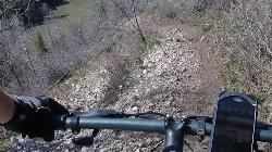
Old Ranger
Ririe, Idaho
28.8 miles SEOn the South end of the Big Hole mountains just above the Snake River is a grueling yet diverse section of single-track on Forest Service Trail 287 called Old Ranger. Because of the...
Mountain Bike

Burns Canyon
Ririe, Idaho
28.9 miles SEHike and Mountain Bike near Ririe, Idaho
Hike, Mountain Bike
Thousand Springs Trail
Driggs, Idaho
29.5 miles EThe Thousand Springs trail begins at Moody Swamp trailhead and ends at Jct Prospect Peak Trail. source: fs.usda.gov Courtesy of Singletracks.com
Mountain Bike
Blacks Canyon Trail
Ririe, Idaho
30.0 miles SEThe Blacks Canyon trail begins at Black Can Road and ends at Junction Fleming Canyon Trail. The trail is open for the following uses: Motorcycle Trail Riding, Off Highway Vehicles (OHV)...
Mountain Bike
South Fork Rim Trail
Ririe, Idaho
30.0 miles SEMotorcycle trail. source: fs.usda.gov Courtesy of Singletracks.com
Mountain Bike
Wright Creek Trail
Tetonia, Idaho
30.2 miles EOpen to MTB, horseback riding, snowshoeing, and hiking. source: fs.usda.gov
Mountain Bike 0.6 mi
Packsaddle Lake
Tetonia, Idaho
32.5 miles EPacksaddle is one of the less well known lakes/trails in the area. If you've got a good offroad vehicle, you can probably make it all the way to the end of the road, otherwise, it's just an...
Dive, Hike, Mountain Bike, Snowshoe, Swim 29.6 mi
Ashton to Tetonia Trail
Ashton, Idaho
34.1 miles NEThe Idaho Department of Parks and Recreation undertook the project to transform the old Teton Valley Branch of the Union Pacific Railroad from Ashton to Tetonia into a trail for bikes, ATVs, and...
Mountain Bike
Probation And Burg Bumper
Tetonia, Idaho
34.1 miles EThe Probation part of the trail is the steepest downhill in the area. Has multiple bridges and log jumps in the short mile down. The Burg portion of the trail is uphill with some...
Mountain Bike
South Fork Snake River Trail
Ririe, Idaho
34.2 miles SEGo left at the trail head. It heads down about a mile and a half on double track. Then you'll come to a creek crossing. After the crossing the trail heads across a gate. Head left...
Mountain Bike
North Mahogany Trail #220
Tetonia, Idaho
34.6 miles Ehe N. Mahogany Trail is open to Motorbikes, Mountain bikes, Horses, and Hikers. Motorbikes and Horseback riders are the most common visitors, but the trail is becoming increasingly...
Mountain Bike
Horseshoe Canyon
Tetonia, Idaho
35.1 miles EHorseshoe Canyon is one of the closest trail systems to the town of Driggs, Idaho. This network doesn't have a ton of climbing or descending, but the smooth, swooping singletrack with a...
Mountain Bike
Bovine
Driggs, Idaho
35.2 miles EBovine trail is part of a larger system. You can use it to access more trails or make it your end destination from other trailheads. It is a steep climb but returns the favor with a fast downhill....
Mountain Bike
Horseshoe Trails
Driggs, Idaho
35.2 miles EMountain Bike near Driggs, Idaho
Mountain Bike
Channel Lock
Driggs, Idaho
35.7 miles ETrail is a little over 1 mile uphill. Recommended route up to access the larger Horseshoe canyon trail system. Makes a nice downhill with twists. Gets its name from the deep ruts made from cows....
Mountain Bike
Sharks Belly
Driggs, Idaho
35.7 miles ETrail system can start from Channel lock or Bovine. Channel Lock is an easier climb than Bovine. This description and mileage starts at the Channel Lock trail, forest service boundary marker. Take...
Mountain Bike
Southbound
Driggs, Idaho
35.7 miles ETrail starts by going up the Channel lock trail. At the top of Channel Lock go right onto the Southbound trail. Trail will loop back to Channel lock which you take back to your car. Trail is...
Mountain Bike


