


124 Mountain Bike Trails near North Mountain National Trail
first prev 1 2 3 4 5 6 7 next lastShowing Mountain Bike Trails within 50 miles Distance miles of 11572 N 7th St, Phoenix, AZ 85020, USA City, Zip, or Address

Levee Trail
Mesa, Arizona
27.4 miles ELocated within the Usery Mountain Regional Park, the Levee trail is named so because it mostly follows the top of levee, running parallel to a large section of the channel trail and a Phoenix...
Hike, Horseback, Mountain Bike
Usery Mountain Regional Park
Mesa, Arizona
27.4 miles EThere are many miles of two-way single-track trails in the park at several levels of difficulty. The Pass Mountain Trail should challenge intermediate to advanced riders. The Cat Peaks...
Mountain Bike 4.8 mi
Lost Creek Petroglyph Trail
Buckeye, Arizona
27.5 miles WStarting at Verrado's trailhead, the trail heads a short ways to a petroglyph site. While a little rocky at times, the trail is easy. To deter vandals, a very necessary fence with barbed-wire has...
Hike, Mountain Bike
Verrado
Buckeye, Arizona
27.6 miles WTechnical, good climbs, lots of open roads to add cardio loops as well.
Mountain Bike
Crismon Wash Trail
Mesa, Arizona
27.6 miles EThe Crismon Wash Trail is 1.8 mile trail that is accessible from the south at the Crismon road trailhead. It is also accessible from the Blevins train to the north. There are several...
Hike, Horseback, Mountain Bike
Cat Peaks - Blevin - Moonrock
Apache Junction, Arizona
27.7 miles EFollow Blevins trail 0.6 miles, the entrance to the Moonrock loop will be on your right, marked by a brown sign and arrow. Take this loop (around 1.4 miles) until it returns to Blevin's...
Mountain Bike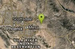
Blevins Via Meridian
Apache Junction, Arizona
29.3 miles EThe ride East down Meridian trail is a one mile intermediate to beginner ride. However if you can stay on the pedals through the several dry wash crossings you are definitely not a...
Mountain Bike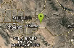
Cat Peaks Via Ruidoso
Apache Junction, Arizona
29.6 miles EThe Ruidoso trail is a beginner ride with a few tricky dry wash crossings that will challenge you to try and stay on the pedals. This trail ends at the Spillway trail after 1.2 miles....
Mountain Bike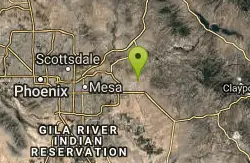
Prospector Loop
Apache Junction, Arizona
31.8 miles EA fast beginners to intermediate (only if youre into speed) training loop. The trail has no markings but is the only trail in the area as it is undeveloped gravel desert. The trail is...
Mountain Bike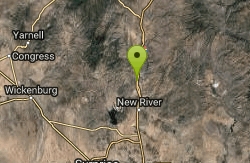
Black Canyon Trail
Black Canyon City, Arizona
32.2 miles NThis discription is for the Table Mesa trail head which has 1.5 miles (N) out on the Black Canyon Trail to the Little Pan Loop. The Little pan loop will take you down to the Agua Fria...
Mountain Bike
Black Canyon Trail - Little Pan Loop
Black Canyon City, Arizona
32.4 miles NThe Black Canyon National Recreation Trail will be a 79-mile hiking, mountain biking and equestrian trail stretching from the Sonoran Desert lowlands in Phoenix to the high grasslands...
Mountain Bike
Lost Dutchman State Park
Apache Junction, Arizona
34.8 miles EThis park has dirt biking trails. Bikes can use the lower trails (#58) shared with hikers. Bikes are not allowed above Jacobs Crosscut Trail.The park has added a new "Mountain Bike...
Mountain Bike
San Tan
Queen Creek, Arizona
36.2 miles SETke the Goldmine trail (approximately 1.1 miles uphill on wide trail) Take left onto SanTan for approximately 1.5 miles. At this point you will reach a T. Go to right for the San Tan...
Mountain Bike
K-trail & Vortex
Gold Canyon, Arizona
39.4 miles EThis is definitely a challenging way to ride both the entire K and Vortex trails. They are best ridden from the North to the South but to do this you need to get to the North end of the...
Mountain Bike
Lost Goldmine & Cougar Loop
Gold Canyon, Arizona
39.4 miles EThis is a short, fun but pretty technical ride. The technical part is the fact that it starts out with a ride on the Lost Goldmine trail which is a very rocky trail built for hiking....
Mountain Bike
Cloudview
Gold Canyon, Arizona
39.5 miles EThis parking area is used primarily for the very popular Hieroglyphs hiking trail and the Lost Goldmine hiking trail which connects with Peralta Road seven miles to the East. It is also...
Mountain Bike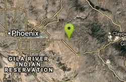
Holy Hill And Gila Monster
Gold Canyon, Arizona
39.8 miles EThe Holy Hill By-Pass Trail was the newest trail in the Gold Canyon system as of April 2012. The Gila monster trail was listed as still under construction earlier in the year but seemed...
Mountain Bike
Buckeye Hills Regional Park
Buckeye, Arizona
40.2 miles SWBiking is primitive. The park has restrooms but no running water or electricity.
Mountain Bike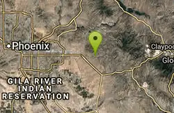
Secret, Tech & K
Gold Canyon, Arizona
41.4 miles EFrom the parking lot start riding the main trail by the sign. Ride about 30 feet and then take the single track trail to the right. This is called the Horse Trail and leads to all of...
Mountain Bike
Slate Creek Divide Loop
Phoenix, Arizona
43.2 miles NEVarious routes available - Alternative #1 (From above): 13 Mi. (22 km) Alternative #2 (From above): 10 Mi. (16 km) Loop top half only (Inc. dirt. to 8 from SR 87): 12 Mi. (19 km) Figure eight: 16 Mi....
Mountain Bike


