


245 Things to do near Ashton to Tetonia Trail
first prev 1 2 3 4 5 6 7 8 9 10 next lastShowing results within 50 miles Distance miles of N 3600 E, Ashton, ID 83420, USA City, Zip, or Address

Horseshoe Trails
Driggs, Idaho
25.5 miles SMountain Bike near Driggs, Idaho
Mountain Bike
Bovine
Driggs, Idaho
25.5 miles SBovine trail is part of a larger system. You can use it to access more trails or make it your end destination from other trailheads. It is a steep climb but returns the favor with a fast downhill....
Mountain Bike
North Mahogany Trail #220
Tetonia, Idaho
25.5 miles She N. Mahogany Trail is open to Motorbikes, Mountain bikes, Horses, and Hikers. Motorbikes and Horseback riders are the most common visitors, but the trail is becoming increasingly...
Mountain Bike 0.1 mi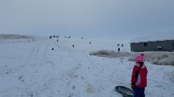
Founder's Square Hill (Under the Water Tower)
Rexburg, Idaho
25.5 miles SWThis is a great sledding hill. It's about the perfect steepness and really wide. It's also big enough to make it worth a little run on a snowboard or an inner tube. While this is a pretty...
Sled 0.8-1.3 mi
Warm Slough Campground
Rexburg, Idaho
25.7 miles SWThis is a pretty popular campsite that fills up pretty quick on busy weekends. Campsites are fairly spread out and there is no official donation box (as of July 2015). A couple of the campsites...
Airsoft, Camp, Canoe
Moody Meadows
Driggs, Idaho
27.3 miles SGood place for kids, they can ride bikes in the meadow, play in the stream, and camping is off of the road. Hiking, motorbiking, and horseback riding trails are abundant in the area.
Camp 0.5-3.5 mi
Webster's Dam
Ririe, Idaho
27.4 miles SAlso known as Manmade Falls or the Woodmansee Dam, Webster Dam is an abandoned dam located deep in Moody Creek canyon, the dam was abandoned when sediment built up behind the dam which then...
Camp, Hike, Mountain Bike
Twin Creek Trail
Driggs, Idaho
27.6 miles SThe Twin Creek trail is 2.3 miles long. It begins at Trail 6195 and ends at Trail 6219. source: fs.usda.gov
Mountain Bike
Herbert Idaho Ghost Town
Ririe, Idaho
27.8 miles SWCLOSED. Private property marked NO TRESPASSING. Herbert is a small ghost town that was operated until the 40s, but with the invention of the automobile, it was much more convenient to live in Rexburg...
Hike
Thousand Springs Trail
Driggs, Idaho
28.0 miles SThe Thousand Springs trail begins at Moody Swamp trailhead and ends at Jct Prospect Peak Trail. source: fs.usda.gov Courtesy of Singletracks.com
Mountain Bike
Coffee Pot Rapids Trail
Island Park, Idaho
28.9 miles NHiker and fisherman parking is available at the campground entrance. Coffee Pot Rapids trail is 2.2 miles in length, is a non-motorized trail that follows the Henry's Fork of the Snake...
Mountain Bike
Upper Coffee Pot Campground
Island Park, Idaho
28.9 miles NUpper Coffeepot Campground stretches along a floatable section of Henry's Fork of the Snake River. A mixed growth lodgepole pine forest provides partial shade and summer wildflowers are...
Camp, Canoe
Boundary Trail
Island Park, Idaho
29.1 miles NBoundary Trail, (Trail #272 and #244) is a 37 mile loop trail that allows stock travel, mountain bike, motorcycle and ATV travel. This trail can be reached by several trailheads,...
Mountain Bike
Big Hole Dispersed Campsites
Ririe, Idaho
29.1 miles SA dispersed campsite is simply an unestablished and unmaintained area where people camp. Often, this means that there is a campfire or other basic campsite feature to identify the site and that's...
Camp
Beaver Dick Park
Rexburg, Idaho
29.1 miles SWBeaver Dick is a park 4.5 miles west of Rexburg, Idaho on Hwy 33. It's a 9.5 acre park that passes next to the west bank of the Henry Fork of the Snake River; it's a popular...
Camp, Canoe, Disc Golf, Swim 3.9 mi
Three Wookie Trail
Driggs, Idaho
29.2 miles SEMountain Bike near Driggs, Idaho
Mountain Bike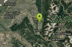
Driggs Nordic Trail
Driggs, Idaho
29.3 miles SEDistance: 3.1 miles (5km) Trail Map: Driggs_Nordic_Track_2015.pdf Grooming Report: http://tvtap.org/nordic-grooming
Cross-country Ski, Snowshoe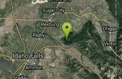
Bighole Mountains / Moody
Ririe, Idaho
29.4 miles SThis is a little unofficial campground with a plenty of shade for your basecamp and a wooded field with great boundaries. There's 2 roads that split and merge giving you very simple...
Airsoft, Paintball 0.6-2.2 mi
Fish Creek Area
Ririe, Idaho
29.4 miles SFish Creek is a network of mountain bike trails up in the Big Hole Mountains. The trails are easily accessed from either the Ririe or Rexburg side of the range. The trail system is set up much...
Hike, Mountain Bike 1.9 mi
Terraced Falls
Grant Village, Yellowstone National Park
29.4 miles E3.6 mile easy out and back trail. 430 ft Elevation gain. The trailhead is off Ashton-Flagg Ranch Road along Yellowstone's South border. Ashton-Flagg Ranch Road is closed during the winter.
Hike


