


189 Things to do near Big Elk Creek
first prev 1 2 3 4 5 6 7 8 9 10 next lastShowing results within 50 miles Distance miles of Forest Rd 270, Irwin, ID 83428, USA City, Zip, or Address
Old Ranger
Ririe, Idaho
26.3 miles NWOn the South end of the Big Hole mountains just above the Snake River is a grueling yet diverse section of single-track on Forest Service Trail 287 called Old Ranger. Because of the...
Mountain Bike
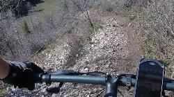
Twin Creek Trail
Driggs, Idaho
27.1 miles NThe Twin Creek trail is 2.3 miles long. It begins at Trail 6195 and ends at Trail 6219. source: fs.usda.gov
Mountain Bike
Jumping Rock at Phelp's Lake
Jackson, Wyoming
27.1 miles NEJust below Teton's Death Canyon, on the eastern shore of Phelp's Lake is a 20 foot boulder sitting all by itself above deep water. It's almost if God said, "Those hikers will need a...
Dive, Hike, Swim 1.3-4.3 mi
Phelps Lake
Jackson, Wyoming
27.1 miles NEThe Phelps Lake trail, located in Teton National Park, Wyoming, is in one of the most scenic locations of the park. Usually overshadowed by nearby Jenny Lake, it can often be missed by visitors of...
Backpack, Camp, Dive, Hike, Swim 0.1-0.2 mi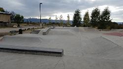
Driggs Bike and Skate Park
Driggs, Idaho
27.5 miles NThis is a great concrete skatepark and small mountain bike park with great features, both natural and wooden. There's a great pavilion right next to the skatepark and parking lot. While...
Mountain Bike, Skateboard
Teton Valley Disc Golf Course
Driggs, Idaho
27.7 miles NEnjoy 360-degree mtn views from this city park that also features a skateboard area. This course is on your way to the Grand Targhee course. Public (No Fee)
Disc Golf 3.9 mi
Three Wookie Trail
Driggs, Idaho
27.7 miles NMountain Bike near Driggs, Idaho
Mountain Bike 4.5 mi
Aspen Trail
Alta, Wyoming
27.8 miles NAspen Trail (tr 034) is single track trail for 4.35 miles along 6,800 ft contour to Darby Canyon (tr 012). Spring Creek Trail (tr 032) is double track trail for 3.68 miles to end. The trail starts...
Hike, Mountain Bike
The Arcane
Ririe, Idaho
27.9 miles NWRock Climb near Ririe, Idaho
Rock Climb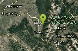
Spring Creek Trail
Alta, Wyoming
28.1 miles NThis trail starts at the remains of the historic Rapid Creek Ranger Station. The trail heads east following an old road. After crossing Rapid Creek, the trail climbs up to a ridge...
Mountain Bike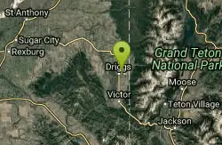
Driggs Nordic Trail
Driggs, Idaho
28.2 miles NDistance: 3.1 miles (5km) Trail Map: Driggs_Nordic_Track_2015.pdf Grooming Report: http://tvtap.org/nordic-grooming
Cross-country Ski, Snowshoe
Thousand Springs Trail
Driggs, Idaho
28.5 miles NWThe Thousand Springs trail begins at Moody Swamp trailhead and ends at Jct Prospect Peak Trail. source: fs.usda.gov Courtesy of Singletracks.com
Mountain Bike

Bovine
Driggs, Idaho
29.0 miles NBovine trail is part of a larger system. You can use it to access more trails or make it your end destination from other trailheads. It is a steep climb but returns the favor with a fast downhill....
Mountain Bike
Horseshoe Trails
Driggs, Idaho
29.0 miles NMountain Bike near Driggs, Idaho
Mountain Bike
North Mahogany Trail #220
Tetonia, Idaho
29.0 miles Nhe N. Mahogany Trail is open to Motorbikes, Mountain bikes, Horses, and Hikers. Motorbikes and Horseback riders are the most common visitors, but the trail is becoming increasingly...
Mountain Bike
Horseshoe Canyon
Tetonia, Idaho
29.1 miles NHorseshoe Canyon is one of the closest trail systems to the town of Driggs, Idaho. This network doesn't have a ton of climbing or descending, but the smooth, swooping singletrack with a...
Mountain Bike
Southbound
Driggs, Idaho
29.1 miles NTrail starts by going up the Channel lock trail. At the top of Channel Lock go right onto the Southbound trail. Trail will loop back to Channel lock which you take back to your car. Trail is...
Mountain Bike
Channel Lock
Driggs, Idaho
29.1 miles NTrail is a little over 1 mile uphill. Recommended route up to access the larger Horseshoe canyon trail system. Makes a nice downhill with twists. Gets its name from the deep ruts made from cows....
Mountain Bike
Sharks Belly
Driggs, Idaho
29.1 miles NTrail system can start from Channel lock or Bovine. Channel Lock is an easier climb than Bovine. This description and mileage starts at the Channel Lock trail, forest service boundary marker. Take...
Mountain Bike
Wolverine Creek Trail
Ririe, Idaho
29.3 miles NWThe Wolverine Creek Trail is a doubletrack trail in Ririe, Idaho. It begins at South Fork Road and ends at Wolverine trailhead. It is commonly used by dirt bikes and four wheelers. This trail is...
Mountain Bike


