


141 Things to do near Big Springs
first prev 1 2 3 4 5 6 7 8 next lastShowing results within 50 miles Distance miles of BIG SPRINGS GRP. AREA - ISLAND PARK, S Big Springs Loop Rd, Island Park, ID 83433, USA City, Zip, or Address

Pelican Creek Nature Trail
Lake Village, Yellowstone National Park
44.2 miles EPelican Creek Nature Trail is a beautiful easy walk that gives visitors views of Yellowstone Lake and Pelican Creek. This family friendly trail can be completed in under an hour. Despite the...
Hike
Badger Creek
Tetonia, Idaho
44.3 miles SBadger Creek is a stream located just 13.6 miles from Ashton, in Teton County, in the state of Idaho, United States, near France, ID. Whether you’re spinning, baitcasting or fly fishing your...
Camp, Cross-country Ski, Hike, Mountain Bike, Rock Climb 7.9 mi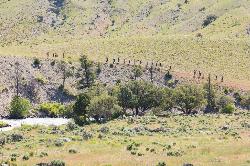
Rescue Creek Trail
Mammoth Hot Springs, Yellowstone National Park
45.3 miles NERescue Creek Trail is an 8 mile hike that crosses the Montana/Wyoming boarder. This double trail makes for a leisurely hike through beautiful hills and colorful yellow green grasslands. This trail,...
Hike 7.4 mi
Blacktail Deer Creek to Yellowstone River Trail
Mammoth Hot Springs, Yellowstone National Park
45.3 miles NEBlacktail Deer Creek Trail is a 7 mile out and back trail that leads to the Yellowstone River. Hikers on this trail will enjoy seeing green open fields, boulder formations and waterfalls at the...
Hike 16.3 mi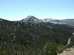
Mount Washburn Spur Trail
Canyon Village, Yellowstone National Park
45.3 miles NEWashburn Spur Trail is an exciting 8-mile trail connecting the peak of Mount Washburn to Seven Mile Hole Trail near Canyon Village. Hikers typically hike the trail starting at Mount Washburn and...
Hike 4.4 mi
Chittenden Road - Mount Washburn Trail
Canyon Village, Yellowstone National Park
45.4 miles NEHiking Mount Washburn via Chittenden Road is the shortest and easiest route to the top. The trail was once a service road and is now a clear well packed trail with a steady, gradual incline. The...
Hike 3.8 mi
Abandoned Railroad Bed Bike Trail
Gardiner, Montana
45.4 miles NEThe Abandoned Railroad Bed Bike Trail, otherwise known as Shortline Trail, is a easily accessible bike trail found just inside the North Entrance of Yellowstone National Park. This bike trail follows...
Mountain Bike 2.8 mi

Mount Washburn Bike Trail
Devils Den, Wyoming
45.7 miles NEMount Washburn Bike Trail follows Chittenden Service Road for 2.5 miles to the top of Mount Washburn. This steep climb up the mountain provides a challenging elevation gain of 1500 feet. Mount...
Mountain Bike 7.4 mi
Pelican Valley Trail
Lake Village, Yellowstone National Park
46.0 miles EPelican Valley Trail is a beautiful 6.2 mile hike that allows hikers to see Yellowstone Lake, Pelican Springs and the Pelican Valley water features. Despite its length this is an easy, level...
Hike 2.1 mi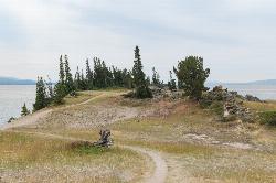
Storm Point Trail
Lake Village, Yellowstone National Park
46.0 miles EStorm Point Trail is a beautiful 2.3 mile hike that can be completed in under 2 hours. This is an easy hike with very little elevation change that is perfect for families with children. Hikers on...
Hike
Marshall's
Saint Anthony, Idaho
46.2 miles SWMarshall's Wave is located on the North Fork of the Teton River, where the Teton River splits into the north and south forks. The wave is created by a headgate and is best at flows above 600...
Kayak
Forces of the Northern Range
Mammoth, Yellowstone National Park
46.4 miles NEThis short 1/2 mile boardwalk located on the Blacktail Deer Plateau between Mammoth Village and Tower Junction will open your eyes and educate you about forces of nature that have sculpted the land...
Hike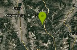
Buck Ridge
Gallatin Gateway, Montana
46.8 miles NThis is a ride you do for the scenery rather than the singletrack. It is an out-and-back on about 8 miles of doubletrack/atv trail. Most of the ride give you fantastic views of the...
Mountain Bike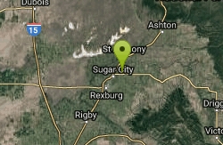
Sucky Courtney's
Saint Anthony, Idaho
47.0 miles SWKayaker playing in Marshall's Wave near Rexburg, Idaho. The wave is located on the North Fork of the Teton River and is best at flows above 600 cfs. The wave is good for beginners. It has a...
Kayak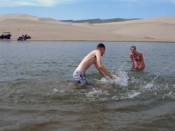
Egin Lakes
Saint Anthony, Idaho
47.5 miles SWEgin Lakes is one of the favorite gateways to the St. Anthony Sand Dunes. The lakes themselves are unusually shallow and where you'll actually find a lake depends greatly on what time of the...
Sled, Swim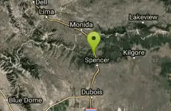
Stoddard Creek
Spencer, Idaho
47.7 miles WStoddard Creek Campground is located just 1 mile off I-15 and 17 miles north of the town of Dubois, Idaho. Visitors come to the area to enjoy the abundance of trails, wildlife viewing opportunities...
Camp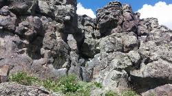
Basalt Bluff / Steve's Rock
Teton, Idaho
49.3 miles SWDon't go anywhere marked No Trespassing and Beware of the Attack Bees at the top of the cliffs and the Stinging Nettle at the bottom. About a mile north of Loon Lake/Wentworth Springs Road...
Rock Climb
Wright Creek Trail
Tetonia, Idaho
49.6 miles SOpen to MTB, horseback riding, snowshoeing, and hiking. source: fs.usda.gov
Mountain Bike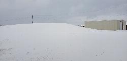
Park on Center St
Sugar City, Idaho
49.7 miles SWSled near Sugar City, Idaho
Sled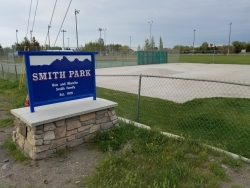
Smith Park
Sugar City, Idaho
49.9 miles SWSugar Hill is a smaller sledding hill in Sugar City's Smith Park. It's great for younger kids or just some quick runs. You can often get a good run on every side.
Skateboard, Sled


