


202 Things to do near Coal Creek Trail
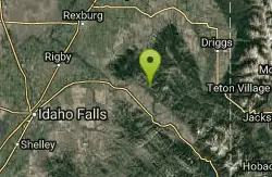
first prev 2 3 4 5 6 7 8 9 10 11 next lastShowing results within 50 miles Distance miles of Coal Creek Trail Head, Alta, WY 83414, USA City, Zip, or Address
Blacks Canyon Trail
Ririe, Idaho
24.1 miles WThe Blacks Canyon trail begins at Black Can Road and ends at Junction Fleming Canyon Trail. The trail is open for the following uses: Motorcycle Trail Riding, Off Highway Vehicles (OHV)...
Mountain Bike
Thousand Springs Trail
Driggs, Idaho
24.5 miles NWThe Thousand Springs trail begins at Moody Swamp trailhead and ends at Jct Prospect Peak Trail. source: fs.usda.gov Courtesy of Singletracks.com
Mountain Bike
South Fork Fall Creek Trail
Swan Valley, Idaho
24.7 miles WOHV trail.
Mountain Bike
Mt. Moran
Alta, Wyoming
24.8 miles NEMount Moran (12,610 feet (3,840 m)) is a mountain in Grand Teton National Park of western Wyoming, USA. The mountain is named for Thomas Moran, an American western frontier landscape artist....
Hike
Burns Canyon
Ririe, Idaho
25.0 miles WHike and Mountain Bike near Ririe, Idaho
Hike, Mountain Bike 0.6-5.5 mi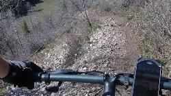
Old Ranger
Ririe, Idaho
25.1 miles WOn the South end of the Big Hole mountains just above the Snake River is a grueling yet diverse section of single-track on Forest Service Trail 287 called Old Ranger. Because of the...
Mountain Bike 0.6 mi
Packsaddle Lake
Tetonia, Idaho
25.3 miles NWPacksaddle is one of the less well known lakes/trails in the area. If you've got a good offroad vehicle, you can probably make it all the way to the end of the road, otherwise, it's just an...
Dive, Hike, Mountain Bike, Snowshoe, Swim
Badger Creek
Tetonia, Idaho
25.6 miles NBadger Creek is a stream located just 13.6 miles from Ashton, in Teton County, in the state of Idaho, United States, near France, ID. Whether you’re spinning, baitcasting or fly fishing your...
Camp, Cross-country Ski, Hike, Mountain Bike, Rock Climb
Bailey Lake
Jackson, Wyoming
26.3 miles SEBailey Lake is located on the Guyandotte River in Wyoming and Mingo Counties in West Virginia, 3.3 miles (5.3 km) east of Justice. Originally referred to as Justice Reservoir, the lake was named by...
Camp, Hike, Horseback, Mountain Bike
Moody Meadows
Driggs, Idaho
26.6 miles NWGood place for kids, they can ride bikes in the meadow, play in the stream, and camping is off of the road. Hiking, motorbiking, and horseback riding trails are abundant in the area.
Camp
The Arcane
Ririe, Idaho
27.2 miles WRock Climb near Ririe, Idaho
Rock Climb
Wright Creek Trail
Tetonia, Idaho
27.6 miles NWOpen to MTB, horseback riding, snowshoeing, and hiking. source: fs.usda.gov
Mountain Bike
South Fork Bear Creek Trail
Wayan, Idaho
28.3 miles SWOHV trail. source: fs.usda.gov
Mountain Bike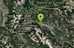
Crystal Creek Campground
Jackson, Wyoming
28.6 miles ECrystal Creek Campground is located along the Gros Ventre River and Crystal Creek, both designated Wild and Scenic Rivers for the spectacular surrounding scenery and excellent fishing opportunities....
Camp
Wolverine Creek Trail
Ririe, Idaho
28.6 miles WThe Wolverine Creek Trail is a doubletrack trail in Ririe, Idaho. It begins at South Fork Road and ends at Wolverine trailhead. It is commonly used by dirt bikes and four wheelers. This trail is...
Mountain Bike 4.3 mi
Leaning Fir #169
Ririe, Idaho
30.4 miles WMountain Bike near Ririe, Idaho
Mountain Bike 0.6-2.2 mi
Fish Creek Area
Ririe, Idaho
30.7 miles WFish Creek is a network of mountain bike trails up in the Big Hole Mountains. The trails are easily accessed from either the Ririe or Rexburg side of the range. The trail system is set up much...
Hike, Mountain Bike
Table Rock Campground
Ririe, Idaho
31.3 miles WTable Rock / Poison Flat Campground is located at the Caribou-Targhee National Forest which occupies over 3 million acres and stretches across southeastern Idaho, from the Montana, Utah, and Wyoming...
Camp
Lower Hawley Gulch Trail
Ririe, Idaho
31.3 miles WThis is a singletrack biking trail in Ririe, Idaho. The trail is mainly flat with a few gradual slopes. You may have to carry your bike over obstacles such as fallen trees, logs, and small ponds....
Mountain Bike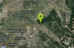
Kelly Canyon/Table Rock
Ririe, Idaho
31.3 miles WThe initial climb is soft, so you might wash out a little. There are enough roots and rocks to add some challenge to the climb and some air to the descent. The trail forks at one point,...
Mountain Bike


