


234 Things to do near Dixie Mine
first prev 1 2 3 4 5 6 7 8 9 10 next lastShowing results within 50 miles Distance miles of 14464 E Golden Eagle Blvd, Fountain Hills, AZ 85268, USA City, Zip, or Address

Usery Mountain Regional Park
Mesa, Arizona
14.7 miles SEThere are many miles of two-way single-track trails in the park at several levels of difficulty. The Pass Mountain Trail should challenge intermediate to advanced riders. The Cat Peaks...
Mountain Bike 1.5 mi
Moon Rock Loop
Apache Junction, Arizona
14.8 miles SELocated within the larger Usery Mountain Regional Park, the Moon Rock loop is a fast and smooth trail that adds 1.3 miles to the more famous Blevins Trail. Although the Moon Rock loop is not known as...
Hike, Horseback, Mountain Bike
Vista del Camino Park
Scottsdale, Arizona
14.8 miles SWThe Shelly Sharpe Memorial Disc Golf Course at Vista del Camino was installed in 1984 and redesigned in 1997 by PDGA Hall of Fame member Dan Ginnelly. It is a pretty level and open course - water...
Disc Golf
Shadow Mountain Trail
Phoenix, Arizona
14.9 miles WThis particular route trailhead starts at 23rd place and Sweetwater rd it's a great wildlife trail.
Hike
Cat Peaks - Blevin - Moonrock
Apache Junction, Arizona
14.9 miles SEFollow Blevins trail 0.6 miles, the entrance to the Moonrock loop will be on your right, marked by a brown sign and arrow. Take this loop (around 1.4 miles) until it returns to Blevin's...
Mountain Bike
Red Mountain - North
Mesa, Arizona
15.0 miles SThe North course is the more challenging of the two courses on site. It begins in the desert and works it way back into the park. Bring lots of water and be prepared for desert plant life, as well as...
Disc Golf
Red Mountain - South
Mesa, Arizona
15.0 miles SEntirely in desert, this is the easier of the two courses on site. Bring water and be prepared for the desert terrain. There are plenty of big trees to challenge as well. Note: rattlesnakes have been...
Disc Golf 1.9 mi
Ruth Hamilton Trail
Phoenix, Arizona
15.1 miles SWHike and Mountain Bike near Phoenix, Arizona
Hike, Mountain Bike 1.7 mi
Levee Trail
Mesa, Arizona
15.1 miles SELocated within the Usery Mountain Regional Park, the Levee trail is named so because it mostly follows the top of levee, running parallel to a large section of the channel trail and a Phoenix...
Hike, Horseback, Mountain Bike
Reach 11 Trail
Phoenix, Arizona
15.1 miles WHike near Phoenix, Arizona
Hike

East Maricopa Floodway
Mesa, Arizona
15.5 miles SWith a primary entrance located at the intersection between Main Street and Higley Road, the East Maricopa Floodway provides riding to cyclists and mountain bikers. The surface of the floodway...
Mountain Bike
Crismon Wash Trail
Mesa, Arizona
15.5 miles SEThe Crismon Wash Trail is 1.8 mile trail that is accessible from the south at the Crismon road trailhead. It is also accessible from the Blevins train to the north. There are several...
Hike, Horseback, Mountain Bike 1.7 mi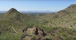
Quartz Ridge Trail
Phoenix, Arizona
15.7 miles SWThis is a very popular trail on weekend mornings. Casual hikers can get great views of Phoenix with moderate effort. Good place to bring out of town visitors The Quartz Ridge Trail is a short,...
Hike, Mountain Bike
Scarlett Canyon
Phoenix, Arizona
15.8 miles WScarlett Canyon trail (not officially named) is an unmarked trail adjacent to the Scarlett Canyon residential neighborhood. This is a 3 mile loop trail considered to be easy to...
Hike, Horseback, Mountain Bike, Rock Climb
Trail #100
Phoenix, Arizona
15.8 miles WFrom Dreamy Draw you can head NW on Trail 100 and immeadiately hit a ridge with good views. Ride on for 5 - 6 miles of nice single track and great views, to 7th and return. If you...
Mountain Bike 1.3 mi
Dreamy Draw Loop Trail
Phoenix, Arizona
15.8 miles WThe Dreamy Draw Nature Trail is a short multi-access loop trail that provides a true Sonoran Desert experience. The trail crosses a number of desert washes and, at times, becomes somewhat rocky....
Hike, Horseback, Mountain Bike 4.8 mi
Trail 1A
Phoenix, Arizona
15.8 miles WThe trail can be accessed from the Dreamy Draw Park parking lot. From there, the trail can be ridden south towards its origin, or east (the trail makes an "L" shape). It is a mix of double...
Mountain Bike 1.4 mi
Mohave Trail (#200)
Phoenix, Arizona
15.8 miles SWAn invigorating swift hike is what Mohave Trail 200 provides for anyone looking for a free and quick escape. Though the main attraction of the Phoenix Mountain’s Preserve is the larger Piestewa...
Hike, Horseback
Reed Skatepark
Mesa, Arizona
16.0 miles SThis nineteen acre outdoor concrete skatepark is fairly big. It features an intermediate level street course, a combi pool, hips, and a large beginners area. For more information call Mesa Reed...
Skateboard
Buffalo Ridge Park
Phoenix, Arizona
16.0 miles WOffering elevation, rugged terrain, blind holes and great views. Begins near the restrooms, then a long 27 alongside the mountain back to the parking lot. Bring plenty of water. * Nov 2011. New holes...
Disc Golf


