


218 Things to do near Founder's Square Hill (Under the Water Tower)
first prev 2 3 4 5 6 7 8 9 10 11 next lastShowing results within 50 miles Distance miles of 1269 Stone Dr, Rexburg, ID 83440, USA City, Zip, or Address

Idaho Falls Skate Park
Idaho Falls, Idaho
26.1 miles SWSkateboard near Idaho Falls, Idaho
Skateboard
South Fork Snake River Trail
Ririe, Idaho
26.5 miles SEGo left at the trail head. It heads down about a mile and a half on double track. Then you'll come to a creek crossing. After the crossing the trail heads across a gate. Head left...
Mountain Bike
Ryder Park
Idaho Falls, Idaho
27.3 miles SWThe bike park Ryder Park is being actively built right now. Plans are to have several trails of varying difficulty.
Mountain Bike
Twin Creek Trail
Driggs, Idaho
28.0 miles EThe Twin Creek trail is 2.3 miles long. It begins at Trail 6195 and ends at Trail 6219. source: fs.usda.gov
Mountain Bike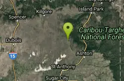
Sand Creek Frenzy
Ashton, Idaho
29.1 miles NThere are some woods back there and it is secluded. There are many places you can play just watch out for campers.
Paintball
West Pine Creek Trail
Ririe, Idaho
29.1 miles SENon-motorized use. source: fs.usda.gov
Mountain Bike
Trail Canyon Trail
Ririe, Idaho
29.2 miles SEThe Trail Canyon trail begins at Trail Canyon Parklot, T8s R43e Sec28 and ends at Intersect Trail 5251,t8s R43e Sec28. source: fs.usda.gov
Mountain Bike
Ashton Hill
Ashton, Idaho
29.9 miles NEFairly thick forest. Considerable underbrush. Lots of places in the area to play.
Airsoft, Paintball
Big Hole Crest Trail
Driggs, Idaho
29.9 miles EThis is a tough ride. Definately for advanced riders. Lots of climbing and descending. The trail at either end is well used and really fun. Not too much technical riding, just fun...
Mountain Bike
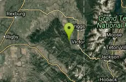
Henderson Canyon
Victor, Idaho
30.3 miles ETrail begins as dirt road/double track with numerous "cow" trails breaking off of road. Some of these trails see more tire tracks than others.
Mountain Bike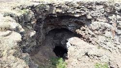
Rexburg Area Ice Caves
Rexburg, Idaho
30.8 miles NNot to be mistaken with the Civil Defense Caves (which are near by), the Ice Caves are about an hour North outside of Rexburg. The Ice Caves were originally formed as lava tubes. Over the years they...
Cave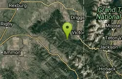
Red Creek Via Spooky Trail
Victor, Idaho
31.3 miles SETrail starts on the Spooky trail segment. About 1.2 up you'll see a trail on your left. This is where you will be coming out at. Continue straight. At about 2.6 from the car you'll...
Mountain Bike 1.2 mi
Spooky
Victor, Idaho
31.3 miles SETrail serves as the stem to Red Creek or access to Corral Creek as well as other possibilities in the big hole mountains. Nice fun singletrack to run as an out n back if your time is...
Mountain Bike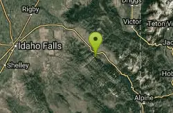
Echo Canyon aka Fall Creek
Ririe, Idaho
31.5 miles SETrail goes to the top of Deadhorse Ridge for some amazing views. Double-track, single-track, and gravel road. Length: 15 miles
Mountain Bike
Badger Creek
Tetonia, Idaho
31.5 miles EBadger Creek is a stream located just 13.6 miles from Ashton, in Teton County, in the state of Idaho, United States, near France, ID. Whether you’re spinning, baitcasting or fly fishing your...
Camp, Cross-country Ski, Hike, Mountain Bike, Rock Climb
Sealander Park
Idaho Falls, Idaho
31.7 miles SWThe story of Sealander park begins with Carl Sealander. Leaving Sweden in 1893 at the age of seventeen, Carl worked in mining communities across Colorado and Utah before meeting his wife, Lizzie...
Camp
Fall Creek Falls
Swan Valley, Idaho
31.9 miles SEFalls Campground is located next to the Snake River near beautiful Swan Valley, only 45 miles east of Idaho Falls, Idaho. Mixed growth cottonwood trees provide partial shade, and grassy meadows with...
Camp, Cave, Hike, Kayak, Swim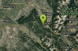
Grove Creek to Drake Creek
Victor, Idaho
31.9 miles SEGreat loop trail that connects several trails through the area. This trail was recently rerouted, and so will have plenty of new switchbacks to take as riders climb the mountain. Originally this...
Mountain Bike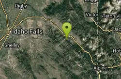
Echo/Indian Creek Trail
Swan Valley, Idaho
31.9 miles SEOHV trail. source: fs.usda.gov
Mountain Bike 3.2-47.0 mi
Yellowstone Branch Line Trail
Ashton, Idaho
32.0 miles NEYellowstone branch line trail runs from Warm River to the Montana border totaling 39 miles. There are a few places to jump on and off the trail as well as a few smaller trails that branch off of this...
Backpack, Cross-country Ski, Hike, Horseback, Mountain Bike


