


205 Things to do near Lorenzo Bridge
first prev 1 2 3 4 5 6 7 8 9 10 next lastShowing results within 50 miles Distance miles of 3987 W 6800 S, Rexburg, ID 83440, USA City, Zip, or Address
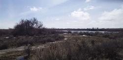
Market Lake Wildlife Management Area
Roberts, Idaho
14.0 miles WMallards, Canada geese, canvasbacks, cinnamon and green-winged teal, northern shovelers and ruddy ducks are common waterfowl species nesting and raising broods on the WMA. Several thousand...
Hike, Horseback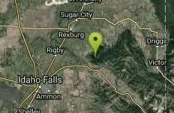
Bighole Mountains / Moody
Ririe, Idaho
14.1 miles EThis is a little unofficial campground with a plenty of shade for your basecamp and a wooded field with great boundaries. There's 2 roads that split and merge giving you very simple...
Airsoft, Paintball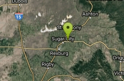
Sucky Courtney's
Saint Anthony, Idaho
14.1 miles NEKayaker playing in Marshall's Wave near Rexburg, Idaho. The wave is located on the North Fork of the Teton River and is best at flows above 600 cfs. The wave is good for beginners. It has a...
Kayak 3.8 mi
Kelly Mountain Trail
Ririe, Idaho
14.4 miles SEKelly Canyon Trail is a moderate, uphill trail that can be used by hikers, mountain bikers, and ATV riders. The trail features views of hills, mountains, trees, wildflowers, and some wildlife. Dogs...
Cross-country Ski, Hike, Mountain Bike, Snowshoe 0.3 mi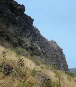
Pointless Crag
Ririe, Idaho
14.4 miles SENO MORE BOLTING as of 5/2012 requested by the Bureau of Land Management. The BLM has asked us NOT to park on the road below the cliff. Please use the obvious parking area next to the river...
Rock Climb
Kelly Canyon Loops
Ririe, Idaho
14.6 miles EThis mountain bike trail near Kelly Canyon Ski Area has several options available. Highlights are the views in all directions from the top of the mountain. Trails: Waterfall...
Mountain Bike 1.8 mi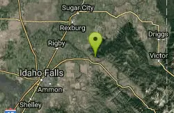
Crystal Cruise
Ririe, Idaho
14.7 miles SEThis trail uses the Crystal Cruise Nordic Trail along the Kelly Canyon ski resort boundary, taking you up to Kelly Canyon proper. It's a good climb, and a quick downhill back to the parking...
Mountain Bike 11.9 mi
Waterfall Loop
Ririe, Idaho
14.8 miles ETrail is a mixture of single track, forest road and double track. Provides a variety of scenery. About 1400 feet of elevation change throughout the trail.GPS is a must unless you are going with...
Mountain Bike 1.7 mi
Buckskin Morgan Ridge
Ririe, Idaho
14.9 miles SEGoing up is a little tough because of the rocks, but once you clear the top it is a twisty down hill portion [until] you get to a fenced road. From there you can turn around or keep going strait...
Hike, Mountain Bike 5.7-8.1 mi
Space Cruz
Ririe, Idaho
14.9 miles SEThe trail starts out with a really flowy singletrack then connects up to some ATV trails. On the single track, just stay on the main trail. There are several little splits several you can take...
Cross-country Ski, Mountain Bike 1.1 mi
Hidden Vista / Pine Loop
Ririe, Idaho
14.9 miles SEYou'll find the Hidden Vista trailhead on the South End of the Buckskin Morgan parking lot about a mile past Y Junction. This is a short trail with a little up and a little down for just under a...
Hike, Mountain Bike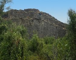
South Park
Ririe, Idaho
15.1 miles SERock Climb near Ririe, Idaho
Rock Climb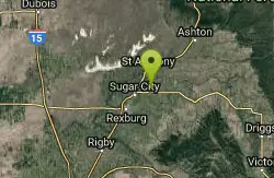
Marshall's
Saint Anthony, Idaho
15.1 miles NEMarshall's Wave is located on the North Fork of the Teton River, where the Teton River splits into the north and south forks. The wave is created by a headgate and is best at flows above 600...
Kayak
Poison Flats
Ririe, Idaho
15.2 miles SEHike near Ririe, Idaho
Hike
Lower Hawley Gulch Trail
Ririe, Idaho
15.5 miles SEThis is a singletrack biking trail in Ririe, Idaho. The trail is mainly flat with a few gradual slopes. You may have to carry your bike over obstacles such as fallen trees, logs, and small ponds....
Mountain Bike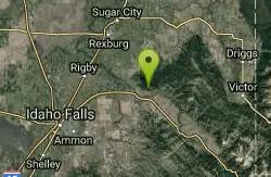
Kelly Canyon/Table Rock
Ririe, Idaho
15.5 miles SEThe initial climb is soft, so you might wash out a little. There are enough roots and rocks to add some challenge to the climb and some air to the descent. The trail forks at one point,...
Mountain Bike

Table Rock Campground
Ririe, Idaho
15.6 miles SETable Rock / Poison Flat Campground is located at the Caribou-Targhee National Forest which occupies over 3 million acres and stretches across southeastern Idaho, from the Montana, Utah, and Wyoming...
Camp
Wolf Flats Recreation Area
Ririe, Idaho
15.8 miles SEWolf Flats is a completely free, dispersed, undeveloped camping area with 25 locations to camp. Some areas are large enough to accommodate groups of 50 people.
Camp 0.6-2.2 mi
Fish Creek Area
Ririe, Idaho
15.9 miles EFish Creek is a network of mountain bike trails up in the Big Hole Mountains. The trails are easily accessed from either the Ririe or Rexburg side of the range. The trail system is set up much...
Hike, Mountain Bike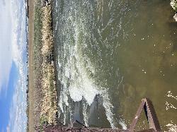
Double Tap wave feature
Idaho Falls, Idaho
15.9 miles SWIt's a fun little double feature in an irrigation canal the first is a open elevation control dam that throws a nice wave and foam pile off of it great for freestyle kayaking then about 30 yards...
Canoe, Kayak


