


140 Things to do near Pine Butte / The Caldera
first prev 1 2 3 4 5 6 7 next lastShowing results within 50 miles Distance miles of 757H+H4 Bedstead Corner, ID, USA City, Zip, or Address

Box Canyon Trail
Island Park, Idaho
23.6 miles NEVarious species of tress and wildflowers can be seen on the trail, as well as songbirds, waterfowl and occasional wildlife. The trail is open for the following uses: Motorcycle Trail Riding, Off...
Hike, Mountain Bike

Monkey Rock
Saint Anthony, Idaho
25.0 miles SECLOSED. PSA: Monkey Rock is no longer open to the public. The owner has posted "No Trespassing" signs and is asking the Fremont County Sheriff's Office to assist with keeping people out of their...
Swim
Mesa Falls
Ashton, Idaho
25.1 miles EUpper Mesa Falls, aka Big Falls, is an absolutely awesome waterfall on the Henrys Fork of the Snake River. The falls drop 114 ft. and measure 300 ft. across. To get to the falls from the parking lot...
Cross-country Ski, Hike, Kayak
Hog Hollow Bridge
Saint Anthony, Idaho
25.1 miles SELess than 1/2 a mile down the road from the Monkey Rock waterfall, Hog Hollow Bridge is a favorite spot for adrenaline junkies to cool off. The place to jump is off the East side of the bridge where...
Dive, Swim 0.9 mi
Buffalo River Campground
Island Park, Idaho
25.3 miles NEThe float here is nice and easy. It's a great early season float. Later in the season the shallow spots will force you to walk a good chunk of the float. The water is super clear and often pretty...
Camp, Canoe, Kayak, Swim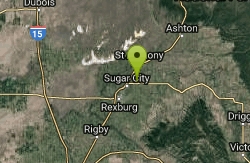
Sucky Courtney's
Saint Anthony, Idaho
26.3 miles SKayaker playing in Marshall's Wave near Rexburg, Idaho. The wave is located on the North Fork of the Teton River and is best at flows above 600 cfs. The wave is good for beginners. It has a...
Kayak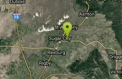
Marshall's
Saint Anthony, Idaho
26.4 miles SMarshall's Wave is located on the North Fork of the Teton River, where the Teton River splits into the north and south forks. The wave is created by a headgate and is best at flows above 600...
Kayak 3.2-47.0 mi
Yellowstone Branch Line Trail
Ashton, Idaho
27.2 miles EYellowstone branch line trail runs from Warm River to the Montana border totaling 39 miles. There are a few places to jump on and off the trail as well as a few smaller trails that branch off of this...
Backpack, Cross-country Ski, Hike, Horseback, Mountain Bike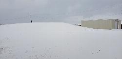
Park on Center St
Sugar City, Idaho
27.2 miles SSled near Sugar City, Idaho
Sled 0.8-1.3 mi
Warm Slough Campground
Rexburg, Idaho
27.2 miles SThis is a pretty popular campsite that fills up pretty quick on busy weekends. Campsites are fairly spread out and there is no official donation box (as of July 2015). A couple of the campsites...
Airsoft, Camp, Canoe
Warm River Campground
Ashton, Idaho
27.3 miles EWarm River Campground is located nine miles northeast of Ashton, Idaho, along the slow-moving Warm River at an elevation of 5,200 feet. Willows line the riverbanks and pine trees offer partial...
Camp 7.6 mi
Mount Jefferson
Island Park, Idaho
27.3 miles NEMount Jefferson, at 10, 203 feet is the highest point in the Centennial Mountains, a small, local range on the border of Idaho and Montana a little west of Yellowstone. These mountains consist of a...
Hike 4.2 mi
Lake Marie
Island Park, Idaho
27.3 miles NELake Marie sits on the North slope of Mount Jefferson in Fremont County, Idaho. The trail to get there cuts back and forth across the Idaho Montana border 4 times. Much of the trail is fairly flat...
Backpack, Hike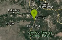
Coffee Pot Rapids Trail
Island Park, Idaho
27.3 miles NEHiker and fisherman parking is available at the campground entrance. Coffee Pot Rapids trail is 2.2 miles in length, is a non-motorized trail that follows the Henry's Fork of the Snake...
Mountain Bike
Sawtell Peak Trail
Island Park, Idaho
27.3 miles NEThis trail offers great views of the valley floor, mountain peaks and wildlife. source: fs.usda.gov
Mountain Bike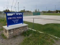
Smith Park
Sugar City, Idaho
27.4 miles SSugar Hill is a smaller sledding hill in Sugar City's Smith Park. It's great for younger kids or just some quick runs. You can often get a good run on every side.
Skateboard, Sled
Upper Coffee Pot Campground
Island Park, Idaho
27.4 miles NEUpper Coffeepot Campground stretches along a floatable section of Henry's Fork of the Snake River. A mixed growth lodgepole pine forest provides partial shade and summer wildflowers are...
Camp, Canoe
The Pit
Ashton, Idaho
27.6 miles EThis location is great because there is no one around only locals know of this area and you can shoot anything out there. Watch out for target shooters there! Also stay away from the main road.
Airsoft, Paintball 0.3-0.6 mi
Bear Gulch
Ashton, Idaho
27.7 miles EBear Gulch is an abandoned ski hill out of operation since 1969. While the vegetation is beginning to take over, there's still some great sledding to be had. It's just far enough into the...
Camp, Cross-country Ski, Hike, Sled 0.8 mi
Conant Creek Pegram Truss Railroad Bridge
Ashton, Idaho
27.9 miles SEAs part of the Rails to Trails project, this old railroad bridge has been transformed into a very safe little viewing experience for the whole family. You can drive right up to the bridge where there...
Hike


