


140 Things to do near Pine Butte / The Caldera
first prev 1 2 3 4 5 6 7 next lastShowing results within 50 miles Distance miles of 757H+H4 Bedstead Corner, ID, USA City, Zip, or Address

Bovine
Driggs, Idaho
45.9 miles SEBovine trail is part of a larger system. You can use it to access more trails or make it your end destination from other trailheads. It is a steep climb but returns the favor with a fast downhill....
Mountain Bike
Sharks Belly
Driggs, Idaho
46.0 miles SETrail system can start from Channel lock or Bovine. Channel Lock is an easier climb than Bovine. This description and mileage starts at the Channel Lock trail, forest service boundary marker. Take...
Mountain Bike
Channel Lock
Driggs, Idaho
46.0 miles SETrail is a little over 1 mile uphill. Recommended route up to access the larger Horseshoe canyon trail system. Makes a nice downhill with twists. Gets its name from the deep ruts made from cows....
Mountain Bike
Southbound
Driggs, Idaho
46.0 miles SETrail starts by going up the Channel lock trail. At the top of Channel Lock go right onto the Southbound trail. Trail will loop back to Channel lock which you take back to your car. Trail is...
Mountain Bike 3.8 mi
Stinking Springs
Ririe, Idaho
46.1 miles SStinking Springs is a great early to late season trail. Being at the edge of the Big Hole range, it gets spring earlier and winter later than other trails in the range. It's closed from December...
Hike, Mountain Bike 2.7 mi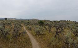
Sidewinder Trail
Ririe, Idaho
46.1 miles SSidewinder's claim to fame is that it's on a South facing hill just above the Snake River. That means that when all the other trails in the Kelly Canyon Trail network are covered with snow...
Mountain Bike 4.3 mi
Leaning Fir #169
Ririe, Idaho
46.3 miles SMountain Bike near Ririe, Idaho
Mountain Bike 14.8 mi
Biscuit Basin to Fairy Falls and Firehole Meadows
Old Faithful, Yellowstone National Park
46.6 miles EFreight Road trail is a almost 15 mile hike that leaves from Biscuit Basin or Fountain Flats Drive. This hike is a beautiful remote hike that passes several unique landmarks, breaking up this hike...
Backpack, Camp, Hike 0.3 mi
Pointless Crag
Ririe, Idaho
46.7 miles SNO MORE BOLTING as of 5/2012 requested by the Bureau of Land Management. The BLM has asked us NOT to park on the road below the cliff. Please use the obvious parking area next to the river...
Rock Climb
Ucon Pit
Idaho Falls, Idaho
46.9 miles SThis is a great set of hills. The hills are big. There's almost no obstacles. With hills on every side, it's almost impossible to find this place over crowded.
Sled
Wolverine Creek Trail
Ririe, Idaho
47.0 miles SThe Wolverine Creek Trail is a doubletrack trail in Ririe, Idaho. It begins at South Fork Road and ends at Wolverine trailhead. It is commonly used by dirt bikes and four wheelers. This trail is...
Mountain Bike
South Park
Ririe, Idaho
47.1 miles SRock Climb near Ririe, Idaho
Rock Climb
Wolf Flats Recreation Area
Ririe, Idaho
47.2 miles SWolf Flats is a completely free, dispersed, undeveloped camping area with 25 locations to camp. Some areas are large enough to accommodate groups of 50 people.
Camp
Blacktail Day Use Area
Ririe, Idaho
47.4 miles SOn the North end of Ririe Reservoir there is a great little park with cliff jumping and even rock climbing. There is a trail from the south end of the parking lot down along the cliffs. There are...
Dive, Rock Climb, Swim

The Arcane
Ririe, Idaho
48.0 miles SRock Climb near Ririe, Idaho
Rock Climb
Cabin Creek
West Yellowstone, Montana
48.1 miles NEStarts out as a nice, buff trail. After a mile or two, there are a lot of tough creek crossings and when I rode it in 2010 there were a lot of trees down. This was from a recent...
Mountain Bike
Twin Creek Trail
Driggs, Idaho
48.6 miles SEThe Twin Creek trail is 2.3 miles long. It begins at Trail 6195 and ends at Trail 6219. source: fs.usda.gov
Mountain Bike
Burns Canyon
Ririe, Idaho
48.9 miles SHike and Mountain Bike near Ririe, Idaho
Hike, Mountain Bike 0.6-5.5 mi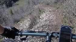
Old Ranger
Ririe, Idaho
48.9 miles SOn the South end of the Big Hole mountains just above the Snake River is a grueling yet diverse section of single-track on Forest Service Trail 287 called Old Ranger. Because of the...
Mountain Bike 1.9 mi
Terraced Falls
Grant Village, Yellowstone National Park
49.2 miles E3.6 mile easy out and back trail. 430 ft Elevation gain. The trailhead is off Ashton-Flagg Ranch Road along Yellowstone's South border. Ashton-Flagg Ranch Road is closed during the winter.
Hike


