


216 Things to do near Ririe River Island (AKA Twin Bridges)
first prev 2 3 4 5 6 7 8 9 10 11 next lastShowing results within 50 miles Distance miles of 10437 Archer Hwy, Rexburg, ID 83440, USA City, Zip, or Address
Hunts Corral
Irwin, Idaho
33.7 miles SENon-motorized use only. source: fs.usda.gov
Mountain Bike 5.6-8.3 mi
Palisades Creek Trail / Lakes and Waterfall Canyon
Irwin, Idaho
33.8 miles SEPalisades Creek Trail is located about 50 miles southeast of Idaho Falls and about 60 miles west of Jackson Hole WY in Swan Valley Idaho. The four mile hike up to lower Palisades Lake or the 6.2 mile...
Backpack, Camp, Hike, Horseback, Mountain Bike 0.9 mi
Hell's Half Acre Lava Walk
Blackfoot, Idaho
34.8 miles WThe Lava Trails traverse the desert of the Snake River Plain through contorted landscapes created from multiple lava flows. These Hawaiian-type lava flows are associated with the stretching of the...
Hike
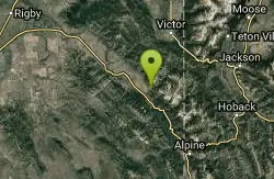
Rush Hour
Victor, Idaho
35.8 miles ETrail is a fun little out n back. 2 miles one way. Only gain about 340' in elevation throughout the trail. Perfect small workout trail and good intro to singletracks in the area. Trail turns...
Mountain Bike
Mike Harris Campground
Victor, Idaho
35.9 miles EMike Harris Campground is located along scenic Teton Pass, just 5 miles from Victor, Idaho at an elevation of 6,200 feet. Visitors enjoy fishing, exploring local trails and sightseeing in this...
Camp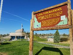
Hell's Half Acre Southbound Rest Stop
Blackfoot, Idaho
35.9 miles SWThis is a well maintained rest area with facilities to keep you happy as you travel through Idaho. This rest stop on Interstate 15 about 15 miles South of Idaho Falls has nice picnic tables and...
Hike
Hell's Half Acre Northbound Rest Stop
Blackfoot, Idaho
36.0 miles SWThis is a well maintained rest area with facilities to keep you happy as you travel through Idaho. This rest stop on Interstate 15 about 9 miles north of Blackfoot Idaho has nice picnic tables and...
Hike
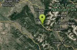
Bitch Creek Trestle
Tetonia, Idaho
36.1 miles NEAs part of the Rails to Trails project, this old railroad bridge has been transformed into a very safe little viewing experience for the whole family. You can drive right up to the bridge where...
Hike 3.3-10.0 mi
Sheep Creek Trail
Irwin, Idaho
36.6 miles SEHike and Mountain Bike near Irwin, Idaho
Hike, Mountain Bike
Spring Creek Trail
Alta, Wyoming
36.6 miles EThis trail starts at the remains of the historic Rapid Creek Ranger Station. The trail heads east following an old road. After crossing Rapid Creek, the trail climbs up to a ridge...
Mountain Bike
South Fork Bear Creek Trail
Wayan, Idaho
36.6 miles SEOHV trail. source: fs.usda.gov
Mountain Bike
Bear Creek Campground at Palisades
Irwin, Idaho
36.7 miles SEPalisades Reservoir is ideal for water skiing in the summer and features many picnic spots and boat docks. The area forest service hosts nine campgrounds containing 181 family units. Boat launch...
Camp, Hike, Horseback, Mountain Bike 4.5 mi
Aspen Trail
Alta, Wyoming
36.7 miles EAspen Trail (tr 034) is single track trail for 4.35 miles along 6,800 ft contour to Darby Canyon (tr 012). Spring Creek Trail (tr 032) is double track trail for 3.68 miles to end. The trail starts...
Hike, Mountain Bike
Calamity Campground
Irwin, Idaho
36.7 miles SECalamity Campground is located just 55 miles east of Idaho Falls, Idaho. This is the perfect area to access the Palisades Reservoir and enjoy the water activities available there. The water here is...
Camp, Canoe, Hike, Kayak, Mountain Bike, Swim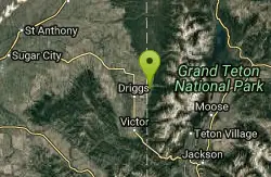
Alta Nordic Trail
Alta, Wyoming
36.9 miles EDistance: 6.2 miles (10km) Trail Map: Alta_Nordic_Trail_2015.pdf Grooming Report: http://tvtap.org/nordic-grooming
Cross-country Ski, Snowshoe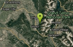
Darby Canyon Cliffs
Alta, Wyoming
37.1 miles EAn interesting cave by Darby Canyon is the major draw to this popular west slope hike, closely followed by intermittent waterfalls splashing down the canyon rim along with impressive displays of...
Rock Climb
Darby Canyon Camping
Alta, Wyoming
37.3 miles EThere's no official campgrounds up the canyon but there are several dispersed campsites with existing fire lays. Please adhere to principles of Leave No Trace. Use existing fire lays and leave...
Camp
Ashton Hill
Ashton, Idaho
37.4 miles NEFairly thick forest. Considerable underbrush. Lots of places in the area to play.
Airsoft, Paintball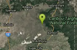
Sand Creek Frenzy
Ashton, Idaho
37.5 miles NThere are some woods back there and it is secluded. There are many places you can play just watch out for campers.
Paintball
Falls River, Lower Run
Ashton, Idaho
37.5 miles NEFall River rises on the Madison and Pitchstone plateaus in the southwest corner of Yellowstone National Park, Wyoming and flows approximately 64 miles (103 km) to its confluence with the Henrys Fork...
Whitewater


