


233 Things to do near Sidewinder Trail
first prev 3 4 5 6 7 8 9 10 11 12 next lastShowing results within 50 miles Distance miles of 5396 E Heise Rd, Ririe, ID 83443, USA City, Zip, or Address

Alaska Basin
Driggs, Idaho
37.9 miles EThe Alaska Basin Trail is a stunning trail through the Jedediah Wilderness near Driggs, Idaho and goes East into Wyoming, just outside of Grand Teton National Park. The trail is wide...
Backpack, Hike, Horseback
Black Canyon
Wilson, Wyoming
37.9 miles ETrail starts at the parking lot ontop of the pass. Take the service road on the west side of the parking lot. The road will turn into singletrack when you reach a service building...
Mountain Bike 7.9 mi
Devil's Stairs
Driggs, Idaho
37.9 miles EJust to the West of Table Rock is this often overlooked trail less traveled by, full of beautiful meadows and beautiful views all its own. The trail begins from the same campsite as the Table Rock...
Backpack, Hike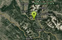
Phillips Ridge
Wilson, Wyoming
38.0 miles ETrail is recommend to be done as a shuttle but can be done as an out and back from trailhead on Fish Creek Road. Shuttle is easiest by parking a vehicle and the Stagecoach bar or the...
Mountain Bike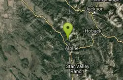
Indian Creek Campground (Palisades)
Irwin, Idaho
38.0 miles SEPalisades Reservoir is a picturesque body of water in eastern Idaho on U.S. Highway 26 near the Idaho & Wyoming border and about 25 miles west of Jackson Hole Wyoming. The reservoir is nestled...
Camp, Hike, Horseback, Swim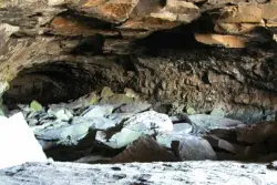
Civil Defense Caves
Rexburg, Idaho
38.3 miles NThe caves are large lava tubes. The name comes from the cold war era when they were anticipated as a safe area in the case of an attack. The entrance is pretty bouldery and does require a small...
Cave 3.2-47.0 mi
Yellowstone Branch Line Trail
Ashton, Idaho
39.1 miles NEYellowstone branch line trail runs from Warm River to the Montana border totaling 39 miles. There are a few places to jump on and off the trail as well as a few smaller trails that branch off of this...
Backpack, Cross-country Ski, Hike, Horseback, Mountain Bike
Warm River Campground
Ashton, Idaho
39.1 miles NEWarm River Campground is located nine miles northeast of Ashton, Idaho, along the slow-moving Warm River at an elevation of 5,200 feet. Willows line the riverbanks and pine trees offer partial...
Camp
Porcupine Creek
Ashton, Idaho
39.3 miles NEPorcupine Creek is a hunting, fishing, camping, and swimming spot near Ashton, Idaho in Fremont County within Targhee National Forest. It's surrounded by forests, meadows, and a creek...
Camp, Swim
Ashton Hill
Ashton, Idaho
39.7 miles NFairly thick forest. Considerable underbrush. Lots of places in the area to play.
Airsoft, Paintball 0.9 mi
Hell's Half Acre Lava Walk
Blackfoot, Idaho
39.9 miles WThe Lava Trails traverse the desert of the Snake River Plain through contorted landscapes created from multiple lava flows. These Hawaiian-type lava flows are associated with the stretching of the...
Hike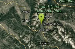
Jackson Hole Mountain Resort Disc Golf Course
Jackson, Wyoming
41.0 miles ELike the skiing, this course is extreme - with a vertical rise of over 700'. Redesigned in spring 2015, it features more technical shots through treed alley-ways, but still boasts aesthetically...
Disc Golf
Teton Village Disc Golf Course
Jackson, Wyoming
41.1 miles ELike the skiing, this course is "extreme" with a vertical rise of over 250 feet and a 9-hole course length of 3,600 ft. Public (No Fee)
Disc Golf
Sand Creek Frenzy
Ashton, Idaho
41.4 miles NThere are some woods back there and it is secluded. There are many places you can play just watch out for campers.
Paintball 0.3-0.6 mi
Bear Gulch
Ashton, Idaho
41.5 miles NEBear Gulch is an abandoned ski hill out of operation since 1969. While the vegetation is beginning to take over, there's still some great sledding to be had. It's just far enough into the...
Camp, Cross-country Ski, Hike, Sled
Alpine Campground
Alpine, Wyoming
41.8 miles SELocated two miles west of Alpine, Wyoming. Campground is situated in lodgepole pine trees, on flat terrain, and subject to wind and summer thunderstorms. Area is located near the south end of...
Camp
The Pit
Ashton, Idaho
41.8 miles NEThis location is great because there is no one around only locals know of this area and you can shoot anything out there. Watch out for target shooters there! Also stay away from the main road.
Airsoft, Paintball
Sheep Falls on Henry's Fork
Island Park, Idaho
42.6 miles NSheep Falls cascades approximately 25' through a narrow basalt chute on the North Fork of the Snake River near Island Park, Idaho. Compared to nearby Lower and Upper Mesa Falls, that height may...
Hike
Sheep Falls on Fall River
Ashton, Idaho
42.7 miles NEThe lesser known Sheep Falls on Fall River is a local treasure off of Cave Falls road. There are primitive campsites and beautiful views for a great picnic spot. The water splits and comes down in...
Camp
Mesa Falls
Ashton, Idaho
43.0 miles NUpper Mesa Falls, aka Big Falls, is an absolutely awesome waterfall on the Henrys Fork of the Snake River. The falls drop 114 ft. and measure 300 ft. across. To get to the falls from the parking lot...
Cross-country Ski, Hike, Kayak


