


Map of 184 Things to do near Menan, Idaho
first prev 1 2 3 4 5 6 7 8 9 10 next lastShowing results within 50 miles Distance miles of Menan, ID 83434, USA City, Zip, or Address
North/South Rainey Creek Trails
Irwin, Idaho
41.2 miles SEMotorcycle trail. source: fs.usda.gov
Mountain Bike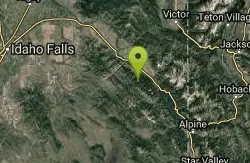
Long Gulch/Indian Trail
Swan Valley, Idaho
41.6 miles SEOff Highway Vehicles (OHV) less than or equal to 50 inches wide, Mountain Biking, Horse Riding, hiking. source: fs.usda.gov
Mountain Bike
Red Ridge Trail
Swan Valley, Idaho
41.6 miles SEOHV trail. source: fs.usda.gov
Mountain Bike
Big Bend Ridge Trail
Ashton, Idaho
42.1 miles NETrail is open to OHVs. source: fs.usda.gov
Mountain Bike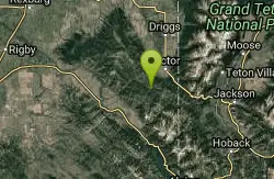
Sheep Driveway
Irwin, Idaho
42.4 miles EOHVs, mountain biking, day hiking, horse riding. source: fs.usda.gov
Mountain Bike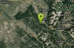
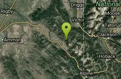
Allen Canyon-Pole Canyon Trail (014)
Victor, Idaho
42.6 miles EThis trail is locally known as the Pole Canyon Trail. Just South of Victor, ID, the Allen Canyon-Pole Canyon Trail (014) is a popular destination for local motorbikers, horseback...
Mountain Bike
Badger Creek
Tetonia, Idaho
43.0 miles EBadger Creek is a stream located just 13.6 miles from Ashton, in Teton County, in the state of Idaho, United States, near France, ID. Whether you’re spinning, baitcasting or fly fishing your...
Camp, Cross-country Ski, Hike, Mountain Bike, Rock Climb 3.2-47.0 mi
Yellowstone Branch Line Trail
Ashton, Idaho
43.5 miles NEYellowstone branch line trail runs from Warm River to the Montana border totaling 39 miles. There are a few places to jump on and off the trail as well as a few smaller trails that branch off of this...
Backpack, Cross-country Ski, Hike, Horseback, Mountain Bike
Warm River Campground
Ashton, Idaho
43.7 miles NEWarm River Campground is located nine miles northeast of Ashton, Idaho, along the slow-moving Warm River at an elevation of 5,200 feet. Willows line the riverbanks and pine trees offer partial...
Camp 3.9 mi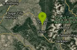
Three Wookie Trail
Driggs, Idaho
43.9 miles EMountain Bike near Driggs, Idaho
Mountain Bike
Falls River, Lower Run
Ashton, Idaho
44.0 miles NEFall River rises on the Madison and Pitchstone plateaus in the southwest corner of Yellowstone National Park, Wyoming and flows approximately 64 miles (103 km) to its confluence with the Henrys Fork...
Whitewater
Sheep Falls on Henry's Fork
Island Park, Idaho
44.2 miles NESheep Falls cascades approximately 25' through a narrow basalt chute on the North Fork of the Snake River near Island Park, Idaho. Compared to nearby Lower and Upper Mesa Falls, that height may...
Hike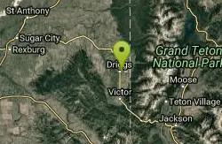
Teton Valley Disc Golf Course
Driggs, Idaho
44.4 miles EEnjoy 360-degree mtn views from this city park that also features a skateboard area. This course is on your way to the Grand Targhee course. Public (No Fee)
Disc Golf 0.1-0.2 mi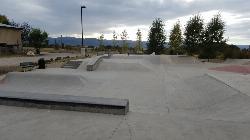
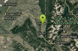
Driggs Bike and Skate Park
Driggs, Idaho
44.4 miles EThis is a great concrete skatepark and small mountain bike park with great features, both natural and wooden. There's a great pavilion right next to the skatepark and parking lot. While...
Mountain Bike, Skateboard
Driggs Nordic Trail
Driggs, Idaho
44.7 miles EDistance: 3.1 miles (5km) Trail Map: Driggs_Nordic_Track_2015.pdf Grooming Report: http://tvtap.org/nordic-grooming
Cross-country Ski, Snowshoe
Bitch Creek Trestle
Tetonia, Idaho
44.7 miles EAs part of the Rails to Trails project, this old railroad bridge has been transformed into a very safe little viewing experience for the whole family. You can drive right up to the bridge where...
Hike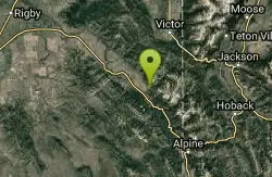
Hunts Corral
Irwin, Idaho
44.9 miles SENon-motorized use only. source: fs.usda.gov
Mountain Bike 5.6-8.3 mi
Palisades Creek Trail / Lakes and Waterfall Canyon
Irwin, Idaho
45.0 miles SEPalisades Creek Trail is located about 50 miles southeast of Idaho Falls and about 60 miles west of Jackson Hole WY in Swan Valley Idaho. The four mile hike up to lower Palisades Lake or the 6.2 mile...
Backpack, Camp, Hike, Horseback, Mountain Bike
Victor Bike Park
Victor, Idaho
45.1 miles EThe Victor Bike Park is home to a progressive jump line, pumptrack, and more stunts.
Mountain Bike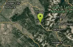
Pioneer Park Nordic Trail
Victor, Idaho
45.2 miles EDistance: 3 miles (4.5km) Trail Map: Pioneer_Park_2015.pdf Grooming Report: http://tvtap.org/nordic-grooming
Cross-country Ski, Snowshoe


