


216 Things to do near Saint Anthony, Idaho
first prev 1 2 3 4 5 6 7 8 9 10 next lastShowing results within 50 miles Distance miles of St Anthony, ID 83445, USA City, Zip, or Address
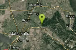
Ririe River Island (AKA Twin Bridges)
Rexburg, Idaho
20.6 miles SGo into the campground WHERE PAINTBALLING IS NOT ALLOWED. Park there and cross the creek on the North side of the park. You'll have to cross the river using the rocks that are there so not too...
Airsoft, Paintball
Big Hole Dispersed Campsites
Ririe, Idaho
20.6 miles SA dispersed campsite is simply an unestablished and unmaintained area where people camp. Often, this means that there is a campfire or other basic campsite feature to identify the site and that's...
Camp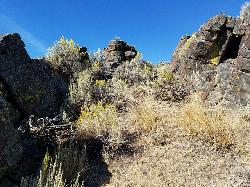
Lava Hill
Menan, Idaho
20.7 miles SWThis is a great little spot. Each team starts at one side of the collapsed lava tube. You can see each other really well from that point. Then you take the hill and get the other guys off it. It...
Airsoft, Paintball
Twin Bridges Park
Rexburg, Idaho
20.7 miles STwin Bridges is a campground 12 miles South East of Rexburg on S. 600 E. It is maintained by Madison County Parks Department. It is a 27 acre park of pristine land rich with wildlife on the Snake...
Camp, Canoe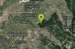
Bighole Mountains / Moody
Ririe, Idaho
21.0 miles SThis is a little unofficial campground with a plenty of shade for your basecamp and a wooded field with great boundaries. There's 2 roads that split and merge giving you very simple...
Airsoft, Paintball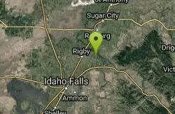
Rigby Wave-45th Wave
Rigby, Idaho
21.2 miles SKayak near Rigby, Idaho
Kayak 3.2-47.0 mi
Yellowstone Branch Line Trail
Ashton, Idaho
21.3 miles NEYellowstone branch line trail runs from Warm River to the Montana border totaling 39 miles. There are a few places to jump on and off the trail as well as a few smaller trails that branch off of this...
Backpack, Cross-country Ski, Hike, Horseback, Mountain Bike 0.3-0.6 mi
Cress Creek Nature Trail
Rexburg, Idaho
21.3 miles SMeandering along the scenic South Fork of the Snake River, the beautiful 1¼ mile Cress Creek Nature Trail will lead you on a journey through sagebrush-grass communities, over juniper covered...
Hike
Sheep Falls on Henry's Fork
Island Park, Idaho
21.4 miles NESheep Falls cascades approximately 25' through a narrow basalt chute on the North Fork of the Snake River near Island Park, Idaho. Compared to nearby Lower and Upper Mesa Falls, that height may...
Hike
Warm River Campground
Ashton, Idaho
21.4 miles NEWarm River Campground is located nine miles northeast of Ashton, Idaho, along the slow-moving Warm River at an elevation of 5,200 feet. Willows line the riverbanks and pine trees offer partial...
Camp
Jefferson County Lake (AKA Rigby Lake)
Rigby, Idaho
21.5 miles SWRigby Lake has long been a favorite swimming hole for those in the area. The county has taken it well under its wing and made it a buzzing spot on any warm summer day. Along with the long standing...
Camp, Canoe, Dive, Kayak, Sled, Swim
Kelly Canyon Loops
Ririe, Idaho
21.6 miles SThis mountain bike trail near Kelly Canyon Ski Area has several options available. Highlights are the views in all directions from the top of the mountain. Trails: Waterfall...
Mountain Bike 0.6 mi
Packsaddle Lake
Tetonia, Idaho
21.7 miles SEPacksaddle is one of the less well known lakes/trails in the area. If you've got a good offroad vehicle, you can probably make it all the way to the end of the road, otherwise, it's just an...
Dive, Hike, Mountain Bike, Snowshoe, Swim 2.1 mi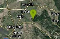
Batman
Ririe, Idaho
21.7 miles SThis trail features rolling terrain, and multiple short, steep downhill sections followed by short steep uphill sections. This trail follows the fence line. Watch out for cows (and cow droppings)...
Mountain Bike
Pine Butte / The Caldera
St. Anthony, Idaho
21.7 miles NThis is about as close to an oasis as you can get in the deserts of Idaho. It's an old volcano in the middle of the sagebrush desert. As soon as you start down the path, you can feel the air...
Camp, Hike, Horseback 1.7 mi
Randy's Cow Trail / Ken's Corner
Ririe, Idaho
21.8 miles SThis trail descends from the fence corner at the West end of Batman and continues down to Lyon's Creek Parking just off Lyon's road. The top of this trail is only a couple hundred yards from...
Mountain Bike 0.6-2.2 mi
Fish Creek Area
Ririe, Idaho
21.9 miles SFish Creek is a network of mountain bike trails up in the Big Hole Mountains. The trails are easily accessed from either the Ririe or Rexburg side of the range. The trail system is set up much...
Hike, Mountain Bike 11.9 mi
Waterfall Loop
Ririe, Idaho
22.1 miles STrail is a mixture of single track, forest road and double track. Provides a variety of scenery. About 1400 feet of elevation change throughout the trail.GPS is a must unless you are going with...
Mountain Bike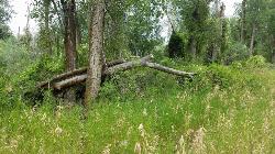
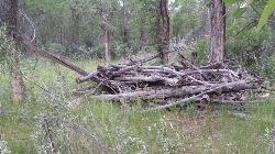
On the banks by Heise
Ririe, Idaho
22.3 miles SOn the banks of the river near Heise. Plenty of trees and ground cover.
Airsoft, Paintball
Kelly Canyon
Ririe, Idaho
22.3 miles SThe trail switchbacks up Kelly Mountain, hitting two brief red-line climbs before you get up on the top. The famed "Shale Chute" is back there somewhere (so this is part of the route for...
Mountain Bike


