


237 Things to do near Scottsdale, Arizona
first prev 3 4 5 6 7 8 9 10 11 12 next lastShowing results within 50 miles Distance miles of Scottsdale, AZ, USA City, Zip, or Address

Lost Creek Petroglyph Trail
Buckeye, Arizona
34.7 miles WStarting at Verrado's trailhead, the trail heads a short ways to a petroglyph site. While a little rocky at times, the trail is easy. To deter vandals, a very necessary fence with barbed-wire has...
Hike, Mountain Bike
Verrado
Buckeye, Arizona
34.8 miles WTechnical, good climbs, lots of open roads to add cardio loops as well.
Mountain Bike 5.4 mi
Denton Trail #69
Tonto Basin, Arizona
40.5 miles NEFrom FR 421, the trail climbs steadily up the east face of the mountain. Some sections are quite steep. The trail eventually tops out at 5,760 feet elevation and then descends to Big Pine Flat for...
Hike, Mountain Bike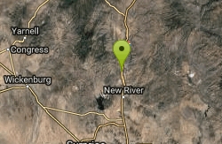
Black Canyon Trail
Black Canyon City, Arizona
40.5 miles NThis discription is for the Table Mesa trail head which has 1.5 miles (N) out on the Black Canyon Trail to the Little Pan Loop. The Little pan loop will take you down to the Agua Fria...
Mountain Bike
Sycamore Trail #68
Tonto Basin, Arizona
40.5 miles NEFrom FR 421, the trail climbs steadily through lower Sonoran Desert and riparian vegetation up the arroyo formed by Sycamore Creek. It turns northward and continues to climb along a...
Mountain Bike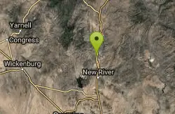
Black Canyon Trail - Little Pan Loop
Black Canyon City, Arizona
40.7 miles NThe Black Canyon National Recreation Trail will be a 79-mile hiking, mountain biking and equestrian trail stretching from the Sonoran Desert lowlands in Phoenix to the high grasslands...
Mountain Bike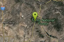
Slate Creek Divide Loop
Phoenix, Arizona
41.6 miles NEVarious routes available - Alternative #1 (From above): 13 Mi. (22 km) Alternative #2 (From above): 10 Mi. (16 km) Loop top half only (Inc. dirt. to 8 from SR 87): 12 Mi. (19 km) Figure eight: 16 Mi....
Mountain Bike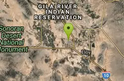
Casa Grande Disc Golf Course - College Park
Casa Grande, Arizona
42.2 miles SShort course in a quiet green park with several mature trees. Tees marked by orange concrete blocks in the ground. Public (No Fee)
Disc Golf
Park Trail #66
Tonto Basin, Arizona
42.3 miles NEFrom the Park Creek Trailhead, the trail crosses Park Creek and climbs gradually through lower Sonoran Desert and riparian vegetation for ½ mile. The trail then ascends steeply...
Mountain Bike
Westpark Skatepark
Coolidge, Arizona
42.6 miles SECity of Coolidge Rotary skate park
Skateboard
Three Bar Route
Tonto Basin, Arizona
44.3 miles EThe Three Bar Wildlife Enclosure is a fenced wildlife study area operated by Arizona Game and Fish. The proximity of two recreation sites provides ample parking should you want to cool...
Mountain Bike
Buckeye Hills Regional Park
Buckeye, Arizona
44.7 miles WBiking is primitive. The park has restrooms but no running water or electricity.
Mountain Bike
Vineyard Trail #131
Tonto Basin, Arizona
44.9 miles ETrail passes through a variety of Lower Sonoran Desert vegetation plant communities. Spectacular views of Roosevelt Lake, Apache Lake, Roosevelt Dam and Four Peaks. Historic Camp...
Mountain Bike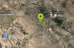
Picket Post
Superior, Arizona
46.0 miles EFrom the parking lot head south as this trail begins to climb, and climb very high into the hills. You don't climb Picket Post mountain but go around it's western side as you climb and...
Mountain Bike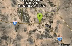
Casa Grande Mountain
Casa Grande, Arizona
47.4 miles SThere are easy trails by the starting point but they are not the main trail. It climbs the mountain side and heads south along the range. Jumping Cholla is a common plant here and the...
Mountain Bike 0.8-2.2 mi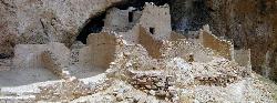
Tonto National Monument
Roosevelt, Arizona
47.9 miles EHike near Roosevelt, Arizona
Hike
Brittlebush Trail
Phoenix, Arizona
48.4 miles SWBrittlebush trail is a flat, 12-mile round trip, out-and-back trail in the heart of the Maricopa Wilderness. It's best used from November - April, and should be avoided in the Summer months...
Hike, Mountain Bike


