


224 Things to do near Victor, Idaho
first prev 1 2 3 4 5 6 7 8 9 10 next lastShowing results within 50 miles Distance miles of Victor, ID 83455, USA City, Zip, or Address

Mill Creek Trail
Moose, Wyoming
12.6 miles NEThere are two ways to do this ride, one as a loop with the Targhee road providing the bulk of the climb, or as an out and back (up the trail and back down). Keep in mind that this trail is...
Cross-country Ski, Mountain Bike, Snowshoe
Black Canyon
Wilson, Wyoming
12.7 miles SETrail starts at the parking lot ontop of the pass. Take the service road on the west side of the parking lot. The road will turn into singletrack when you reach a service building...
Mountain Bike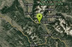
Phillips Ridge
Wilson, Wyoming
12.7 miles SETrail is recommend to be done as a shuttle but can be done as an out and back from trailhead on Fish Creek Road. Shuttle is easiest by parking a vehicle and the Stagecoach bar or the...
Mountain Bike
Reunion Flat Campground
Alta, Wyoming
13.3 miles NECamp near Alta, Wyoming
Camp
Probation And Burg Bumper
Tetonia, Idaho
13.9 miles NWThe Probation part of the trail is the steepest downhill in the area. Has multiple bridges and log jumps in the short mile down. The Burg portion of the trail is uphill with some...
Mountain Bike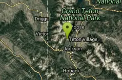
Jackson Hole Mountain Resort Disc Golf Course
Jackson, Wyoming
14.1 miles ELike the skiing, this course is extreme - with a vertical rise of over 700'. Redesigned in spring 2015, it features more technical shots through treed alley-ways, but still boasts aesthetically...
Disc Golf
Teton Village Disc Golf Course
Jackson, Wyoming
14.2 miles ELike the skiing, this course is "extreme" with a vertical rise of over 250 feet and a 9-hole course length of 3,600 ft. Public (No Fee)
Disc Golf
Teton Canyon Campground
Alta, Wyoming
14.3 miles NETeton Canyon is the start of several great adventures, including the Alaska Basin Trail, Table Rock, Devil's Stairs, and the Teton Crest. The campground offers a perfect basecamp to get an...
Camp 3.8-6.4 mi
Table Rock / Table Mountain
Driggs, Idaho
14.4 miles NEAt 11,300 feet, Table Mountain is possibly the most beautiful climb this side of the Tetons and offers what may well be the very best view of the Grand Tetons. It's just far enough away...
Camp, Hike 15.0-18.4 mi
Alaska Basin
Driggs, Idaho
14.4 miles NEThe Alaska Basin Trail is a stunning trail through the Jedediah Wilderness near Driggs, Idaho and goes East into Wyoming, just outside of Grand Teton National Park. The trail is wide...
Backpack, Hike, Horseback 7.9 mi
Devil's Stairs
Driggs, Idaho
14.4 miles NEJust to the West of Table Rock is this often overlooked trail less traveled by, full of beautiful meadows and beautiful views all its own. The trail begins from the same campsite as the Table Rock...
Backpack, Hike 4.0 mi
Quakie Ridge
Moose, Wyoming
14.8 miles NETrail starts at the base ski area on a service road then heads out on nice single track. Trail winds through meadows of wildflowers. Some minor altitude gain along the trail. The...
Mountain Bike 2.1 mi
Buffalo Soldier
Moose, Wyoming
14.9 miles NETrail is a nice loop, all singletrack, with about 300' of elevation gain. Trail is about 1.8 miles one way. You can also use it as a connector to Mill Creek or lightning loop. Buffalo...
Mountain Bike 1.1 mi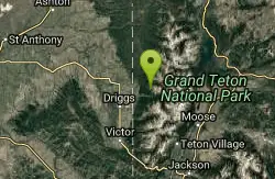
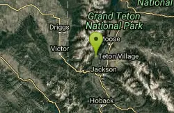
More Cowbell
Moose, Wyoming
14.9 miles NEThis singletrack trail winds through aspens, high alpine meadows and old growth conifers.
Mountain Bike 1.9 mi
Perm-a-grin
Moose, Wyoming
14.9 miles NEPerma Grin is guaranteed to fix a smile on your face indefinitely! This swooping, flowing, smooth singletrack descends the hillside above Rick's Basin.
Mountain Bike 0.6-4.0 mi
Grand Targhee XC Park
Moose, Wyoming
14.9 miles NEMountain Bike 5.6-8.3 mi

Palisades Creek Trail / Lakes and Waterfall Canyon
Irwin, Idaho
15.0 miles SPalisades Creek Trail is located about 50 miles southeast of Idaho Falls and about 60 miles west of Jackson Hole WY in Swan Valley Idaho. The four mile hike up to lower Palisades Lake or the 6.2 mile...
Backpack, Camp, Hike, Horseback, Mountain Bike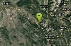
Hunts Corral
Irwin, Idaho
15.1 miles SNon-motorized use only. source: fs.usda.gov
Mountain Bike 1.7 mi
Rick's Basin
Driggs, Idaho
15.5 miles NEMountain Bike near Driggs, Idaho
Mountain Bike
South Fork Snake River Trail
Ririe, Idaho
15.9 miles WGo left at the trail head. It heads down about a mile and a half on double track. Then you'll come to a creek crossing. After the crossing the trail heads across a gate. Head left...
Mountain Bike


