


38.2K 1 by endovereric
first prev 1 next last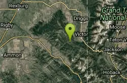
Spooky
Victor, Idaho
6.5 miles W of Victor, IdahoTrail serves as the stem to Red Creek or access to Corral Creek as well as other possibilities in the big hole mountains. Nice fun singletrack to run as an out n back if your time is limited. Spooky segment is 1.2 to the first trail option or turn around for out n back. Courtesy of Singletracks.com

Webster's Dam
Ririe, Idaho
9.8 miles NE of Ririe, IdahoAlso known as Manmade Falls or the Woodmansee Dam, Webster Dam is an abandoned dam located deep in Moody Creek canyon, the dam was abandoned when sediment built up behind the dam which then caused the stream to split and flow around both sides of the dam, creating two beautiful waterfalls each about 15 feet in height. This makes a fun evening trip and is good for almost any time of the year as well. It's beautiful in the spring with powerful falls from the spring runoff and in the fall, there are plenty of fall colors along the pole line trail and around the waterfalls. At the falls, you'll find two waterfalls coming over each end of the dam. On the south end of the dam there is a bridge that spans the creek on that side. There is a little island in the middle where you can sit on the rock wall and take in the whole scene.
There are two trails which weave back and forth a couple of times so you can really choose your route a little bit. The main parking area is at the top of the hill by pole line and that's also the most common trailhead. The pole line trail follows the ATV road with several ups and downs. For the most part its a fairly rounded out and bermed double track awesome for mountain bikes and ATVs. For much of it, there's a hiking trail that follows along the side of it. However you travel this trail, be very aware of other riders and hikers which can seem to appear out of nowhere. The trail continues along the power pole lines for just over 3/4 miles, then turns left just as the balls on the power lines come into view. After a couple hundred feet, you'll see the other trail merge into this one from the left and then take off again to the right about 150 yards later. Keep left on the "pole line trail" for a more gradual decent or go right on the "wooded trail" for a more adventurous and much steeper route. The pole line trail go out and hook back taking you straight to the falls.
The wooded trail trailhead is Northwest of the pole line trail. It's a less used ATV track that goes back and forth between the woods and the pole line until it merges with the pole line trail about 3/4 miles in, only to split to the right 150 yards later. In another 100 yards, you'll come across another junction; keep left. In another 150 yards it will come back together with the pole line trail and continue all the way to the falls. On the upper portions, this trail is has a lot fewer ups and downs making it a more gradual hike. After merging with the pole line trail though, this trail becomes the much steeper option.
Whichever of these 2 paths you choose, the last 1/3 mile descent is more like a chunky forest road than the double track above. It has some pretty steep parts, some chunky rock sections, and some rollers that make great mountain bike jumps. While it's a little steep and chunky, most intermediate riders should be able to handle it just fine. At the bottom just before the falls are some very large dirt jumps off to the side. The last 30 yards to the falls after the dirt jumps is much more janky, probably more like a black diamond on a bike but not too tricky to get down on foot.
The third option is much longer, starting at the warming cabin on Brown's Road. It's an intermediate trail to the creek and then a green (easy) trail along the creek to the dam.
A very popular route to do this on a mountain bike is to loop it starting either at the warming cabin or the top of the pole line and riding down the pole line to the waterfall and then out Mad Cow and up Cabin Climb to complete the loop.
This can be a great family hike. Plan on 2-4 hours to hike it with little ones, depending on how fast and tough they are.


