


234 Things to do near Coachwhip Trail Loop
first prev 3 4 5 6 7 8 9 10 11 12 next lastShowing results within 50 miles Distance miles of Pemberton Trail, Fountain Hills, AZ 85268, USA City, Zip, or Address

Dixie Summit Trail
Phoenix, Arizona
21.8 miles WA steep and difficult short trail using many switchbacks to get to the summit. You will be rewarded with spectacular views of the surrounding area.
Hike
Dixie Mountain Loop with Two Summits
Phoenix, Arizona
21.8 miles WHike, Horseback, and Mountain Bike near Phoenix, Arizona
Hike, Horseback, Mountain Bike 2.8 mi
Desert Tortoise
Phoenix, Arizona
21.8 miles WAt just over a mile long, Desert Tortoise is a doubletrack connector to the Valle Verde Trail. Very good hiking area with a good range of difficulty levels. Starts with a short climb from the...
Hike, Mountain Bike
Dixie Mountain Loop Trail
Phoenix, Arizona
21.8 miles WThe main loop trail at Phoenix's Sonoran Preserve provides plenty of options for either a short walk or a longer hike. The elevation gain is accumulated through small ups-and-downs along the...
Hike, Horseback, Mountain Bike
Hawk's Nest Trail and Dixie Mountain Loop
Phoenix, Arizona
21.8 miles WModerate Trail providing access from the Car Park to all other trails. Directly links to Desert Tortoise Trail and Dixie Mountain Loop. Good hiking shoes/boots recommended....
Hike, Horseback, Mountain Bike
Hawk's Nest/Desert Tortoise/Dixie Mountain Loop
Phoenix, Arizona
21.8 miles WA nice moderate trail through great desert scenery crossing creeks and twisting and turning around the hills. Provides a loop opportunity between Hawk's Nest Trail, Valle Verde Trail,...
Hike, Horseback, Mountain Bike
Union Peak Loop
Phoenix, Arizona
21.8 miles WHike near Phoenix, Arizona
Hike
Sonoran Trail
Phoenix, Arizona
21.8 miles WThe Sonora Trail is smooth, but hilly, and has a 10-12 mile loop course that is well marked at intersections. This ride is suitable for many levels, but beginners should have good...
Mountain Bike
Tower Road - Sonoran Preserve
Phoenix, Arizona
22.3 miles NWShort and steep (.6 mile each way) out and back asphalt road to the radio tower.
Hike
Sidewinder-Ocotillo-West Loop
Phoenix, Arizona
22.3 miles NWThis loop starts at Carefree Hwy and 7th Ave, be aware there is limited parking at the trailhead. The Ocotillo part of the trail is relatively flat and the Sidewinder part has some good...
Hike, Horseback, Mountain Bike
Sweetwater
Phoenix, Arizona
22.5 miles WHilly and challenging moderate length course in a dry lake bed. Not well marked - bring the map. Concrete tees on front 9. Public (No Fee)
Disc Golf
Bobcat Trail - Sonoran Preserve
Phoenix, Arizona
22.5 miles WBobcat Trail is a short, easy trail, often used for connecting to other bigger trails in the Sonoran Desert Preserve. This is a 2 mile out-and back trail. There isn't much of a parking...
Hike 3.9 mi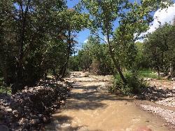
Cave Creek Swimming Hole
Cave Creek, Arizona
22.5 miles NHidden along Cave Creek Trail #4 is a swimming hole deep enough to refresh from the summer heat. It takes almost four miles of hiking in Arizona desert to reach the swimming hole, but the water is...
Hike, Swim
Conocido Park
Phoenix, Arizona
23.0 miles WMostly flat grassy holes with trees in play. Dual tees. Requires hyzers, anhyzers, rollers and tubes. Play backwards for 18. Alt. pins vary difficulty. Public (No Fee)
Disc Golf
Deem Hill
Phoenix, Arizona
24.3 miles WThe trail starts out going north around the mountain then heads uphill and gives you some good inclines with switch backs. Total incline is approximately 650'. The trail is rocky and...
Mountain Bike
Palisade to Basalt to Circumference Trail Loop
Phoenix, Arizona
24.3 miles WHike near Phoenix, Arizona
Hike
Deem Hills Inner Loop
Phoenix, Arizona
24.3 miles WHike and Mountain Bike near Phoenix, Arizona
Hike, Mountain Bike
Deem Hills East Trail
Phoenix, Arizona
24.3 miles WDeem Hills is one of the newer parks in Phoenix to open (2010) and as such a lot of people still don't know it's there. This means that it has much more of a secluded feel then some of...
Hike 5.4 mi
Denton Trail #69
Tonto Basin, Arizona
25.0 miles EFrom FR 421, the trail climbs steadily up the east face of the mountain. Some sections are quite steep. The trail eventually tops out at 5,760 feet elevation and then descends to Big Pine Flat for...
Hike, Mountain Bike 1.9 mi
Javelina Trail
Phoenix, Arizona
25.1 miles SWComing down Javelina is fast and fun no doubt. It sure beats the crowded Pima Canyon trail back to the Pima lot if you parked there. Javelina is just one more sweet trail on South Mountain. Not a...
Hike, Horseback, Mountain Bike


