


5 Local Runs by kingbalak
first prev 1 next last
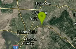
Stinking Springs
Ririe, Idaho
6.5 miles E of Ririe, IdahoStinking Springs is a great early to late season trail. Being at the edge of the Big Hole range, it gets spring earlier and winter later than other trails in the range. It's closed from December through April to accommodate wintering mule deer but is often very accessible up until it's closed and as soon as its open.The trail begins at the Stinking Springs Multiple Use Area parking lot on East Heise Road to the right (South) of the Sidewinder trailhead. You'll be looking for the gate with a cattle guard. The small spring gate will take you to Sidewinder, a MTB specific trail.
The trail starts out pretty straight and gradual but as you get higher up, there are more and more switchbacks that get more and more bermed as you get higher up. At the upper end, you'll find well bermed corners, rock rolls, and rock gardens great for more experienced mountain bikes. The once beautifully laid rock corners have broken down somewhat making them more of a chunky ride than they were originally though. If you continue up the trail, you can connect into the trails at Kelly Canyon and throughout the Bighole range.
Although this is primarily an ATV and dirt bike trail, Stinking Springs is the unsung hero of mountain biking with its brother Sidewinder. Most bikers take Sidewinder up and down or use Stinking Springs as a climbing trail to access Sidewinder. However, coming down Stinking Springs has a little bit of a Wolverine Canyon feel to it with wide track, beautiful berms and floating jumps. It's not as rollie as those Space Cruz trails and has far fewer switchbacks but is a fast roll with a lot of fun.
Skyline
Ririe, Idaho
5.6 miles E of Ririe, IdahoPunchy climb out of Little Kelly Canyon. Great vistas along a narrow traverse. Fast and loose downhill. A mix of narrow singletrack and old motorized trail.Courtesy of trailforks.com
Henry's Fork Green Way (St. Anthony Green Belt)
Saint Anthony, Idaho
0.6 miles SW of Saint Anthony, IdahoThis is a great walk along the river. While it is nestled right next to the highway, the closeness and beauty of the river flowing on the other side of the trail more than make up for it. Halfway along the trail, there's a statue of Andrew Henry and a loop that will take you right back for an easy 1 mile. The full length is a mile itself making a full 2 mile round trip.
Pet Friendly: Yes
Difficulty: Easy
Trail: Paved
Length:
- Statue Loop: 1 mile
- Full Round Trip: 2 miles
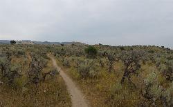
Sidewinder Trail
Ririe, Idaho
6.5 miles E of Ririe, IdahoSidewinder's claim to fame is that it's on a South facing hill just above the Snake River. That means that when all the other trails in the Kelly Canyon Trail network are covered with snow and mud, Sidewinder is getting plenty of sun, keeping it dry earlier and later in the year. It's closed from December through April to accommodate wintering mule deer but is often rideable up until it's closed and as soon as its open.
The singletrack trail meanders through sagebrush for the first 1/4 mile before it gets into the switchbacks of which there are several. From there, the incline is pretty gradual and consistant until you get closer to the top. There are plenty of areas where it flattens out a bit for a little relief and several dips and even a little downhill. The downhill sections on the way up almost always precede a steeper uphill. It's a great way to get up a little speed to make the steep parts a little easier.
There's a little bench at the top of the trail where you can sit and enjoy the view before continuing to the ATV junction. Continuing upward on the ATV junction will connect you into the rest of Kelly Canyon's trail system. If it's wet, you'll find slimy clay mud. There are also sections of the trail that are covered with shale.
Going down makes it all worth it. Sidewinder is a great flow track with corners much tighter than you realized on the way up. There aren't a lot of well bermed corners so you'll see plenty of people go off the trail. Luckily, going off a corner usually just results in a ride through some sagebrush. You won't find any serious jumps but there's plenty of dips and turns to make for a great time.
Like any of the Kelly Canyon Trails, Sidewinder can get pretty dusty in the summer. It's best if you can ride it relatively soon after a light rain so it's just barely damp. The trail can get pretty crowded during peak times which can interrupt your climb momentum and your flow downhill. Please do your best to respect other riders.

Eagle Park
Rexburg, Idaho
0.9 miles N of Rexburg, IdahoEagle Park is a little urban oasis. Once you drive in to this cottonwood forest along the river, you may forget that you're still inside Rexburg city limits. You can camp, picnic, throw rocks in the river, fish, mountain bike, or just go for a walk along the trail or road. All sites have picnic tables, fire rings, and tent pads. Just off the main parking lot is a nicely mowed grassy area that is a popular dog park. On the West end of the parking lot, you'll find a multi-use trail that will take you almost the entire length of the park.
Mountain Biking/Hiking/Walking
The trail system at Eagle Park is maintained in part by Free Arenas. If you have any would like to get involved or just want to share your thoughts on how to improve it, email trailbuilding@freearenas.com.
Tenderfoot is primarily a mountain bike trail. The trail runs back behind most of the campsites. While it's built for mountain bikes, it's usually great for a nice quiet walk as well, and arguably the best way to see the park. This 0.5 mile trail is rated Easy but is about as tough as an easy trail can get. It's pretty mellow but does have a couple of very short ups.
Taut-line is cut into the slope along the fence line. It begins on the embankment at the West end of the campground and goes for 0.4 miles before meeting back up with Tenderfoot. The Northwest section is the longest section of trail in Eagle Park and is cut into a steep slope above marsh and ponds. It is generally downhill from the West end but has plenty of up and down. Towards the middle of the trail, there is a berm and a couple of table top jumps. The section South of the Tenderfoot junction was an Eagle Project completed by Ian Hoffman and his volunteer crew. The trail continues to cut up and down the side hill with a fun rock berm and a rock garden. The end drops in to connect back to Tenderfoot right near the junction with Bugler. The trail is a one-way trail from West to East and has short climbs and fun decents. Because it's much higher than the Tenderfoot Trail it parallels, Taut-line does not flood and actually bypasses the flood areas of Tenderfoot. Because the trail does go along a steep slope on the West end, remember to fall uphill. This trail is rated Intermediate.
Bugler drops off the Tenderfoot Trail and runs down and around a small pond just off the main lawn. There's a few decents, climbs, and berms adding a little bit of speed and a little more difficulty.
Jamboree drops off the Eagle Park Road near campsite 19 and continues down along the river to the old campsite 14 that's now a disc golf basket. This trail rolls back and forth through a trough of sorts with some jumps along the edges and potential for many more. It seeps ground water when the water is higher and is completely flooded in May/June when the river is really high. When it's dry though, it rides decently fast and is a lot of fun!
Skills Park Along the Tenderfoot Trail and just off the lawn is a skills park built as an Eagle Scout project by Erik Hurst and other volunteers. It features a large wrap-around berm on the north end, raised skinnies made of 2x8, 2x6, and 2x4 treated lumber, a ladder a-frame, a rock garden, and a see-saw.
While not all trails are intended to bi-directional and multi-use, they are all used as such so please be aware of others on the trail.
Looking for a little longer hike or ride? Go to the Northwest end of the park and you'll find an old embankment road that follows the airport fence line to the Nature Park. It's pretty popular to loop both parks together.
Sledding
There's some mounds above a bench that can be used as a sledding hill area just off the main grassy area. It's a terraced hill with a couple set runs and then quite a bit of open hill as well. Elevation is only about 20 feet from top to bottom but there's plenty to keep kids busy for awhile. There's even a more difficult run that includes jumps and drops for snowboards. The terrace trails are better when the snow's a little bit icier but the small hills are great for little kids that wnat to avoid the more popular hill at Smith Park
Camping
Picnicking is free but there is a fee for camping. Overnight camping fee is $10.00 per space paid via rexburg.org. All fees are used for future picnic tables, restrooms and other park improvements. The camp fee for boy scout troops may be waived as long as they perform an approved 1 hour service project to the park while camped here. Picking up garbage and pulling weeds are always approved. Weeds that need pulled include hounds tongue, cocklebur, bull thistle, and the occasional stinging nettle.
Posted Eagle Park Rules
- No RVs in park
- No motorcycles, scooters, or ATVs on park roads
- 7 day camping limit
- Tents only on designated tenting pads
- Fires in designated fire pits only. No non-burnable items in firepits.
- No smoking, tobacco, or alcoholic beverages
- Pets on leashes only. (All pet droppings to be put in bags for droppings)
- All garbage to be put in garbage cans. Pack it in - Pack it out.
- No firearms, firecrackers, or explosives
- Avoid loud music and noises — Be respectful of other campers
To reserve an entire shelter, call City Hall at 359-3020. Reservation fee is $25 per half day.
This is a community service project of Free Arenas, the Madison Lions Club, Trails of Madison County, the City of Rexburg, and numerous Eagle Scouts in the Yellowstone District of the Grand Teton Council, BSA. Constructed 2001-2005.
Please respect the flora and fauna and practice the Outdoor Code. This park only exists because of volunteer service from many in the community. Please, don't be afraid to help out by collecting some hounds tongue, cocklebur, and bull thistle. If you're looking for ideas for a bigger service project, contact trailbuilding@freearenas.com


