


1 locations
Add Location
1.1 mi
 Full Listing
Show more
Hike
Full Listing
Show more
Hike
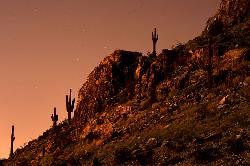
Piestewa Peak Summit Trail #300
Phoenix, Arizona
7.0 miles NE of Phoenix, ArizonaSome people still refer to the Peak by its original name of "Squaw Peak" before its name changed to "Piestewa Peak" in honor of Lori Piestewa who died serving her country in the Iraq conflict. The elevation of Piestewa is the second highest peak in Phoenix behind Camelback Mountain which is located nearby and features some difficult treks.Courtesy of arizona-leisure.com
The infamous Piestewa Peak Summit Trail is an out and back trail that rewards successful hikers with a three-hundred-sixty-degree view of the Phoenix metropolitan area. While short in length, a little over one mile, the trail is steep, jagged, and consists of multiple switchbacks and modified steps with integrated sections of gravel and rock. This summit trail has been a Phoenix favorite for several decades and is internationally recognized among hiking communities. Water, parking, and restrooms are available at the base of the trail.Courtesy of phoenix.gov
Although described as moderate to difficult, many kids and older adults do the Summit Trail. It's a climb all the way, and most areas have carved steps and there are two short segments with rails. It took us a little less than an hour to get to the top at a leisurely rate, frequently stopping to enjoy the scenery. If you plan to stay for the sunset, especially in winter months, it is suggested to take a flashlight as some areas become dark soon after sunset.Courtesy of hikingproject.com
The hike itself takes anywhere from 25 to 60 minutes in fair weather, depending on each hiker's capabilities (higher temperatures and sunny conditions may force the hiker to take up to twice as long). A beginning hiker should allow 60 minutes for a leisurely ascent and 40 for descent. The path is mostly well marked. There are 4 spots that are confusing and hikers who are not familiar with the path will be forced to look around for the designated route. There are a few sections that are technically difficult as they are steep and there are no guard rails.Courtesy of en.wikipedia.org
×


