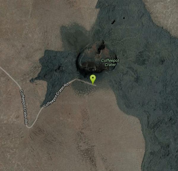
Coffee Pot Crater / Jordan Craters
Jordan Valley, Oregon
| GPS: |
43°8'45.2"N 117°27'37.2"W Maps | Directions |
| State: | Oregon |
Cave
Jordan Craters is one of Oregon's most otherworldly landscapes — a vast, young volcanic lava field sprawling across the remote high desert of Malheur County in the state's far southeastern corner. Covering some 27 square miles of jet-black olivine basalt erupted less than 30,000 years ago, this BLM-protected area is a surreal moonscape of craters, lava tubes, and rippled “pahoehoe” flows — a geologist's dream and an unforgettable off-the-beaten-path adventure.
The centerpiece, and the only feature you can drive right up to, is Coffee Pot Crater — a well-preserved, steep-sided volcanic vent covering about two-thirds of a square mile. From the parking area, a roughly one-mile loop circles the rim and drops along a red-cinder path into the heart of the crater. Beyond it, you can explore the frozen black sea of lava, picking your way along cow tracks and collapsed lava tubes through one of the most pristine basalt flows in the country.
Come prepared — this is rugged, remote country. The lava is razor-sharp and the footing treacherous, with hidden open pits and no marked trails, so watch every step. There's no water, no shade, and no cell service, and the black rock soaks up heat, reaching well over 120 degrees on summer days, so spring and fall are far better times to visit.
Getting there is a commitment: from Highway 95 about 8 miles north of Jordan Valley, it's roughly 26 miles of dirt road (the last stretch needs high-clearance four-wheel drive, and the route turns impassable when wet). Carry plenty of water and food, tell someone your plans, wear sturdy boots, and pack out everything. For lovers of wild geology and true solitude, Jordan Craters is a one-of-a-kind Oregon wonder.
More Information

- Plan Ahead and Prepare
- Travel & camp on durable surfaces
- Dispose of waste properly
- Leave what you find
- Minimize campfire impacts
- Respect wildlife
- Be considerate of other visitors
Directions
From Jordan Valley, Oregon
- Head east on Main St toward Yturri Blvd (240 ft)
- Continue onto US-95 N/Bassett StContinue to follow US-95 N(8.1 mi)
- Turn left onto Curly Lodge Rd (6.9 mi)
- Continue onto Cow Creek Rd (1.9 mi)
- Continue straight onto Lodge Ranch Rd (2.5 mi)
- Turn right onto Blowout Reservoir Rd (13.7 mi)
- Turn left onto Coffeepot Crater RdDestination will be on the right(1.4 mi)
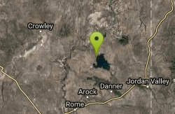
Jordan Craters is located in the southeast corner of Oregon in Malheur County. From Highway 95, eight miles north of Jordan Valley, turn west at the Jordan Craters sign onto Cow Creek Road. Follow BLM Jordan Craters access signs 25 miles to the site. From a distance the lava field appears dark, as if shaded by a cloud.