Dam West Beach
Shelbyville
Hike and Swim
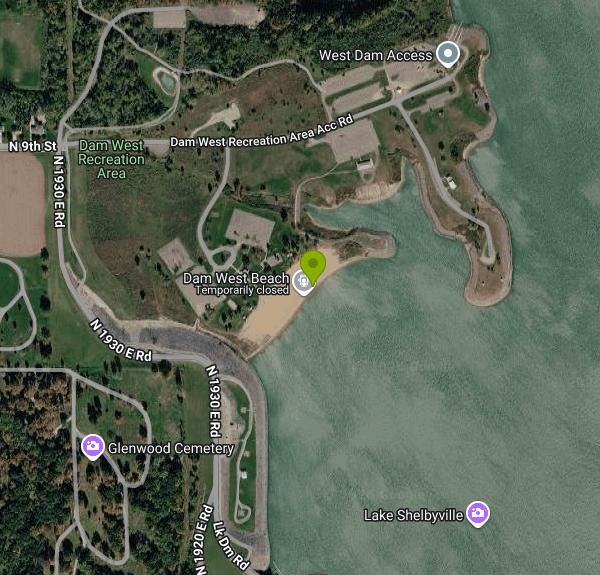
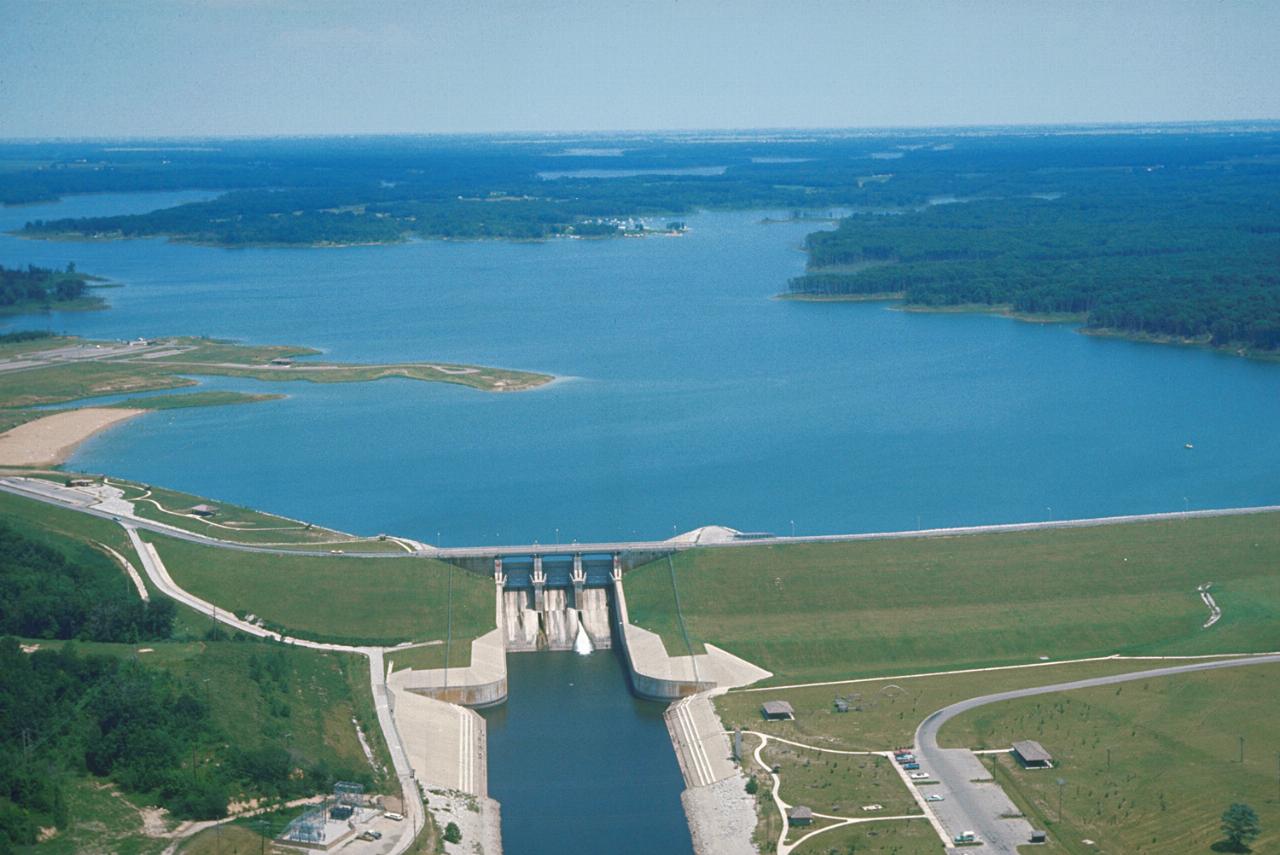
Dam West Beach is the sand swimming beach inside the Dam West Recreation Area, a U.S. Army Corps of Engineers day use area at the southwest corner of Lake Shelbyville. The lake is the Corps reservoir on the Kaskaskia River, and the beach sits just north of the west end of the Shelbyville Dam, a little over a kilometer from downtown Shelbyville in Shelby County. It is one of three Corps-run public beaches on the lake, along with Sullivan Beach and Wilborn Creek Beach, and it is the closest of the three to town.
From town, the dam road begins at North 9th Street on the east side of Shelbyville and runs past the Dam West Overlook to the recreation area. Coming from the other side of the lake, the Corps directions follow State Route 16 to the Spillway Recreation Area road, turn left across the dam, and then turn right at the stop sign into Dam West. There are several paved parking lots, and a sidewalk runs from the large group picnic shelter down to the beach. The Corps also points walkers and cyclists to the General Dacey Trail, which links the dam, the spillway and Forest Park in town.
The beach is a long strip of sand facing east toward the open lake, with a shower house, two playgrounds and a sand volleyball court just behind it. The swim area is a designated beach rather than open shoreline, and the Corps rules at Lake Shelbyville beaches require swimmers to stay inside the yellow buoy line. No lifeguards are posted, and the open lake can kick up waves on windy afternoons. The Corps beach season has run from the third Saturday in May through the Sunday after Labor Day, open daily from 8 a.m. until sunset.
Dam West Beach is not free. The Corps charges a day use fee of $5 per vehicle and has charged $2 per person for those who walk or bike in, with children under 16 and visitors camping in a Corps campground admitted at no charge. The lake sells day use passes as QR code passes through Recreation.gov, and rangers check payment by license plate. A USACE annual pass or an America the Beautiful pass covers the fee. The Corps waives day use fees on a few dates a year, such as its June 16 birthday.
High water is the main thing that closes this beach. Lake Shelbyville is a flood control reservoir, and after wet springs the Corps has kept Dam West and the other beaches closed past their opening date until the water dropped and crews cleared debris. The road across the dam also closes now and then for maintenance. Lake Shelbyville beach rules ban alcohol in the beach area, food and drinks on the sand, and pets on the sand. Call the Lake Shelbyville Project Office at (217) 774-3951 before a trip early in the season.
The rest of the recreation area is set up for a full day at the lake. There is a boat ramp with a fish cleaning station, two picnic shelters that rent for $30 to $50 through Recreation.gov, open picnic ground and the Dam West Overlook just to the south. Each July 4 the Corps launches the fireworks from Ramp Point, so expect the area to fill up and the dam road to close that evening.
More Information
Be courteous, informed, and prepared. Read trailhead guidelines, stay on the trail, and don't feed the wildlife.
Read More
- Plan Ahead and Prepare
- Travel & camp on durable surfaces
- Dispose of waste properly
- Leave what you find
- Minimize campfire impacts
- Respect wildlife
- Be considerate of other visitors
Directions
From Shelbyville
- Head west on North Side Sq/
Public Square N toward N Spring St/ West Side Sq (217 ft) - Continue onto W Holland St (0.1 mi)
- Turn right onto N Cannon Blvd/
Florida Short Route Continue to follow N Cannon Blvd(0.4 mi) - Turn left onto N Main StPass by Burger King (on the right in 0.8 mi)(2.3 mi)
- Continue onto US-231 N (20.6 mi)
- At the interchange Interstate 24, keep left and follow signs for I-24 W toward Nashville (29.4 mi)
- Keep left to stay on I-24 W, follow signs for I-40 W/
Nashville (2.2 mi) - Slight right to stay on I-24 W (signs for I-65 N/
Clarksville/ Louisville) (2.7 mi) - Keep right to stay on I-24 W, follow signs for I-65 N/
Clarksville/ Louisville (2.2 mi) - Take exit 88 on the left for I-24 W toward Clarksville (0.7 mi)
- Continue onto I-24 WPassing through KentuckyEntering Illinois(175 mi)
- Take exit 44B to merge onto I-57 N toward Chicago (52.1 mi)
- Slight right to stay on I-57 N (signs for Chicago) (39.3 mi)
- Take exit 135 for IL-185 toward Farina/
Vandalia (0.4 mi) - Take the ramp to IL-185 W/
County Rd 700 N/ W Washington St (102 ft) - Turn left onto IL-185 W/
County Rd 700 N/ W Washington St Continue to follow IL-185 W(3.3 mi) - Turn right onto N 2400 St/
County Rd 2400 E Continue to follow N 2400 St(11.6 mi) - Continue onto IL-128 N (26.8 mi)
- Turn right onto IL-128 N/
IL-16 E (3.0 mi) - Turn left onto IL-128 N/
N Cedar St Continue to follow IL-128 N(0.9 mi) - Turn right onto W N 12th St (0.7 mi)
- Turn right onto N Broadway St (0.3 mi)
- Turn left onto E North 9th St (0.4 mi)
- Continue onto N 9th St (430 ft)
- Continue straight onto Dam West Recreation Area Acc Rd (0.2 mi)
- Turn right (0.2 mi)
- Turn left (230 ft)
- Turn right (131 ft)