


Forest Park Trail Network
New York, New York
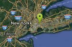
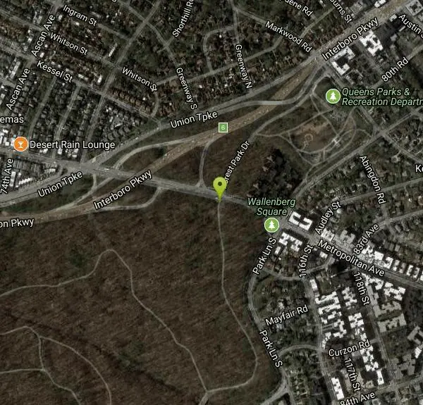
| Address: | ~Forest Park Dr, Queens, NY, USA |
| GPS: |
40°42'30.3"N 73°50'20.5"W Maps | Directions |
| State: | New York |
| Trail Length: | 9.00 miles |
| MTB Difficulty: | Beginner |
| Trail Type: | Other |
| MTB Trail Type: | Singletrack |
Mountain Bike
Single track , double track fire road log climbs bmx jumps drop off's down hills, steep short climbs all within city limits. Great training ground if you don't have time to go out side city. E-mail me if you want to ride!! Courtesy of Singletracks.com
More Information
Forest Park Trail Network
Forest Park Trail Network is a singletrack mountain bike trail in Queens, New York. View maps, videos, photos, and reviews of Forest Park Trail Network bike trail in Queens.
http://www.singletracks.com/bike-trails/forest-park-trail-network/Never modify trail features. Ride trails when they're dry enough that you won't leave ruts. Speak up when you see others on the trail and always yield to hikers, horses, and others coming uphill. Always ride on the established trail.
Read More
- Plan Ahead and Prepare
- Travel & camp on durable surfaces
- Dispose of waste properly
- Leave what you find
- Minimize campfire impacts
- Respect wildlife
- Be considerate of other visitors
Directions
From New York, New York
- Head south on S Las Vegas Blvd (0.1 mi)
- Turn right onto W Tropicana Ave (0.4 mi)
- Turn right to merge onto I-15 NPassing through ArizonaEntering Utah(248 mi)
- Take exit 132 for I-70 E toward Richfield/Denver (0.5 mi)
- Continue onto I-70 EEntering Colorado(501 mi)
- Take exit 269B on the left for I-76 E toward Ft Morgan (0.6 mi)
- Continue onto I-76 E (12.0 mi)
- Keep right to stay on I-76 E (0.7 mi)
- Continue onto I-76 E (61.1 mi)
- Keep left to stay on I-76 EEntering Nebraska(113 mi)
- Merge onto I-80 E (340 mi)
- Keep left to stay on I-80 E (8.2 mi)
- Keep left to stay on I-80 EEntering Iowa(6.3 mi)
- Keep left at the fork to stay on I-80 E, follow signs for Des Moines (119 mi)
- Keep right at the fork to stay on I-80 E, follow signs for Interstate 35 S/Kansas City (15.0 mi)
- Keep right to stay on I-80 E (151 mi)
- Take exit 290 for Interstate 280/US-6 E toward Rock Island/Moline (0.6 mi)
- Continue onto I-280 E/US-6 EContinue to follow I-280 EEntering Illinois(26.8 mi)
- Continue onto I-80 EPartial toll road(145 mi)
- Keep left at the fork to stay on I-80 EPartial toll roadEntering Indiana(23.6 mi)
- Take exit 16 to merge onto I-80 E/I-90 EPartial toll roadEntering Ohio(278 mi)
- Keep left at the fork to continue on I-80 EToll road(76.2 mi)
- Take exit 218 for I-80 EToll road(0.9 mi)
- Keep left at the fork, follow signs for Mahoning Ave/OH-18Toll road(0.2 mi)
- Keep left and merge onto I-80 EPartial toll road(4.5 mi)
- Keep left at the fork to stay on I-80 E, follow signs for Interstate 80 E/OH-11 N/New York CityPartial toll roadParts of this road may be closed at certain times or daysPassing through PennsylvaniaEntering New Jersey(369 mi)
- Keep right to stay on I-80 E, follow signs for Interstate 80 E/Paterson/New York (16.6 mi)
- Keep left at the fork to continue on I-80 Express E (6.0 mi)
- Merge onto I-95 Express N (2.6 mi)
- Continue onto Interstate 95 Upper Level N/NJ Tpke NPartial toll road(0.7 mi)
- Continue onto U.S. 9 N/Interstate 95 Upper Level NToll roadEntering New York(1.1 mi)
- Continue onto Interstate 95 Upper Level N/US-1 Upper Level N (0.8 mi)
- Continue onto I-95 N (394 ft)
- Keep left to stay on I-95 N (4.4 mi)
- Take exit 6A toward I-678 S/Whitestone Bridge (0.8 mi)
- Merge onto I-678 SPartial toll road(2.5 mi)
- Keep right to stay on I-678 S (2.0 mi)
- Keep left at the fork to stay on I-678 S, follow signs for Interstate 678 S/Van Wyck Expwy/Kennedy Airport (3.5 mi)
- Take the exit toward J Robinson Pkwy (0.2 mi)
- Merge onto Interboro Pkwy W/Jackie Robinson Pkwy (0.7 mi)
- Take exit 6 for Metropolitan Ave (0.2 mi)
- Turn left onto Metropolitan Ave (0.2 mi)
Other Mountain Bike Trails Nearby
East Side Green way 34th st to the Staten Island Ferry
New York, New York
8.9 miles WA waterfront bike route from 34th Street under the FDR Drive to the Staten Island Ferry, passing under the Williamsburg, Manhattan, and Brooklyn Bridges and along the Fulton Street waterfront.
Mountain Bike
West Street Greenway
New York, New York
9.2 miles WA multi-mile greenway bike trail running from the Staten Island Ferry north to past the George Washington Bridge along the west side of Manhattan.
Mountain Bike
Highbridge Park Trails
New York, New York
11.2 miles NWFrom smooth cruisers to technical east coast gnar, a freeride trail, and a dirt jump park — Highbridge Park delivers a surprising slice of mountain biking in New York City.
Mountain Bike
NJ Long Trail
New York, New York
11.9 miles NThis listing indicates no biking is permitted on the NJ Long Trail near New York.
Mountain Bike
North-South County Trailway
New York, New York
12.0 miles NA mountain bike trail running from Van Cortlandt to Briar Cliff along the North-South County Trailway in New York.
Mountain Bike
Clear Water Court
New York, New York
16.9 miles SWMountain Bike near New York, New York
Mountain Bike
South beach Midland Beach Greenway
17.1 miles SW
A paved and boardwalk trail along the Atlantic Ocean and under the Verrazano Bridge, passing federal campgrounds with open water views throughout.
Mountain Bike
Richmond Avenue and Forest Hill road
New York, New York
18.4 miles SWA mix of crushed gravel, tar, roots, ruts, rocks, and wood bridges in New York City — expect a sloppy trail after rain and shared use with other cyclists.
Mountain Bike
Brickyard
Bethpage, New York
19.7 miles ERutty, highly technical singletrack on the eastern side of the park — more demanding than the western half and a solid challenge for skilled riders.
Mountain Bike
Bethpage State Park
Bethpage, New York
19.7 miles EA beginner-to-intermediate trail network in Bethpage with mixed singletrack and fire roads — marked trails that are manageable for most riders with connections to the paved Massapequa path.
Mountain Bike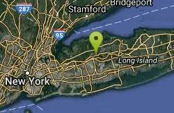
Trail View State Park
Woodbury, New York
20.6 miles EA 6-to-8-mile south-running trail from Woodbury toward Bethpage State Park — mostly easy, with a technical stretch between the two parkways and a few road crossings.
Mountain Bike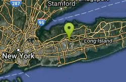
Manetto Hills
Woodbury, New York
20.9 miles EA short, advanced-beginner singletrack surrounded by suburbia in Woodbury, NY — tight switchbacks, some technical climbs, and easy bailing access make it a great local gem.
Mountain Bike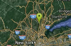
Boy Scout Camp
Rockleigh, New Jersey
20.9 miles NA half-mile climb to the camp hilltop, a fireroad crossing to north-side singletrack, and a descent to a wooden bridge — a solid after-work neighborhood ride for those who live nearby.
Mountain Bike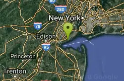
Bunker Pond
21.4 miles SW
A rough, overgrown trail across from Arbutus Woods in New York — interesting to explore, but not worth the thorn bushes for a proper ride.
Mountain Bike
Trails seperated by streets
New York, New York
21.5 miles SWWooded singletrack trails on Staten Island — best enjoyed a few days after a snowfall when the sun softens the surface and the ground is still white.
Mountain Bike
Mills Reservation Trails
Montclair, New Jersey
21.6 miles NWSix miles of loop trails through preserved deciduous woodland and wetlands on the First Watchung Mountain, with basalt lava outcrops, NYC skyline views, and a Lenape Trail segment.
Mountain Bike
Eagle Rock
Montclair, New Jersey
21.9 miles WA fun singletrack ride at Eagle Rock in Montclair with roots, rocks, short descents, and alt routes — something for riders of all levels.
Mountain Bike
Arbutus Woods
21.9 miles SW
One of many short connector trails on Staten Island, linking various streets just a few blocks from the Wolf's Pond trail system.
Mountain Bike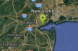
Staten Island Beach
22.1 miles SW
Staten Island Beach is rideable on frozen damp sand at low tide — great views of New Jersey and the Atlantic, but best in winter only, not recommended in summer.
Mountain Bike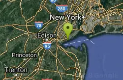
Wolfes Pond park
22.3 miles SW
A mix of beginner, intermediate, and advanced singletrack near Staten Island with short climbs, twisty rooty trails, and a link to Mt. Loretto forest 1.5 miles away.
Mountain Bike


