Governors Landing Day Use Area
Del Rio
Camp, Canoe, Kayak, and Swim
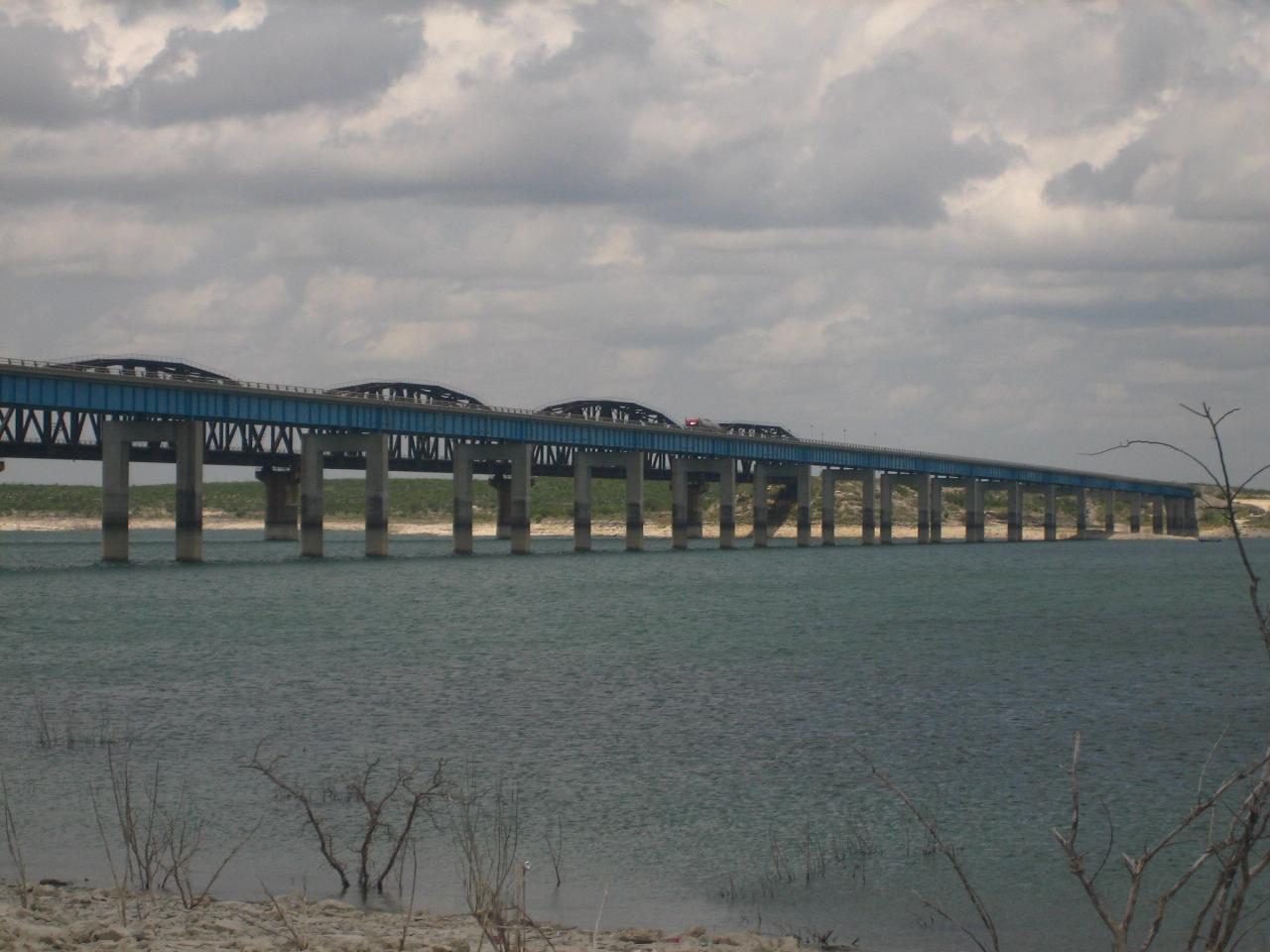
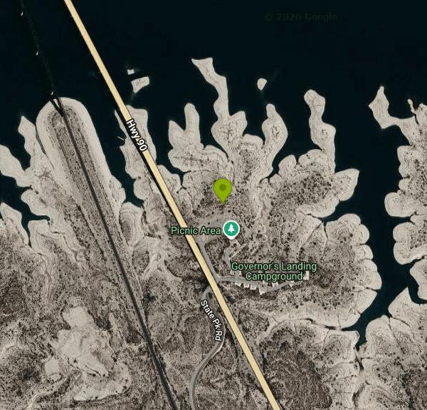
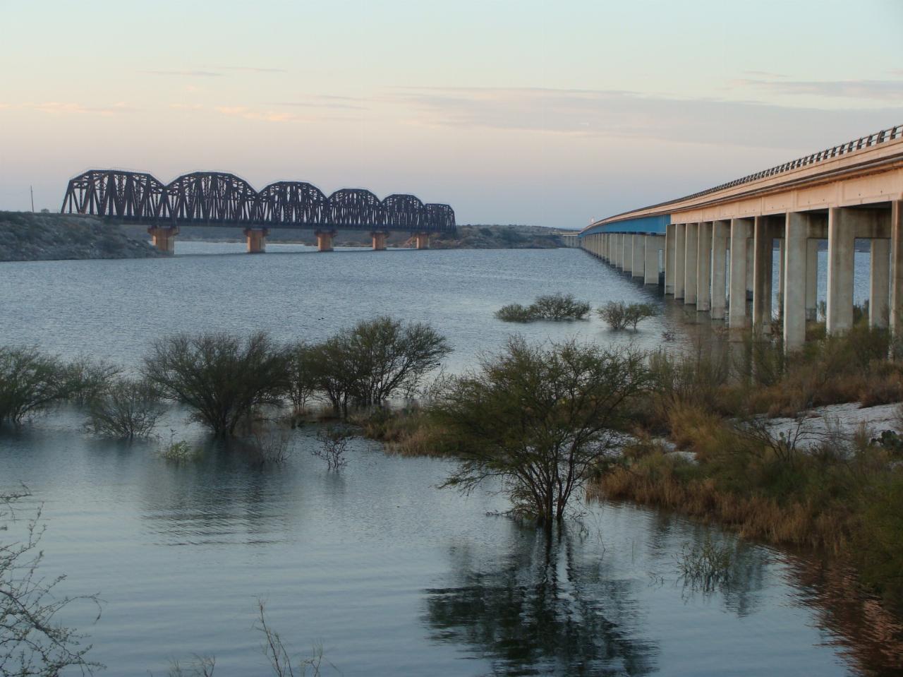
Governors Landing Day Use Area is the main swimming spot in Amistad National Recreation Area, the National Park Service unit that covers the U.S. side of Amistad Reservoir on the Rio Grande northwest of Del Rio, Texas. The day-use area sits on the Devils River arm of the lake, right at the east end of the US 90 highway bridge (the Herbert C. Petry Bridge) and the tall steel truss railroad bridge that runs beside it. The NPS lists Governors Landing as one of two unsupervised swim areas in the park, along with Diablo East, and calls it the most popular of the park's seven day-use areas.
From Del Rio, take US 90 west past the Amistad Visitor Center and turn off just before the highway crosses the lake. The day-use area is below Governors Landing Campground. Its large paved lot fits cars, RVs, buses and boat trailers, and the picnic area next to it has tables under tin-roofed shade ramadas, grills, restrooms (including accessible ones) and an amphitheater. From the lot you walk down to the water.
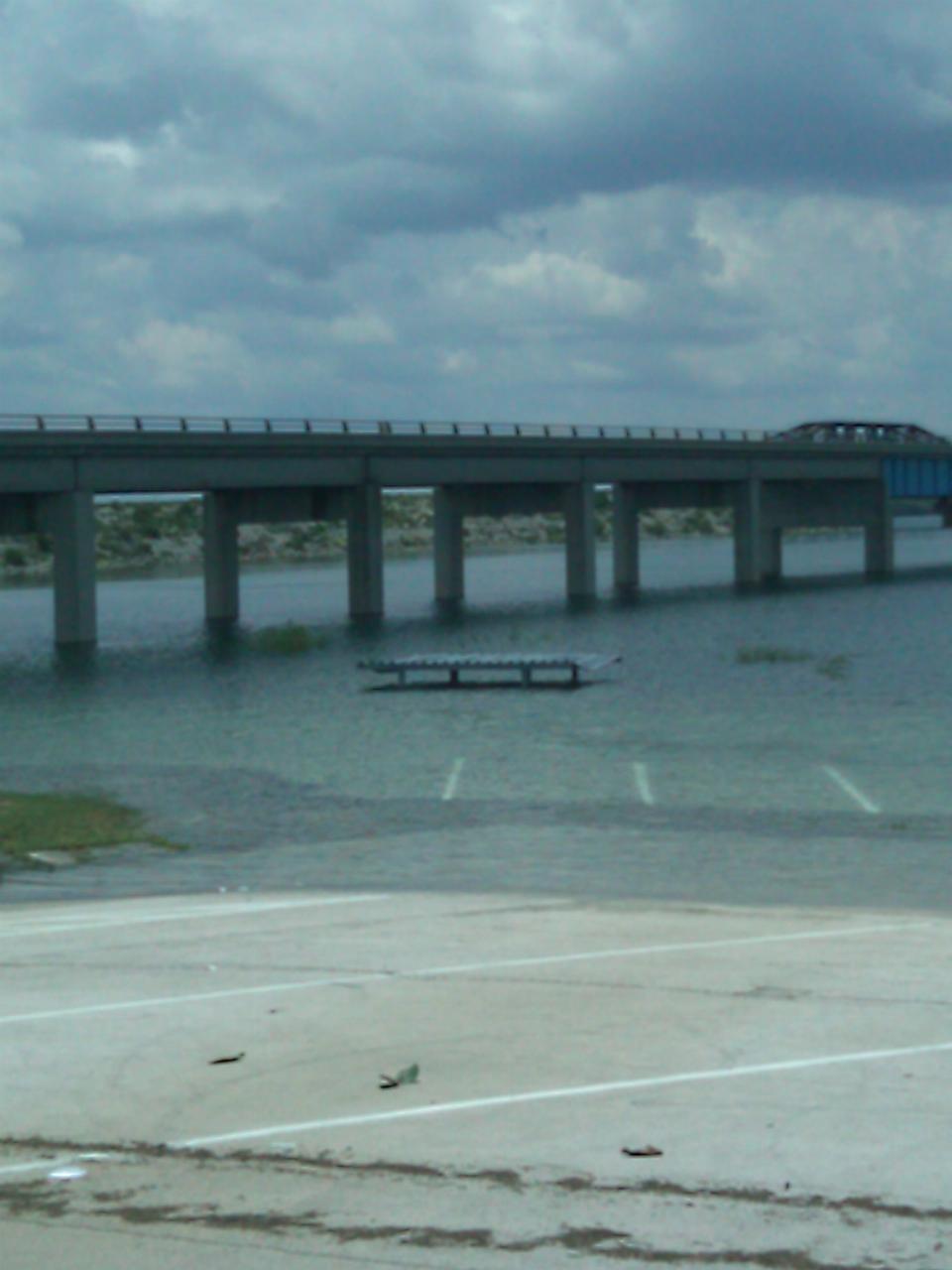
There is no sand beach, lifeguard or roped swim area. You get into the reservoir from a rocky shore that moves with the lake level. Amistad is a flood-control and water-supply reservoir, and in drought it drops a long way. It hit a record low of 1,047.15 feet in July 2024, when it was 24 percent full. Check Texas Water Development Board figures for the current level against the 1,117-foot conservation pool. At low levels the walk from the parking lot to the water is long and rough, and the NPS warns that some parts of the lake have sudden drop-offs. When the lake is high it can go the other way. Photos from July 2010 show the Governors Landing ramadas and restrooms standing in water. The water is clear and blue-green, ranging from about 54 degrees F in winter to 86 degrees F in late summer, and mild weather often stretches swimming season well into fall.
Swimming and picnicking at Governors Landing are free. Amistad charges no entrance fee, and the NPS lists no activity fee for swimming. The only lake fee is the Lake Use Pass for motorized boats and other vessels that need Texas registration: $4 for one day, $10 for three days or $50 for a year. Picnicking in empty sites inside the campground itself is allowed only from 7 a.m. to 3 p.m.; after that you leave or pay the camping fee. The NPS does not post gate hours for the day-use area and recommends keeping swims to daylight.
Park rules ban swimming in harbors, within 200 feet of fishing docks, and near mooring areas and boat ramps, so stay away from the launch area. Don't swim alone, keep children within reach, and put small children and weak swimmers in Coast Guard approved life jackets. The NPS says diving from cliffs is extremely dangerous and is not recommended. Pets are allowed on a leash no longer than 6 feet. Kayaks and canoes can be launched here, especially when the lake is up.
Governors Landing Campground sits just uphill on a first-come, first-served basis. The Amistad Visitor Center is a few miles east on US 90, and boaters can reach the Panther Cave pictographs on the Rio Grande near the Pecos River. Check the park's current conditions page for lake levels and ramp closures before you go.
More Information
Amistad National Recreation Area - Wikipedia
Amistad National Recreation Area is a national recreation area managed by National Park Service (NPS) that includes the area around the Amistad Reservoir at the confluence of the Rio Grande, the Devils River, and the Pecos River near Del Rio in Val Verde County, Texas.[3] The reservoir was created by the Amistad Dam (Presa de la Amistad in Spanish), completed in 1969, located on the Rio Grande at the United States-Mexico border across from the city of Ciudad Acuña in the Mexican state of Coahuila. Amistad, Spanish for “friendship,” refers broadly to the close relationship and shared history between Ciudad Acuña and Del Rio.[4]
https://en.wikipedia.org/wiki/Amistad_National_Recreation_AreaBoat and Fish the Friendliest Lake on the Texas-Mexico Border
The Texas badlands east of the Pecos River and along the state’s border with Mexico bristle in thorn-covered plateaus and jagged limestone canyons. But after spring rains, the country often reveals a softer side, blushing with Texas sage blooms. The sage grows on both sides of the Rio Grande, clinging to crevices, thriving among the flats, and populating the rocky shores of Amistad Reservoir, home to Amistad National Recreation Area and ground zero for the most important shared resource in badlands territory—water. Read More >
https://texashighways.com/outdoors/water/boat-and-fish-the-friendliest-lake-on-the-texas-mexico-border/Governors Landing Campground, Amistad National Recreation Area - Recreation.gov
Explore Governors Landing Campground in Amistad National Recreation Area, Texas with Recreation.gov. Governors Landing Campground is open year-round and rarely fills up, except possibly on holiday weekends. It is suitable for tents and RVs up to 28 feet in leng
https://www.recreation.gov/camping/poi/10128981Governors Landing Day Use Area - Amistad (U.S. National Park Service)
Governors Landing Day Use Area - Amistad
https://www.nps.gov/places/governors-landing-day-use-area-amistad.htmWater Data For Texas
Lake Amistad straddles the border of Texas and Mexico. By treaty, Texas has rights 56.2% of the total conservation capacity. The fraction of the actual storage that belongs to Texas is formally determined biweekly by the International Boundary Water Commission (IBWC). The IBWC is the legal repository of data related to this lake for treaty purposes and official versions of the datasets should be obtained directly from them. Conservation capacity is based on 56.2% of total conservation capacity. Conservation storage is based on the bi-weekly changing Texas fraction.
https://www.waterdatafortexas.org/reservoirs/individual/amistad
- Plan Ahead and Prepare
- Travel & camp on durable surfaces
- Dispose of waste properly
- Leave what you find
- Minimize campfire impacts
- Respect wildlife
- Be considerate of other visitors
Directions
From Del Rio
- Head north on Avenue J toward E 6th St (0.2 mi)
- Turn right onto E 7th St (0.2 mi)
- Turn left onto N Bedell Ave (0.6 mi)
- Turn right onto Dodson Ave (1.4 mi)
- Turn left onto Chapman Rd (0.3 mi)
- Turn right onto US-277/
US-377/ US-90/ Veterans Blvd Continue to follow US-277/(1.8 mi)US-377/ US-90 - Keep left to continue on US-277/
US-90 Continue to follow US-90(7.8 mi) - Turn left onto TX-349 Spur (0.2 mi)
- Turn right (0.6 mi)
- Continue onto State Pk Rd (0.6 mi)
- Turn left (459 ft)
 Swimmers wading at Governors Landing during high water in July 2010, with a picnic ramada and restro courtesy of homeronz↗ (CC BY-SA 3.0↗)
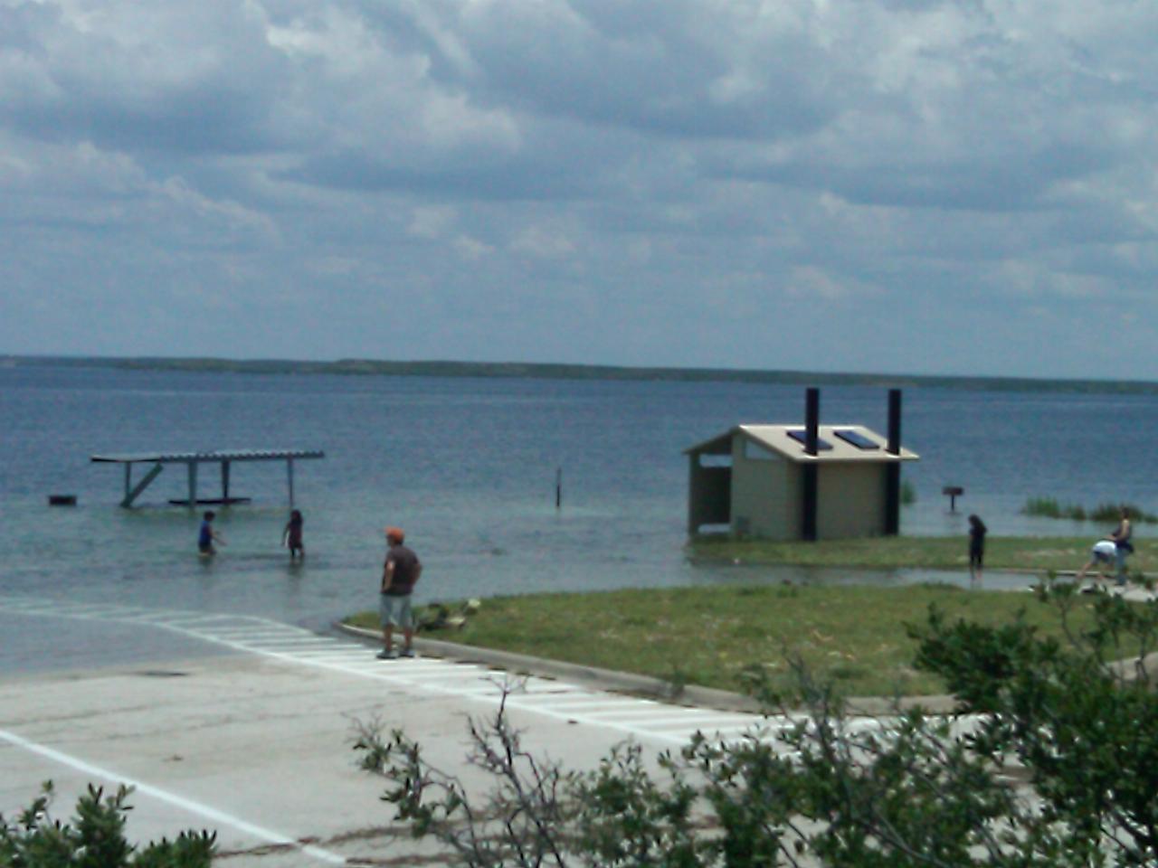
 A picnic ramada under water at Governors Landing in July 2010, with the US 90 bridge across the Devi courtesy of homeronz↗ (CC BY-SA 3.0↗)
 Amistad Reservoir at dusk beside the US 90 highway bridge and the railroad truss bridge next to Gove courtesy of Zereshk↗ (CC BY-SA 3.0↗)
 The US 90 bridge crossing the Devils River arm of Amistad Reservoir, the water that Governors Landin courtesy of Billy Hathorn at en.wikipedia↗ (CC BY-SA 3.0↗)