


3 Hiking Trails near Ingleside, IL 60041
first prev 1 next lastShowing Hiking Trails within 50 miles Distance miles of Ingleside, IL 60041, USA City, Zip, or Address
Add Location
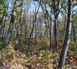
Gander
Antioch, Illinois
8.2 miles NA challenging hike to the top of Lake County's highest natural elevation — 957 feet above sea level at Gander Mountain — rewarded with scenic views of the Fox River valley below.
Hike
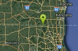
Emma Carlin Trail
Whitewater, Wisconsin
39.5 miles NWThree color-coded mountain bike trails from 3.5 to 8 miles through hilly hardwood forest near Whitewater — more challenging than the nearby John Muir Trails, with glacial terrain and scenic overlooks.
Cross-country Ski, Hike, Mountain Bike, Snowshoe
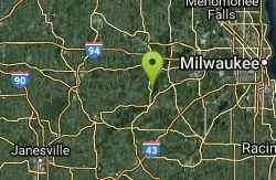
Kettle Morain South Trail Head
Dousman, Wisconsin
41.7 miles NWOver 30 miles of connected mostly single-track trails through the Southern Unit of Kettle Moraine State Forest — the John Muir and Emma Carlin systems linked by a connector trail.
Camp, Cross-country Ski, Hike, Swim


