Lake Arrowhead Swimming Beach
Wichita Falls
Camp, Canoe, Hike, Kayak, and Swim
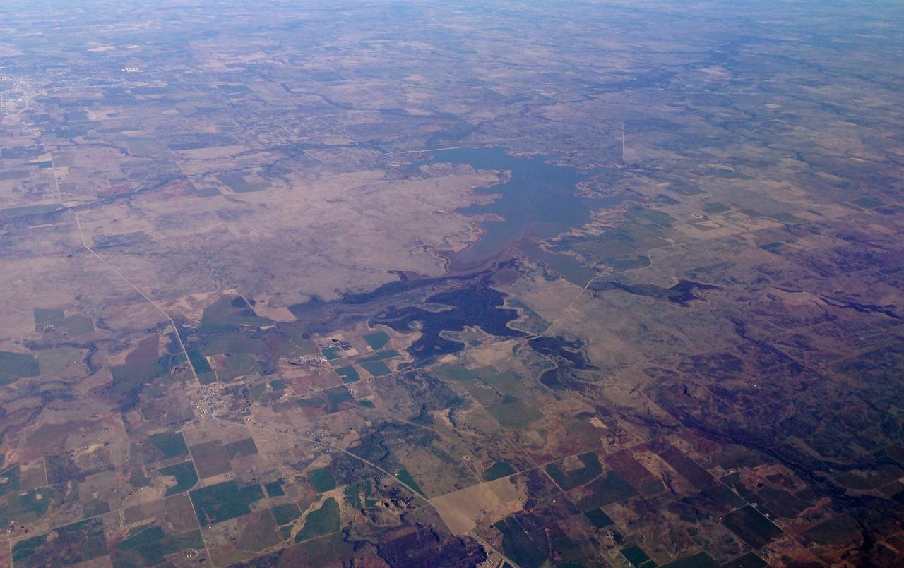
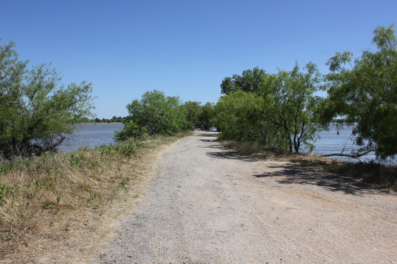
Lake Arrowhead spreads across the rolling prairie about fifteen miles south of Wichita Falls in southwestern Clay County, and the designated swimming area sits on the east side of the day use peninsula at Lake Arrowhead State Park. Getting in is simple. You park in the day use lot, walk a short distance across mown grass and gravel, and wade in on a shallow, gradually sloping bottom. The park map marks the swim zone and posts it closed to boats, so the water here stays flat and free of wake even when skiers are working the open lake a few hundred yards out.
The lake was created in 1966, when the City of Wichita Falls dammed the Little Wichita River to build a municipal water supply. It covers roughly 16,200 acres at a conservation pool elevation of 926 feet, averages about 16 feet deep, and bottoms out near 45. The water is north Texas reservoir water: warm through the summer, stained tan to green by the red clay soils of the Rolling Plains, with a firm sand and clay bottom underfoot. There is no lifeguard and no gate at the beach itself, just open shoreline and a long view down the lake.
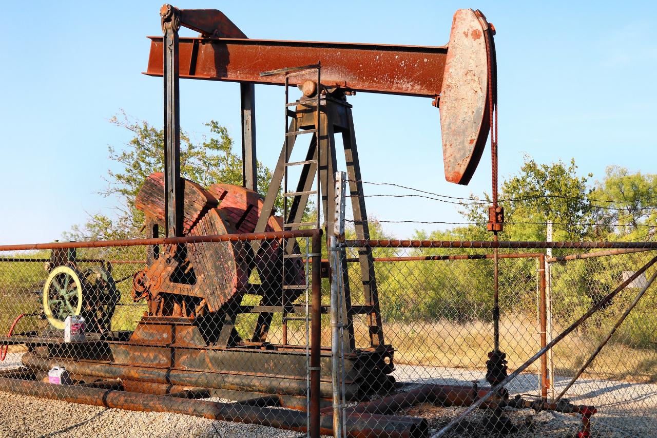
What makes this water look like nowhere else is the oil derricks. Fifteen steel derricks still stand above the surface out on the open lake, marking wells that were capped and sealed before the reservoir filled. They break the horizon in every direction from the beach, and anglers work them hard for crappie. A pumpjack completed in 1952 is still running inside the park near the camping loops, close enough that you can hear it turning over at night. The town of Halsell went under when the lake came up.
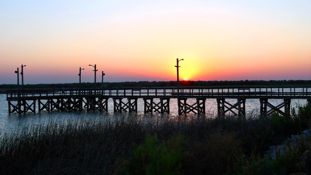
Beyond the water, the park covers 524 acres of mesquite savanna and restored prairie with more than five miles of multiuse trail. Dragonfly Trail is a half mile nature loop. Mesquite Ridge climbs 0.6 miles to an overlook that is the best sunset spot here. Onion Creek Trail runs 4.4 miles past views of the spillway and through a tunnel under FM 2606 that the park calls The Horn. Birders have logged over 200 species, including bald eagles, osprey and great egrets. There is also an 18 hole disc golf course, a lighted fishing pier, nine boat ramps, and a campground laid out as eight small loops.
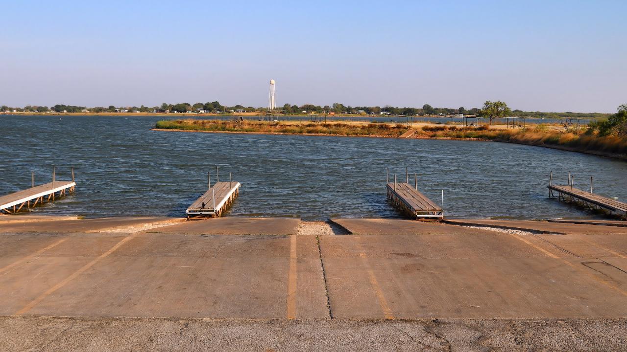
Entry is $4 per person for ages 13 and up and free for children 12 and under. Check the lake level before you drive out. Lake Arrowhead is a working water supply and it draws down hard in dry years. In late September 2026 it was holding about 70 percent of conservation storage, roughly five feet below the 926 foot pool, which pushes the waterline out and widens the beach without closing it. In a deeper drought the swim area becomes a long walk to water, and warm shallow reservoir water in this part of Texas is prone to blue green algae, so look at the park alert page before you commit to a swim day.
More Information
Be courteous, informed, and prepared. Read trailhead guidelines, stay on the trail, and don't feed the wildlife.
Read More
- Plan Ahead and Prepare
- Travel & camp on durable surfaces
- Dispose of waste properly
- Leave what you find
- Minimize campfire impacts
- Respect wildlife
- Be considerate of other visitors
Directions
From Wichita Falls
- Head northwest on Scott Ave toward 6th St (0.1 mi)
- Turn left onto 5th St (0.6 mi)
- Turn left after Arby's (on the left) (190 ft)
- Merge onto US-281 S/
US-287 S via the ramp on the left to US-82 E (1.8 mi) - Take the exit on the left onto TX-79 S/
US-281 S toward Jacksboro/ Archer City Continue to follow US-281 S(6.0 mi) - Turn left onto FM1954 E (7.3 mi)
- Continue straight onto Park Rd 63 (0.6 mi)
- Turn rightDestination will be on the right(197 ft)
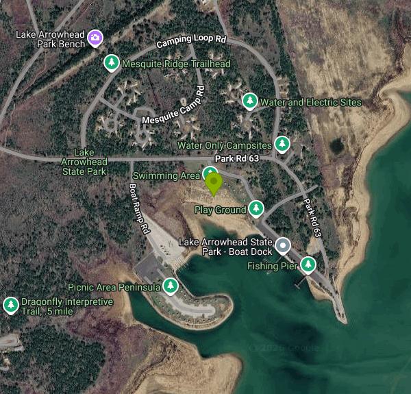 The day use area at Lake Arrowhead State Park, where swimming, picnicking and shore fishing all happ courtesy of Larry D. Moore↗ (CC BY 4.0↗)
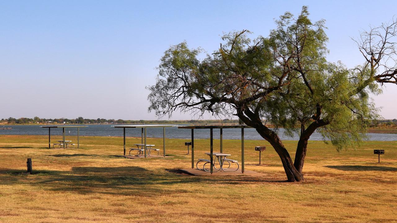
 Open water and shoreline at Lake Arrowhead State Park in Clay County, Texas. courtesy of Nicolas Henderson from Coppell, Texas↗ (CC BY 2.0↗)
 Sunset from the lighted fishing pier on the north shore of Lake Arrowhead. courtesy of Larry D. Moore↗ (CC BY 4.0↗)
 Boat ramps at the park, showing the low waterline typical of a dry year on this water supply reservo courtesy of Larry D. Moore↗ (CC BY 4.0↗)
 The pumpjack inside the park, completed in 1952 and still active, a reminder of the oilfield the lak courtesy of Larry D. Moore↗ (CC BY 4.0↗)
 Lake Arrowhead in Clay County, Texas, seen from the air on a flight into Dallas Fort Worth. courtesy of Fredlyfish4↗ (CC BY-SA 3.0↗)