Lake Carlsbad Beach Park
Carlsbad
Canoe, Hike, Kayak, and Swim
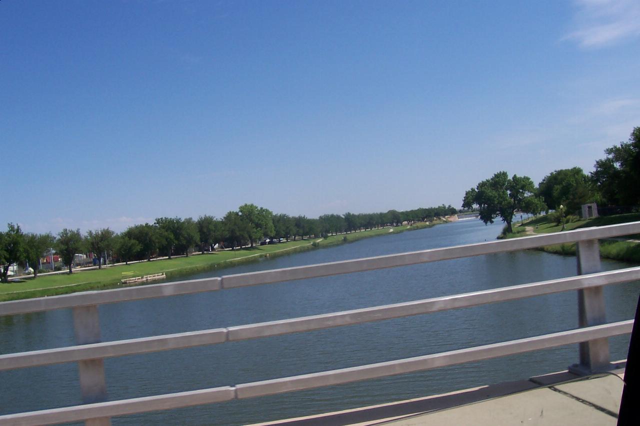
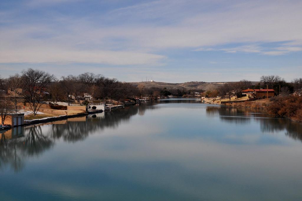
Lake Carlsbad is not a lake in the ordinary sense. It is the Pecos River, backed up behind the upper Tansill Dam into a slow green pool that runs straight through downtown Carlsbad from the railroad bridge down to the dam. The city owns both banks, roughly 125.6 acres of park, and the swimming happens off the west side at the end of Park Drive.
Getting in the water here is sanctioned, not merely tolerated. Carlsbad's municipal code names the Carlsbad Municipal Beach swimming area outright, the city hires seasonal lifeguards for that beach along with the water park next door, and the city's own notices about treating invasive aquatic weeds state that swimming, boating and fishing stay safe during treatment. No admission charge is published for the beach or for river access. The guards are a summer arrangement, so do not count on one in May or September.
What does cost money is the Carlsbad Water Park at 708 Park Drive, a separate chlorinated facility a short walk south of the beach with five slides, a lazy river and a zero entry children's area. Admission is $5, free for anyone under 4 or over 61. It runs Tuesday through Sunday, 11 a.m. to 6 p.m., Memorial Day weekend through Labor Day weekend, and drops to weekends only in August. Slide riders have to be 48 inches. A free splash pad sits at the beach area itself, open 8 a.m. to 8 p.m. daily. The Riverwalk Recreation Center at 400 Riverwalk Drive is free to use but has no pool despite the name, so the year round indoor option in town is the Carlsbad High School Natatorium.
The swim area shares water with boats. A concrete ramp sits just north of it, kayaks and paddle boats rent on the bank, and skiers use the lake. Close to five miles of lighted walkway follow the two banks past tennis and racquetball courts, playgrounds, a skate park, sand volleyball and the Beach Bandshell.
Dogs are excluded twice over. One section of city code keeps them off the Municipal Beach swimming area, and another makes it unlawful to let an animal swim in the Pecos anywhere the river abuts a public park between the flume near Calloway Drive and the Bataan bridge at Greene Street.
Flow here is managed rather than natural. Brantley and Avalon dams sit upstream, the two Tansill dams sit in town, and the river between Lake Carlsbad and Avalon Reservoir is usually dry because that water is diverted into the Carlsbad main canal. Releases can put current under a flat looking surface, so it is worth checking the USGS gauge at Carlsbad before a long swim. Summer air runs past 100 degrees with thin shade on the bank, which catches out more people here than the water does.
On water quality, plainly. New Mexico's environment department carries this reservoir as assessment unit NM-2203.B_00, 134.28 acres, and has not assessed it for primary contact recreation. It is listed as not supporting aquatic life because of DDT and PCB fish consumption advisories, first listed in 2016 and 2010. Those advisories are about eating what you catch, not about getting in. Golden algae, Prymnesium parvum, has caused repeated fish kills in the Carlsbad municipal reservoirs, and it kills gill breathers rather than people. If the water looks oddly dark blue in July, that is the city's aquatic shade dye, applied to starve the invasive weeds of light, and it clears in seven to ten days.
More Information
Carlsbad Water Park | City of Carlsbad, NM
The Carlsbad Water Park opened on the shores on the Pecos River by early summer 2016.
https://www.cityofcarlsbadnm.com/Departments/Community-Development/Carlsbad-Water-ParkInvasive Aquatic Vegetation | City of Carlsbad, NM
The City of Carlsbad has developed an adaptive Aquatic Plant Management Plan for Lake Carlsbad. It focuses on managing sago pondweed through mechanical harvesting and suction while mitigating the risk of toxic golden algae blooms to maintain safe recreational access.
https://www.cityofcarlsbadnm.com/Aquatic-VegetationORDINANCE NO. 2017-10 AN ORDINANCE AMENDING CHAPTER 6 OF THE CODE OF ORDINANCES, CITY OF CARLSBAD, N
ORDINANCE NO. 2017-10 AN ORDINANCE AMENDING CHAPTER 6 OF THE CODE OF ORDINANCES, CITY OF CARLSBAD, NEW MEXICO REGARDING ANIMALS.
https://www.egovlink.com/public_documents300/carlsbad/published_documents/city_clerk/ordinances/2017/Ord-No-2017-10-Final-Draft.pdfPecos River at Carlsbad, NM - USGS Water Data for the Nation
Discover water data collected at monitoring location USGS-08405000, located in Eddy County, New Mexico and find additional nearby monitoring locations.
https://waterdata.usgs.gov/monitoring-location/08405000/Riverwalk Recreation Center | City of Carlsbad, NM
The Riverwalk Recreation Center is one of Carlsbad’s most inviting family recreational facilities.
https://www.cityofcarlsbadnm.com/Departments/Community-Development/Riverwalk-Recreation-CenterSwimming in Carlsbad New Mexico
Swimming in Carlsbad New Mexico can be done many places, including an indoor pool, the city’s beach park, and some beautiful natural lakes at nearby parks.
https://carlsbadnewmexico.com/activities/swimming/Water Activities | City of Carlsbad | Carlsbad NM Tourism
An oasis in the desert, Carlsbad is abundantly equipped with magnificent bodies of water to quench your thirst for fishing, boating, and more!
https://www.explorecarlsbadnm.com/water-activities/Wayback Machine
The Wayback Machine - https://web.archive.org/web/20230425193824/https://cityofcarlsbadnm.com/download/employment/Lifeguard.pdf
https://web.archive.org/web/20230425193824/https://cityofcarlsbadnm.com/download/employment/Lifeguard.pdfBe courteous, informed, and prepared. Read trailhead guidelines, stay on the trail, and don't feed the wildlife.
Read More
- Plan Ahead and Prepare
- Travel & camp on durable surfaces
- Dispose of waste properly
- Leave what you find
- Minimize campfire impacts
- Respect wildlife
- Be considerate of other visitors
Directions
From Carlsbad
- Head southwest on Carlsbad Village Dr (0.1 mi)
- Turn left to merge onto I-5 S (19.2 mi)
- Continue straight onto I-805 S (10.7 mi)
- Take exit 17B to merge onto I-8 E toward El CentroEntering Arizona(343 mi)
- Take exit 178A to merge onto I-10 E toward Tucson (63.9 mi)
- Keep left (2.0 mi)
- Merge onto I-10 EParts of this road may be closed at certain times or daysPassing through New MexicoEntering Texas(296 mi)
- Exit onto S Desert Blvd (1.0 mi)
- Turn left onto TX-375 Loop/
Woodrow Bean Transmountain Dr Continue to follow TX-375 Loop(24.9 mi) - Take exit 38 toward Edgemere Blvd (0.2 mi)
- Merge onto Joe Battle Blvd (0.2 mi)
- Slight left toward Joe Battle Blvd (443 ft)
- Merge onto Joe Battle Blvd (0.9 mi)
- Turn right onto US-180 E/
US-62 E/ Montana Ave Continue to follow US-180 E/US-62 E Entering New Mexico(147 mi) - Turn left onto San Jose Blvd (2.3 mi)
- San Jose Blvd turns slightly right and becomes Plaza St (413 ft)
- Turn left onto S Canyon St (0.6 mi)
- Turn right onto US-180 E/
US-62 E/ W Greene St (0.2 mi) - Turn left onto Park Dr (0.8 mi)
- Turn right (0.1 mi)
- Turn right (112 ft)
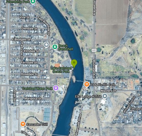 The Pecos River held back behind the Tansill dams at Carlsbad courtesy of rutlo↗ (CC BY 2.0↗)
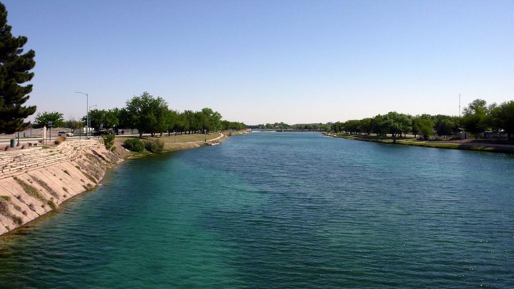
 The Pecos River running through downtown Carlsbad past the boat garage courtesy of Clinton Steeds↗ (CC BY 2.0↗)
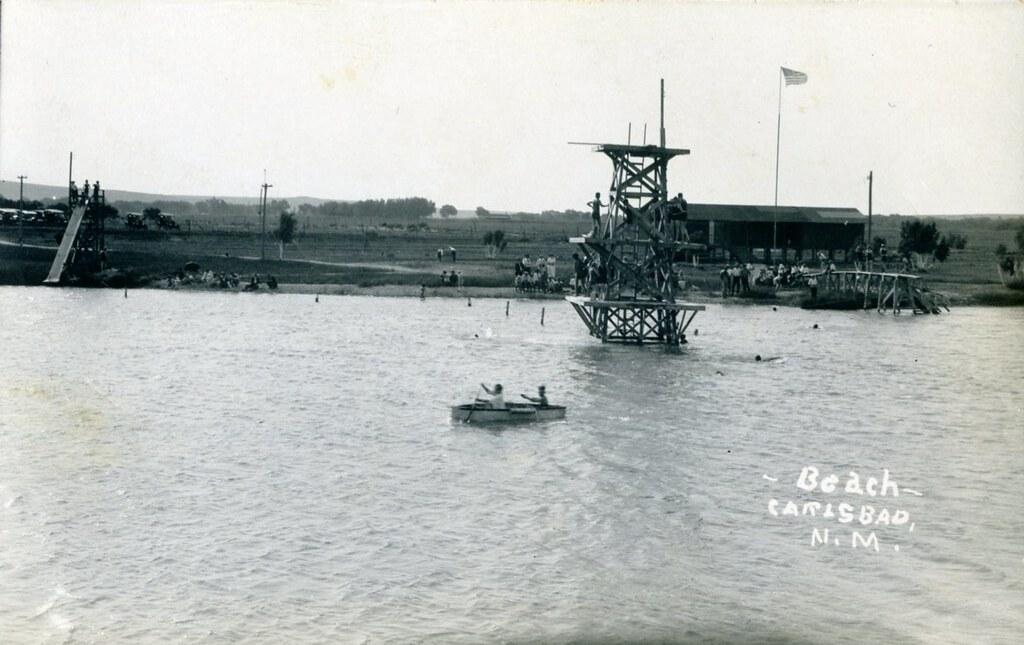
 Carlsbad Beach on the Pecos River, real photo postcard from about 1920 courtesy of waterarchives↗ (CC BY-SA 2.0↗)
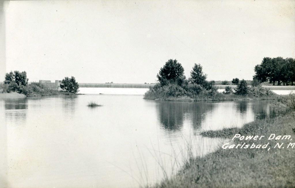
 The Carlsbad Power Dam, the upper Tansill Dam that holds back Lake Carlsbad courtesy of waterarchives↗ (CC BY-SA 2.0↗)
 The Greene Street, Bataan, bridge over the Pecos River in Carlsbad courtesy of Ryan Leon↗ (CC BY-SA 3.0↗)