


Lake Holbrook Beach
Mineola

Canoe, Kayak, and Swim
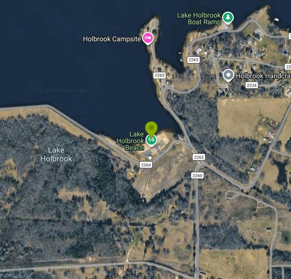
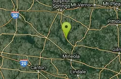
Lake Holbrook Beach is the small sand swimming beach on the south shore of Lake Holbrook, a 653-acre reservoir in southwestern Wood County a few miles northwest of Mineola. Wood County built the lake in 1961 and 1962 behind Wood County Dam No. 2 on Keys Creek, a Sabine River tributary (Texas Parks and Wildlife lists the creek as Lankford Creek), and still owns and runs it for flood control and recreation. Texas Parks and Wildlife lists the beach near the dam as one of the lake's public facilities, next to two free county boat ramps. On maps the beach is part of a small county day-use area labeled Lake Holbrook Recreational Area.
From Mineola, take US 80 west and turn north on County Road 2231, then follow County Road 2260 toward the south shore. That is the same route Texas Parks and Wildlife gives for the South Access ramp. The beach sits just east of the earthen dam where County Roads 2263 and 2264 meet the water, with a small parking lot and a covered shelter behind the sand. The South Access ramp, a one-lane concrete ramp with room for about 20 vehicles, is less than half a mile farther along the same shoreline.
The swim area is a short strip of sand that slopes into a sheltered corner of the lake. The lake reaches 30 feet at its deepest, and the water deepens toward the dam, so keep weaker swimmers close to the beach. Texas Parks and Wildlife describes the water as moderately clear, with cattails and other emergent plants along much of the shoreline and little submerged vegetation. In an East Texas summer the surface water is warm, often in the high 80s, and the season for comfortable swimming runs roughly from late May into September. No official source lists lifeguards, posted hours or a swim season, so plan on swimming at your own risk.
No source shows any entry or parking fee for the beach. Texas Parks and Wildlife lists both county ramps as free and open all year, and the beach is part of the same county-run public access. Wood County has no page of its own for the park, so call the Reservoir Controlling Authority, Wood County District 2, at (903) 569-6351 to confirm hours or any rules before a big group outing.
Lake Holbrook is a busy bass and crappie lake, and fishing boats come and go from the south ramp, so stay inside the beach area and away from the boat lanes. The water level moves two to four feet over a year, which changes how much sand is exposed. The dam just west of the beach is a flood-control structure, so stay off the spillway and out of the outflow area below it after heavy rain. No agency posts bacteria test results for the lake, so skip swimming for a couple of days after big storms.
The two county ramps make the lake an easy place to put in a canoe or kayak, and the quiet coves at the upper end hold standing timber worth paddling around. Mineola is about four miles away for food, fuel and supplies, and the Mineola Nature Preserve on the Sabine River south of town adds trails and river access.
More Information

- Plan Ahead and Prepare
- Travel & camp on durable surfaces
- Dispose of waste properly
- Leave what you find
- Minimize campfire impacts
- Respect wildlife
- Be considerate of other visitors
Directions
From Mineola
- Head northwest on Willis Ave toward Hopkins AvePass by Papa Johns Pizza (on the left in 0.6 mi)(2.4 mi)
- Turn left onto the Northern State Parkway ramp to New York (0.2 mi)
- Merge onto Northern State Pkwy (3.8 mi)
- Continue onto Grand Central Pkwy (1.3 mi)
- Take exit 23 for Cross Island Pkwy N toward I-495 (0.4 mi)
- Merge onto Cross Island Pkwy (4.2 mi)
- Take exit 33 for I-295/
Throgs Neck Br toward Bronx/ New England Toll road(0.5 mi) - Merge onto I-295 NToll road(2.6 mi)
- Keep left to stay on I-295 N, follow signs for I-95 S/
Cross Bronx ExpwyW/ Geo Washington Br (1.3 mi) - Continue onto Cross Bronx Expy (0.6 mi)
- Merge onto I-95 S (4.7 mi)
- Slight right onto Cross Bronx Expy/
Interstate 95 Lower Level S/ Trans-Manhattan Expy/ U.S. 1 Lower Level S (signs for I-95 S/ US-1 S/ George Washington Br Lower Level) (0.6 mi) - Keep left to continue on Interstate 95 Lower Level S/
U.S. 1 Lower Level S, follow signs for I-95 S/ New Jersey Entering New Jersey(1.8 mi) - Keep right to continue on I-95 (2.7 mi)
- Keep left to continue on I-95 S, follow signs for NJ Turnpike South/
US-46/ Newark Toll road(2.4 mi) - Keep left to continue on I-95 S/
NJ Turnpike S, follow signs for Trenton Toll road(2.6 mi) - Keep left to continue on I-95 S, follow signs for Express EZPassToll road(7.7 mi)
- Take exit 14-14 A-14 B-14 C for I-78 W toward US-1/
US-9/ Newark Airport Toll road(1.6 mi) - Continue onto I-78 WToll road(0.1 mi)
- Keep left to continue on I-78 Express W/
Phillipsburg–Newark Expy, follow signs for I-78 W/ Garden State Parkway/ Clinton Toll road(9.2 mi) - Continue onto I-78 W/
Phillipsburg–Newark Expy (16.9 mi) - Slight right to stay on I-78 WToll roadEntering Pennsylvania(109 mi)
- Take the exit onto I-81 S toward Harrisburg (18.8 mi)
- Keep right to stay on I-81 SPassing through Maryland, West VirginiaEntering Virginia(359 mi)
- Keep left to continue on I-81 S/
US-52 N, follow signs for Bristol Continue to follow I-81 SEntering Tennessee(148 mi) - Take exit 1B for I-40 W toward Knoxville (0.7 mi)
- Merge onto I-40 (3.0 mi)
- Keep left to stay on I-40 (49.7 mi)
- Slight right to stay on I-40 (signs for Nashville) (155 mi)
- Continue straight to stay on I-40 (2.1 mi)
- Slight left to stay on I-40 (3.4 mi)
- Take the I-40 W exit on the left toward Memphis (0.4 mi)
- Continue onto I-40 W (1.4 mi)
- Keep right to stay on I-40 W, follow signs for Memphis (188 mi)
- Keep left to stay on I-40 W (7.2 mi)
- Take exit 10A-10B for I-40 W toward Little Rock (0.8 mi)
- Continue onto I-40 W (10.5 mi)
- Keep left to stay on I-40 W, follow signs for Little RockEntering Arkansas(10.5 mi)
- Keep left to stay on I-40 W, follow signs for Little Rock (123 mi)
- Take exit 153B on the left for I-30 W/
US-65 S/ US-67 S/ US-167 S toward Little Rock (0.6 mi) - Continue onto I-30 W/
US-167 S/ US-65 S/ US-67 S (4.3 mi) - Slight right onto I-30 W (signs for Texarkana)Entering Texas(214 mi)
- Take exit 146 toward TX-37/
Clarksville/ Winnsboro (0.2 mi) - Merge onto Interstate 30 Service Rd (456 ft)
- Turn left onto TX-37 S (30.2 mi)
- Turn right onto E Goode St (0.3 mi)
- Turn left onto TX-37 S/
S Main St Continue to follow TX-37 SPass by Quitman Dairy Queen (on the right in 0.6 mi)(7.9 mi) - Turn right onto TX-564 Loop (0.7 mi)
- Turn right onto US-69 N (2.0 mi)
- Turn left onto Co Rd 2260 (2.6 mi)
- Continue straight onto Co Rd 2263 (285 ft)
- Slight left onto Co Rd 2264Destination will be on the right(453 ft)


Other Swimming Holes, Canoeing Areas, and Kayaking Areas Nearby
Redneck Monet
Yantis, Texas
12.2 miles NLaunch from Hideaway Harbor, paddle east 0.7 miles to Little Caney Peninsula — hundreds of acres of rewilding farmland owned by Sabine River Authority, roamed by deer, otters, coyotes, and bobcats.
Canoe, Hike, Kayak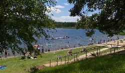
Tyler State Park Swimming Beach
Tyler
20.5 miles SEA sandy designated swim beach on a 64 acre spring fed lake, served by the Prairie Style bath house the CCC finished in 1939. No lifeguards, $6 per person, open year round.
Camp, Canoe, Hike, Kayak, Swim
Gilmer Pond
Gilmer, Texas
39.4 miles EA little-known local pond swimming spot near Gilmer with reportedly clean water and a short walk from the road — explore carefully and only go in if it looks safe.
Swim


