Lake of the Ozarks State Park Public Beach 1
Brumley
Camp, Canoe, Hike, Kayak, and Swim
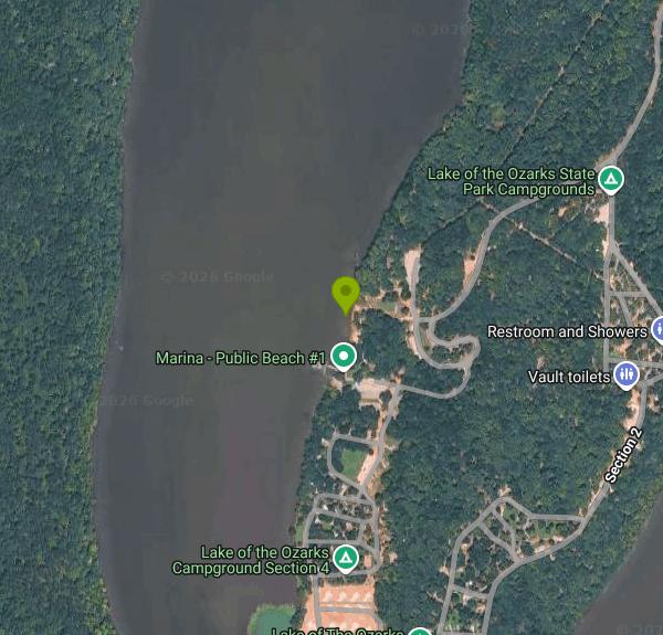
Public Beach 1 (signed by the park as Swim Beach, Public Beach #1) is one of two designated swimming beaches in Lake of the Ozarks State Park, the largest park in the Missouri state park system at about 17,600 acres. Missouri State Parks, a division of the Missouri Department of Natural Resources, runs it. The beach sits on the Grand Glaize Arm of Lake of the Ozarks, the Osage River reservoir, roughly 12 miles up the arm by water, in the Highway 134 half of the park. The other beach, Grand Glaize Beach (Public Beach 2), is a separate site off Highway 54 near Osage Beach.
To get there, follow Highway 134 into the park and turn onto Public Beach Drive, which ends at the water. The park's mailing address is 403 Highway 134, Brumley, and the beach area sits right next to the main campground. Several parking lots sit just above the sand, so the walk from car to water is short. The Public Beach 1 marina and a paved boat ramp share the same cove just south of the swim area.
The beach is a strip of sand on a sheltered cove, with a restroom and change house behind it, shady picnic spots, and playground equipment close by. There are no lifeguards, pets are not allowed on the beach, and the park's rule is swim at your own risk. The park doesn't publish depth or bottom details, so wade in before you jump. This is a reservoir, so there's no current to speak of, and by midsummer the water is warm. The swimming season runs roughly Memorial Day weekend to Labor Day weekend, with posted hours of sunrise to sunset. In the off season the park lists the beach as closed for the season.
There is no charge to use the beach. Missouri doesn't charge entrance fees at its state parks, and the Parks, Soils and Water Sales Tax that pays for that has been renewed by voters. The park grounds are open from sunrise to a half hour after sunset. The Public Beach 1 picnic shelter near the campground has electricity and rents for $45 a day; when nobody has reserved it, it's first come, first served at no cost.
Water quality is the main thing to check before you go. The Department of Natural Resources samples every state park swim beach weekly during the season and posts swimming-not-recommended signs when the geometric mean tops 190 E. coli colonies per 100 milliliters. Public Beach 1 lands on that list fairly often after heavy rain, and one sample has come back more than 12 times over the safe level. Look up the current result on the DNR beach status page the day you plan to swim. Boats come and go from the ramp and marina next door, so stay inside the swim area.
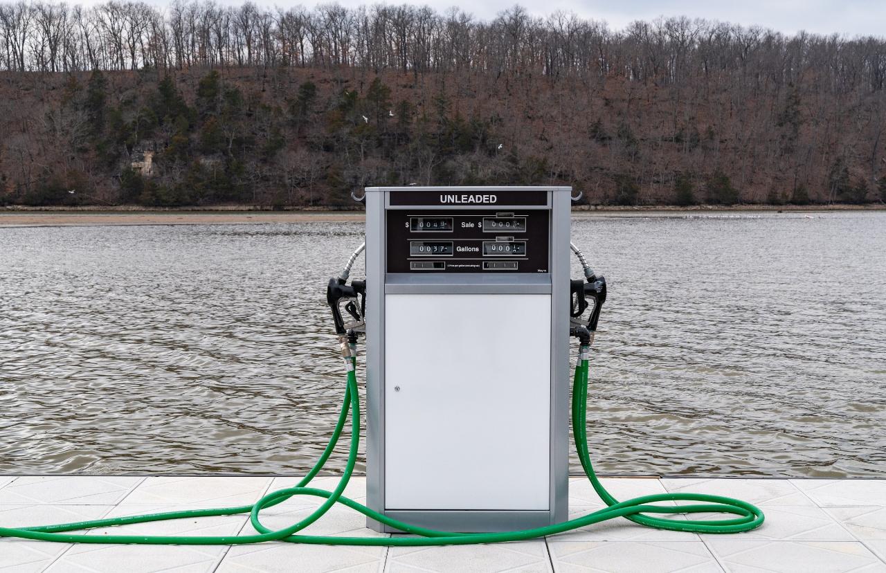
The marina at Public Beach 1, run by a park concessionaire, rents one- and two-person kayaks, canoes and paddleboards, sells fishing and boating supplies, and has six open slips rented by the night (573-302-1044). Paddlers can take a rented kayak out on the park's aquatic trail, the Lake View Bend Trail begins just up the road, and the campground loops start a few hundred yards from the sand, which makes this the easiest beach in the park for an overnight stay.
More Information
Beaches | Missouri Department of Natural Resources
It is normal to find E.
https://dnr.mo.gov/water/alerts-hazards/beachesFacility Hours | Missouri State Parks
Cool Parks gear for sale. Get ready for your trip to one of Missouri's State Parks.
https://mostateparks.com/hours/301/park/lake-ozarks-state-parkMarina - Public Beach #1 | Missouri State Parks
Cool Parks gear for sale. Get ready for your trip to one of Missouri's State Parks.
https://mostateparks.com/key-location/marina-public-beach-1Missouri State Parks selected as a National Gold Medal finalist | Missouri Department of Natural Res
JEFFERSON CITY, MO, MAY 4, 2023 - The American Academy for Park and Recreation Administration, in partnership with the National Recreation and Park Association, has selected Missouri State Parks as a finalist for the 2023 National Gold Medal Award for Excellence in Park and Recreation Management.
https://dnr.mo.gov/communications/news/missouri-state-parks-selected-national-gold-medal-finalistPicnic Areas/Shelters - Lake of the Ozarks State Park | Missouri State Parks
Cool Parks gear for sale. Get ready for your trip to one of Missouri's State Parks.
https://mostateparks.com/park/lake-ozarks/picnickingSandy Beaches At Lake Of The Ozarks? There Are More Than You Think. Here's Where To Find Them | Thin
Everyone knows Lake of the Ozarks rocks. And anyone who
https://www.lakeexpo.com/vacations/things_to_do/sandy-beaches-at-lake-of-the-ozarks-there-are-more-than-you-think-heres-where/article_209af67e-4acb-11ef-b596-ef9f460de74a.htmlSwim Beach - Public Beach #1 | Missouri State Parks
Check beach status by clicking here.For more information about swimming in the park, click here.
https://mostateparks.com/key-location/swim-beach-public-beach-1Swimming - Lake of the Ozarks State Park | Missouri State Parks
Cool Parks gear for sale. Get ready for your trip to one of Missouri's State Parks.
https://mostateparks.com/park/lake-ozarks/swimmingSwimming not recommended at three Missouri state park beaches due to bacteria levels - KBSI FOX23 Ne
JEFFERSON CITY, Mo. — State health officials are advising against swimming at three Missouri state park beaches after water samples showed elevated levels
https://www.kbsi23.com/news/swimming-not-recommended-at-three-missouri-state-park-beaches-due-to-bacteria-levels/Be courteous, informed, and prepared. Read trailhead guidelines, stay on the trail, and don't feed the wildlife.
Read More
- Plan Ahead and Prepare
- Travel & camp on durable surfaces
- Dispose of waste properly
- Leave what you find
- Minimize campfire impacts
- Respect wildlife
- Be considerate of other visitors
Directions
From Brumley
- Head north on FM2454 toward Turtle Rd/
Turtle Cir (2.4 mi) - Turn right onto FM556 (6.1 mi)
- Continue onto Clayton St/
Farm to Market Rd 556 N/ Simpsonville Rd (0.7 mi) - Turn left onto Rusk St (0.3 mi)
- Continue onto Mt Pleasant St (1.1 mi)
- Turn left onto US-271 S/
US Hwy 271 N (5.7 mi) - Keep left (1.2 mi)
- Continue onto US-271 (7.9 mi)
- Turn left onto US-271 N (46.9 mi)
- Take the US-271 ramp to Hugo (482 ft)
- Continue onto US-271 N (466 ft)
- Turn right onto US-271 N/
N Main St Continue to follow US-271 NEntering Oklahoma(22.6 mi) - Slight right onto the US-70 BYP W/
US-271 BYP N ramp to Antlers (0.2 mi) - Merge onto US-271 N/
US-70 W (3.2 mi) - Continue onto OK-375/
Indian Nation Tpke Toll road(63.3 mi) - Merge onto US-69 N via the ramp to McAlesterPass by Arby's (on the left in 68.7 mi)(83.3 mi)
- Continue straight onto S Dewey Ave (200 ft)
- Continue onto US-69 N/
Blake Dr Continue to follow US-69 NPass by KFC (on the left in 24.9 mi)(44.1 mi) - Turn rightToll road(0.2 mi)
- Keep leftToll road(0.7 mi)
- Merge onto I-44 EToll roadEntering Missouri(176 mi)
- Take exit 129 for MO-64/
MO-5/ MO-32 (0.2 mi) - Turn left onto MO-32 W/
MO-5 N/ MO-64 W/ S Jefferson Ave (0.4 mi) - Turn right onto Washington Ave (1.3 mi)
- Turn right onto MO-5 NPass by the gas station (on the left in 1.2 mi)(23.5 mi)
- Take the US-54 E exit toward Osage Beach (0.2 mi)
- Turn right onto US-54 E (13.0 mi)
- Take the Osage Beach Pkwy exit toward MO-42/
Business 54/ Business Dist (0.3 mi) - Turn right onto Osage Beach Pkwy N (0.4 mi)
- Turn right onto MO-134 E/
State Hwy 42 E (3.5 mi) - Turn right onto MO-134 E (1.7 mi)
- Turn left to stay on MO-134 E (3.3 mi)
- Turn right (89 ft)