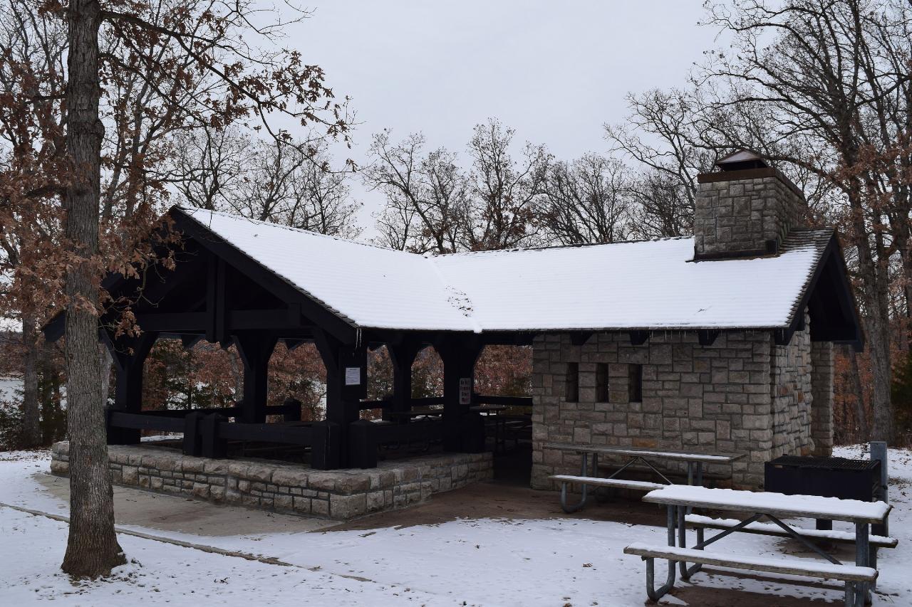
Mark Twain State Park Beach
Florida
Camp, Canoe, Hike, Kayak, and Swim
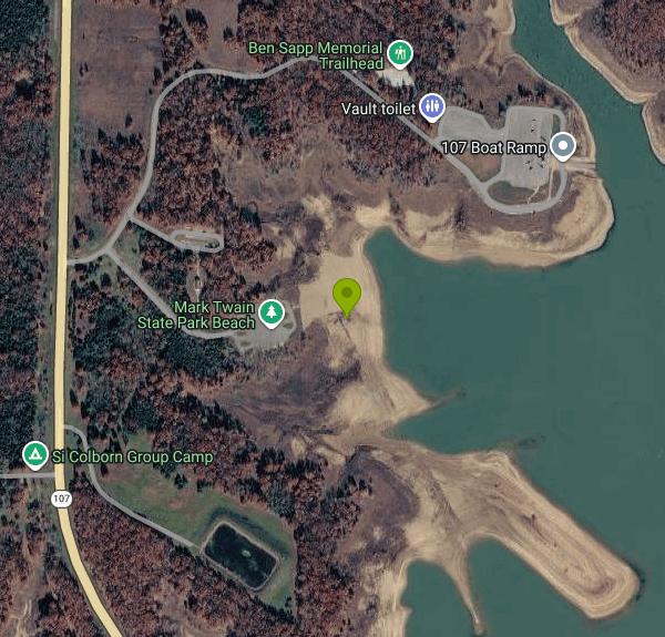
This beach belongs to Mark Twain State Park, which Missouri State Parks operates, and it sits at the north end of the park in the Highway 107 Recreation Area. Park mapping and local signage call it the HWY 107 Beach. The distinction matters on this lake. The water is Mark Twain Lake, an 18,600-acre U.S. Army Corps of Engineers reservoir on the Salt River behind Clarence Cannon Dam, and the Corps operates its own separate day use areas on the same shoreline at Ray Behrens, Indian Creek and John F. Spalding. Those Corps areas collect federal day use fees. This one does not. Missouri State Parks charges no entrance fee, no parking fee and no fee for the beach, funding the system through the state parks, soils and water sales tax instead. Camping and the camper cabins are the only things here you pay for.
The beach is open and still monitored. The Missouri Department of Natural Resources samples it weekly through the recreational season between Memorial Day and Labor Day, and posts a swimming-not-recommended sign when the geometric mean exceeds 190 E. coli colonies per 100 milliliters. In 2026 that sign went up in May and the beach was back under the threshold by late August. In late September the park's beach page reads that the beach is closed for the season, which is the ordinary off-season state rather than a shutdown. Check the department's beach status page before driving out, because both the spring opening and any midsummer closure depend on lake level and bacteria counts, and a drawn-down reservoir can leave the sand well short of the water.
There is no lifeguard, so swimming is at your own risk. Fishing is not allowed along the beach, and neither is launching or parking a boat, which keeps this stretch separate from the 107 boat ramp a few hundred yards northeast. Pets and alcohol are prohibited in the beach area. A change house stands nearby. The parking lot sits on Beach Road roughly 150 yards inland from the sand, so the coordinate published by the park lands on asphalt rather than water; the pin here is on the waterline at the middle of the beach.
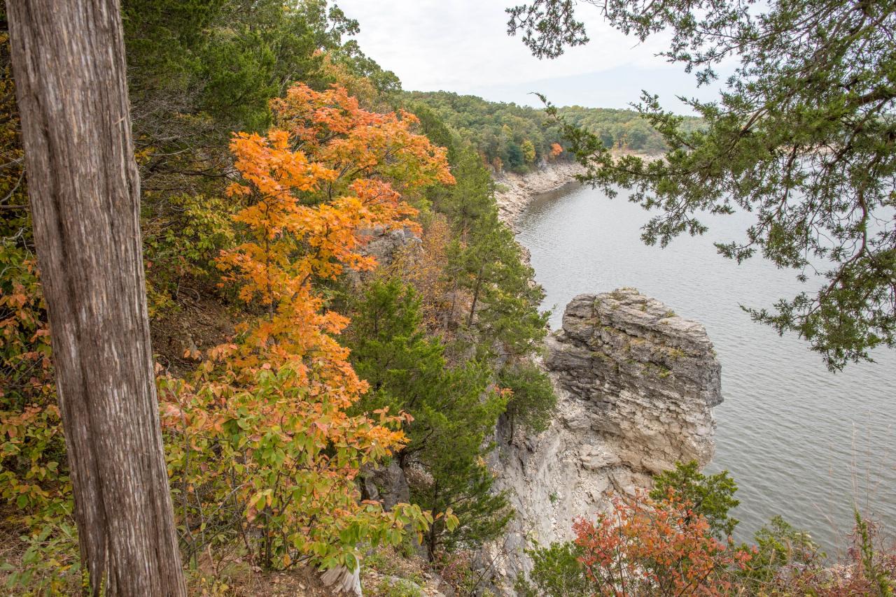
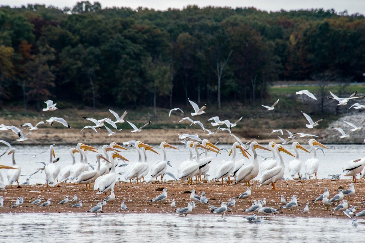
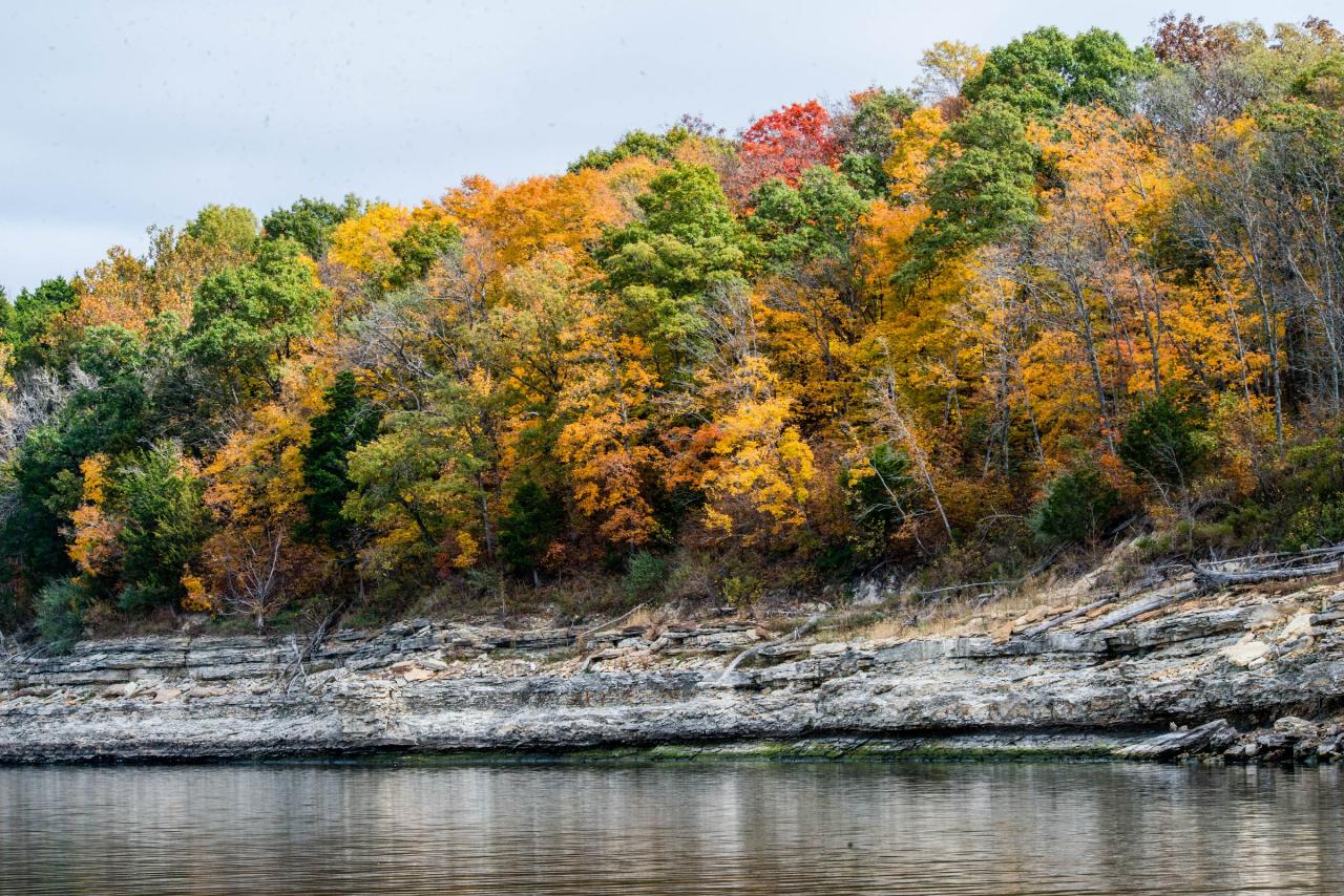
The rest of the park backs up the trip. Mark Twain State Park covers 2,788 acres of the Salt River Hills in Monroe County, with three campgrounds, camper cabins, more than six miles of trail, disc golf and two four-lane boat ramps. Buzzard's Roost holds a stone picnic shelter built around 1941 by an all-African-American Civilian Conservation Corps company, listed on the National Register of Historic Places since 1985. The bluffs above the lake are thin-bedded limestone, and white pelicans stage on the open water during migration.
The town in the address is Florida, Missouri, not the state. It is a village of five residents at the 2020 census, where Samuel Clemens was born in 1835. The Mark Twain Birthplace State Historic Site next door shelters the original cabin inside a museum along with a manuscript of Tom Sawyer.
More Information
Beach | Missouri State Parks
Check beach status by clicking here.The following are prohibited in and along the beach area:FishingLaunching and parking of boatsPetsAlcoholFor more information about swimming in the park, click here.
https://mostateparks.com/key-location/beach-2Beaches | Missouri Department of Natural Resources
It is normal to find E.
https://dnr.mo.gov/water/alerts-hazards/beachesCamping - Mark Twain State Park | Missouri State Parks
Mark Twain State Park offers basic and electric campsites, a
https://mostateparks.com/park/mark-twain-state-park/campingCorps Lakes Gateway: Missouri - Mark Twain Lake
An official website of the United States government Here's how you know
https://corpslakes.erdc.dren.mil/visitors/projects.cfm?ID=B302560Mark Twain SP - Public Beach - Swim Guide
This beach in Mark Twain State Park provides access specifically for swimming, as no fishing or boat launching is allowed in this area. Swimming is allowed anywhere else in the park, where you can also enjoy boating, camping, and hiking. This location also offers a change house facility.
https://www.theswimguide.org/beach/10124/Mark Twain State Park | Missouri State Parks
Nestled in the Salt River Hills of north-central Missouri, Mark Twain State Park gives visitors access to sprawling Mark Twain Lake, as well as unparalleled outdoors activities.
https://mostateparks.com/park/mark-twain-state-parkSwimming - Mark Twain State Park | Missouri State Parks
Cool off in Mark Twain Lake!
https://mostateparks.com/park/mark-twain-state-park/swimmingBe courteous, informed, and prepared. Read trailhead guidelines, stay on the trail, and don't feed the wildlife.
Read More
- Plan Ahead and Prepare
- Travel & camp on durable surfaces
- Dispose of waste properly
- Leave what you find
- Minimize campfire impacts
- Respect wildlife
- Be considerate of other visitors
Directions
From Florida
- Head southeast (0.7 mi)
- Turn right (0.2 mi)
- Turn left onto Old Avon Park Rd (3.1 mi)
- Turn left onto T S Wilson Rd (1.5 mi)
- Continue onto Kelly Rd (1.0 mi)
- Turn right onto Hopson Rd (0.5 mi)
- Turn left onto Fort Meade Rd (1.2 mi)
- Continue onto Co Rd 630 (0.5 mi)
- Turn right onto US-27 N (35.6 mi)
- Slight right to merge onto I-4 E toward Orlando (4.5 mi)
- Take exit 60 for FL-429 Toll N toward ApopkaToll road(1.0 mi)
- Continue onto FL-429 N/
FL-429 Toll N Toll road(5.1 mi) - Keep left to continue on FL-429 NToll road(10.6 mi)
- Keep left to stay on FL-429 NToll road(5.0 mi)
- Take exit 22 for Florida's Turnpike toward Turnpike/
Ocala/ Miami Toll road(0.2 mi) - Take the ramp onto Florida's TpkeToll road(41.6 mi)
- Merge onto I-75 NEntering Georgia(300 mi)
- Take exit 156 on the left for I-475 N toward Atlanta (0.7 mi)
- Continue onto I-475 N (15.3 mi)
- Merge onto I-75 N (49.5 mi)
- Keep left to stay on I-75 N (22.9 mi)
- Continue straight to stay on I-75 N (signs for Marietta) (8.5 mi)
- Keep left to stay on I-75 N (10.1 mi)
- Continue straight to stay on I-75 NEntering Tennessee(87.1 mi)
- Take exit 2 for I-24 W toward Chattanooga/
Nashville (0.7 mi) - Continue onto I-24 WEntering Georgia(16.8 mi)
- Keep right to stay on I-24 W, follow signs for NashvilleEntering Tennessee(118 mi)
- Keep left to stay on I-24 W, follow signs for I-40 W/
Nashville (2.2 mi) - Slight right to stay on I-24 W (signs for I-65 N/
Clarksville/ Louisville) (2.7 mi) - Keep right to stay on I-24 W, follow signs for I-65 N/
Clarksville/ Louisville (2.2 mi) - Take exit 88 on the left for I-24 W toward Clarksville (0.7 mi)
- Continue onto I-24 WPassing through KentuckyEntering Illinois(175 mi)
- Take exit 44B to merge onto I-57 N toward Chicago (52.1 mi)
- Keep left to continue on I-64 W, follow signs for St Louis (70.8 mi)
- Take exit 3B to merge onto I-70 W toward IL-3 N/
Kansas City Entering Missouri(3.2 mi) - Take the I-70 W exit toward Kansas City (0.3 mi)
- Continue onto I-70 W (38.6 mi)
- Take exit 210B to merge onto US-61 N toward Hannibal (46.9 mi)
- Take the US-54 ramp to Mexico/
Louisiana (0.3 mi) - Turn left onto US-54 W (11.6 mi)
- Continue straight onto MO-154 W (12.3 mi)
- Turn right onto MO-154 W/
MO-19 N (5.3 mi) - Turn left onto MO-154 W (8.7 mi)
- Turn right onto MO-107 N (4.1 mi)
- Turn right (259 ft)
- Turn right (0.2 mi)
 Limestone bluff dropping into Mark Twain Lake inside the state park, in autumn color courtesy of mostateparks↗ (Public domain↗)
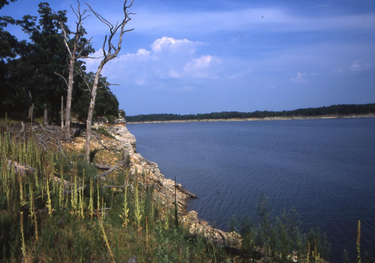
 Rocky shoreline and open water on Mark Twain Lake courtesy of mostateparks↗ (Public domain↗)
 American white pelicans and gulls staging on a sandbar in Mark Twain Lake courtesy of mostateparks↗ (Public domain↗)
 Thin-bedded rock ledges along the lakeshore below hardwood timber courtesy of mostateparks↗ (Public domain↗)
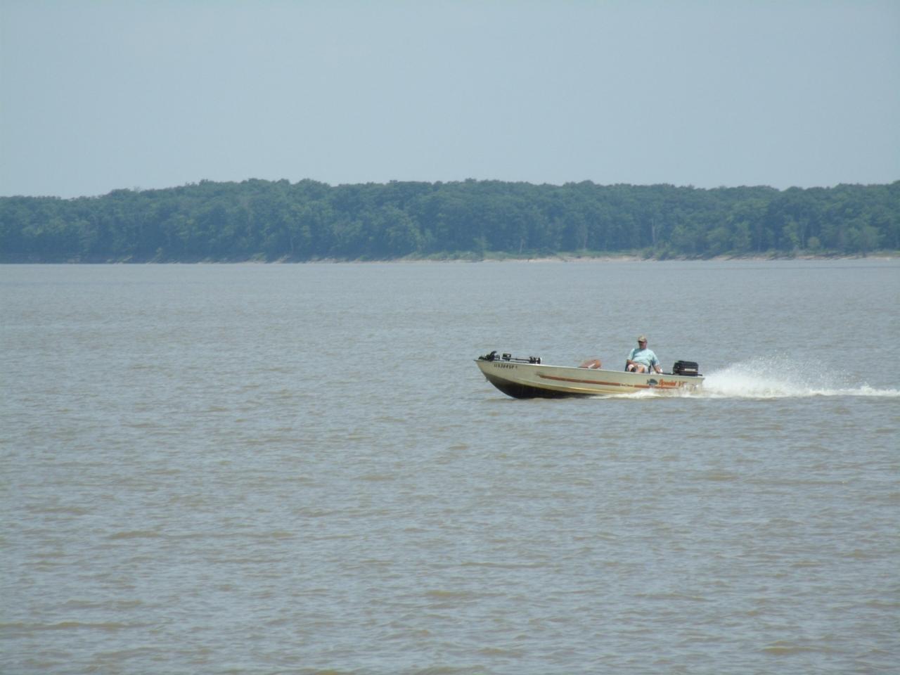
 A fishing boat running the open water of Mark Twain Lake courtesy of mostateparks↗ (Public domain↗)
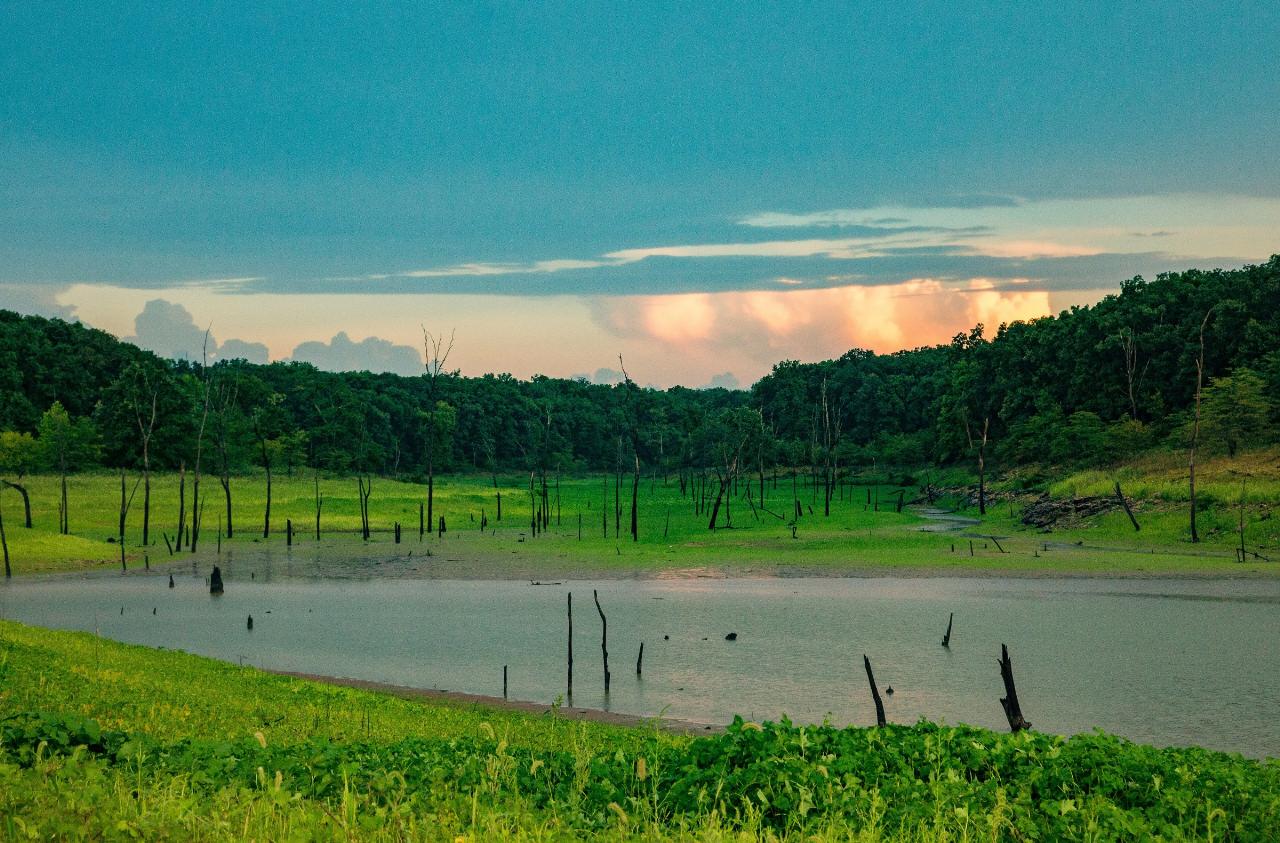
 Sunset over a shallow upper arm of Mark Twain Lake courtesy of Tony Webster↗ (CC BY 2.0↗)
 The stone CCC picnic shelter at Buzzard's Roost in Mark Twain State Park courtesy of TheCatalyst31↗ (CC0↗)