


94 Mountain Bike Trails near Horseshoe Canyon
first prev 1 2 3 4 5 next lastShowing Mountain Bike Trails within 50 miles Distance miles of Forest Rd 140, Tetonia, ID 83452, USA City, Zip, or Address

Stinking Springs
Ririe, Idaho
19.5 miles SWStinking Springs is a great early to late season trail. Being at the edge of the Big Hole range, it gets spring earlier and winter later than other trails in the range. It's closed from December...
Hike, Mountain Bike 1.6 mi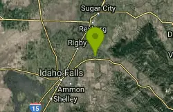
Skyline
Ririe, Idaho
19.5 miles WPunchy climb out of Little Kelly Canyon. Great vistas along a narrow traverse. Fast and loose downhill. A mix of narrow singletrack and old motorized trail.
Mountain Bike
Echo Canyon aka Fall Creek
Ririe, Idaho
20.9 miles STrail goes to the top of Deadhorse Ridge for some amazing views. Double-track, single-track, and gravel road. Length: 15 miles
Mountain Bike
Echo/Indian Creek Trail
Swan Valley, Idaho
21.2 miles SOHV trail. source: fs.usda.gov
Mountain Bike 4.6 mi
Coal Creek Trail
Alta, Wyoming
21.2 miles SEEnjoy outstanding views from upper Coal Creek Meadows, this hike description travels just beyond the meadows to the top of Coal-Mesquite Divide where you'll enjoy some rather dramatic views of...
Hike, Mountain Bike
Flat Iron Trail
Swan Valley, Idaho
21.9 miles SOHV trail. source: fs.usda.gov
Mountain Bike 5.6-8.3 mi
Palisades Creek Trail / Lakes and Waterfall Canyon
Irwin, Idaho
22.8 miles SPalisades Creek Trail is located about 50 miles southeast of Idaho Falls and about 60 miles west of Jackson Hole WY in Swan Valley Idaho. The four mile hike up to lower Palisades Lake or the 6.2 mile...
Backpack, Camp, Hike, Horseback, Mountain Bike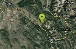
Hunts Corral
Irwin, Idaho
22.9 miles SNon-motorized use only. source: fs.usda.gov
Mountain Bike
Fuzzy Bunny/Power Line Jumps/Parallel
Wilson, Wyoming
23.8 miles SEThis is a steep, fast, rugged downhill trail with some freeride features that are also "ride-around-able." At the end of Fuzzy Bunny, look for Power Line Jumps off the Old Pass Road...
Mountain Bike
South Fork Fall Creek Trail
Swan Valley, Idaho
24.2 miles SOHV trail.
Mountain Bike 0.1-2.3 mi
Hidden Valley Trails
Rexburg, Idaho
24.6 miles WRight on the edges of town outside of the Hidden Valley subdivision, you'll find this fun little set of trails that's pretty good for mountain bikes. It is mostly a dirt bike...
Hike, Mountain Bike
Long Gulch/Indian Trail
Swan Valley, Idaho
24.9 miles SOff Highway Vehicles (OHV) less than or equal to 50 inches wide, Mountain Biking, Horse Riding, hiking. source: fs.usda.gov
Mountain Bike
Red Ridge Trail
Swan Valley, Idaho
24.9 miles SOHV trail. source: fs.usda.gov
Mountain Bike
Black Canyon
Wilson, Wyoming
25.0 miles SETrail starts at the parking lot ontop of the pass. Take the service road on the west side of the parking lot. The road will turn into singletrack when you reach a service building...
Mountain Bike
Phillips Ridge
Wilson, Wyoming
25.0 miles SETrail is recommend to be done as a shuttle but can be done as an out and back from trailhead on Fish Creek Road. Shuttle is easiest by parking a vehicle and the Stagecoach bar or the...
Mountain Bike 29.6 mi
Ashton to Tetonia Trail
Ashton, Idaho
25.4 miles NThe Idaho Department of Parks and Recreation undertook the project to transform the old Teton Valley Branch of the Union Pacific Railroad from Ashton to Tetonia into a trail for bikes, ATVs, and...
Mountain Bike 3.3-10.0 mi
Sheep Creek Trail
Irwin, Idaho
25.5 miles SHike and Mountain Bike near Irwin, Idaho
Hike, Mountain Bike 0.4-0.7 mi
Rexburg Bike Park
Rexburg, Idaho
25.7 miles WIt's a small but great bike park for all ages; if you are a beginner, then this is the bike park to go to. The mounts are a decent size and approximately 4-6 mounts in different sizes for the...
Mountain Bike, Sled 0.1-0.5 mi
Eagle Park
Rexburg, Idaho
26.3 miles WEagle Park is a little urban oasis. Once you drive in to this cottonwood forest along the river, you may forget that you're still inside Rexburg city limits. You can camp, picnic, throw rocks in...
Camp, Hike, Mountain Bike, Sled 3.2-47.0 mi
Yellowstone Branch Line Trail
Ashton, Idaho
27.5 miles NYellowstone branch line trail runs from Warm River to the Montana border totaling 39 miles. There are a few places to jump on and off the trail as well as a few smaller trails that branch off of this...
Backpack, Cross-country Ski, Hike, Horseback, Mountain Bike


