


Pleasant Valley Skatepark
Kansas City, Missouri

| Address: | Pleasant Valley Rd., Kansas City, MO |
| GPS: |
39°12'56.0"N 94°30'45.5"W Maps | Directions |
| State: | Missouri |
Skateboard
Kansas Citys first skatepark is free, cement, and no pads are required. The park consists of ledges, stairs, and rails intergrated into a giant bowl with hips and a spine.Courtesy of skatepark.com
More Information
Google Maps
Find local businesses, view maps and get driving directions in Google Maps.
https://www.google.com/maps/search/?api=1&query=Pleasant+Valley+Skatepark%2C+Kansas+City%2C+Missouri
- Plan Ahead and Prepare
- Travel & camp on durable surfaces
- Dispose of waste properly
- Leave what you find
- Minimize campfire impacts
- Respect wildlife
- Be considerate of other visitors
Directions
From Kansas City, Missouri
- Head north on Oak St toward E 12th St (20 ft)
- Turn right at the 1st cross street onto E 12th St (0.4 mi)
- Turn left onto Harrison St (440 ft)
- Turn left onto E 11th St (203 ft)
- Turn right onto the I-70 N ramp (463 ft)
- Merge onto I-70 W (0.4 mi)
- Continue onto I-29 N/I-35 N (4.5 mi)
- Keep right at the fork to continue on I-35 N, follow signs for Interstate 35 N/Des Moines (2.1 mi)
- Take exit 10 for N Brighton Ave (0.3 mi)
- Turn left onto N Brighton Ave (2.2 mi)
- Turn right onto NE Pleasant Valley Rd (0.5 mi)
I-70 to 35 North, exit 10 North Brighton. Make a right on Pleasant Valley Rd., and the park is on your right.Courtesy of skatepark.com
to add photos & videos and suggest edits
Edit Review
Delete Review

Other Skateboard Parks Nearby

Nearby Campsites
Add Location
Blue Springs Lake Beach
Blue Springs
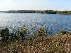
17.1 miles SELifeguarded sand beach on 720-acre Blue Springs Lake in Jackson County's Fleming Park, open Memorial Day to Labor Day with a county admission of $9 for adults and $7 for kids and seniors.
Camp, Canoe, Hike, Kayak, Swim
Watkins Woolen Mill State Park
Kearney, Missouri
18.7 miles NEA 100-acre lake with a paved bike path, excellent fishing, whitetail deer, wild turkeys, and a picturesque campground adjacent to the Watkins Woolen Mill National Historic Landmark.
Camp, Hike, Horseback, Swim
Lake Miola Beach
Paola
47.0 miles SWFree sandy swim beach on 200-acre Lake Miola, Paola's city-owned water supply lake. Swimming is daylight only and limited to the marked beach area, with no lifeguards listed.
Camp, Canoe, Hike, Kayak, Swim


