


Red Rock Canyon Area
McGill, Nevada
Swim
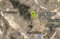
Easy hike to a spring-fed swimming hole in the beautiful Red Rock Canyon National Conservation Area (BLM). The canyon is a very dry, desert area but there are a few springs. BLM HIKING INFO. MAP OF HIKING TRAILS. For details...Courtesy of swimmingholes.org
Bathing suits: Optional
More Information

- Plan Ahead and Prepare
- Travel & camp on durable surfaces
- Dispose of waste properly
- Leave what you find
- Minimize campfire impacts
- Respect wildlife
- Be considerate of other visitors
Directions
From McGill, Nevada
- Head west toward S 4th St (52 ft)
- Turn left onto US-93 S/S 4th StContinue to follow US-93 S(11.9 mi)
- Turn left onto Great Basin Blvd (0.8 mi)
- Turn right onto US-6 W (24.0 mi)
- Turn left onto NV-318 S (111 mi)
- Turn right onto US-93 S (85.2 mi)
- Turn right to merge onto I-15 S/US-93 S toward US-95/Las Vegas (20.7 mi)
- Take exit 42 to merge onto US-95 N toward Reno (5.3 mi)
- Take exit 81A for Summerlin Pkwy (0.9 mi)
- Continue onto Summerlin Pkwy W (5.6 mi)
- Take the exit onto Co Rd 215 S/Bruce Woodbury Beltway S/Clark County 215 S (2.2 mi)
- Take exit 26 for Charleston Blvd/NV-159 (0.4 mi)
- Turn right onto NV-159 W/W Charleston BlvdContinue to follow NV-159 W(5.2 mi)
- Turn right toward Scenic Loop DrToll road(0.2 mi)
- Turn right onto Scenic Loop DrToll road(11.7 mi)
- Turn right onto Oak CreekDestination will be on the left(0.7 mi)
to add photos & videos and suggest edits
Edit Review
Delete Review

Other Swimming Holes Nearby
Nearby Campsites
Add Location

Black Canyon
Boulder City, Arizona
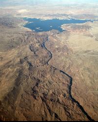
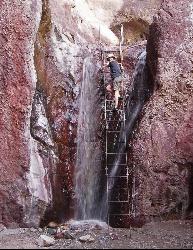
41.0 miles EVolcanic basalt cliffs, desert-varnished boulders, and hidden hot springs line the Colorado River below Hoover Dam — kayak or canoe the Black Canyon Water Trail for the best views.
Camp, Canoe, Hike, Hot Springs, Kayak 0.1-1.8 mi
Arizona Hot Springs
Willow Beach, Arizona
43.9 miles ENatural hot springs in a desert canyon inside Lake Mead — a 3.25-mile hike with stunning canyon scenery. Closed June through September. Don't submerge your head due to rare infection risk, and go with a companion.
Camp, Hike, Hot Springs
Willow Beach (Lake Mead National Recreation Area)
Willow Beach, Arizona
48.1 miles ESwim beach, marina and campground on the cold, clear Colorado River in Black Canyon, 14 river miles below Hoover Dam and the launch point for Emerald Cave and Arizona Hot Springs.
Camp, Hike, Kayak, Swim


