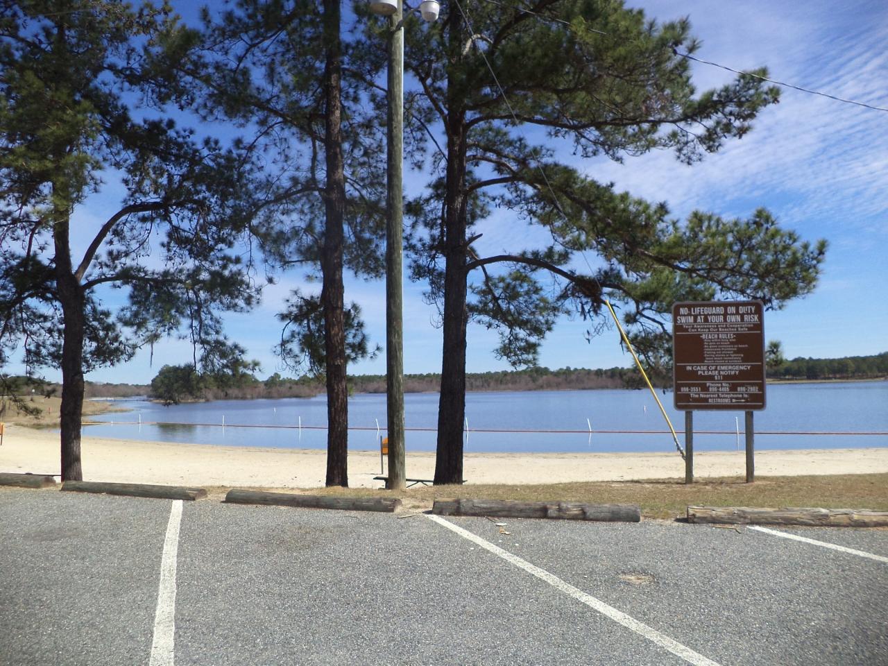
Reed Bingham State Park Beach
Norman Park, Georgia
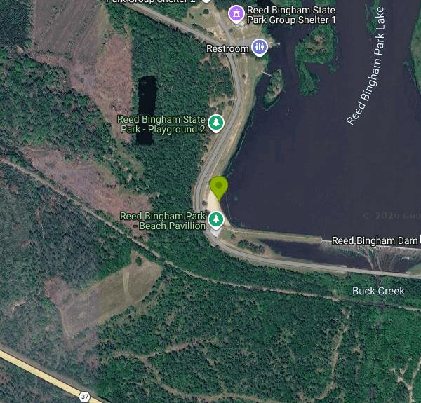
| GPS: |
31°9'46.1"N 83°32'53.2"W Maps | Directions |
| State: | Georgia |
Camp, Canoe, Hike, Kayak, and Swim
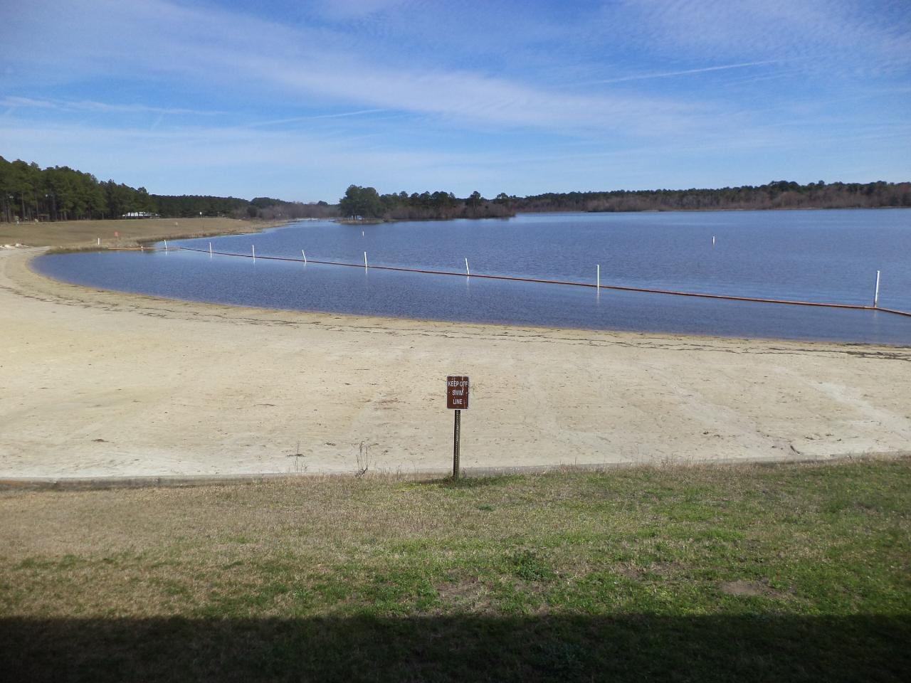
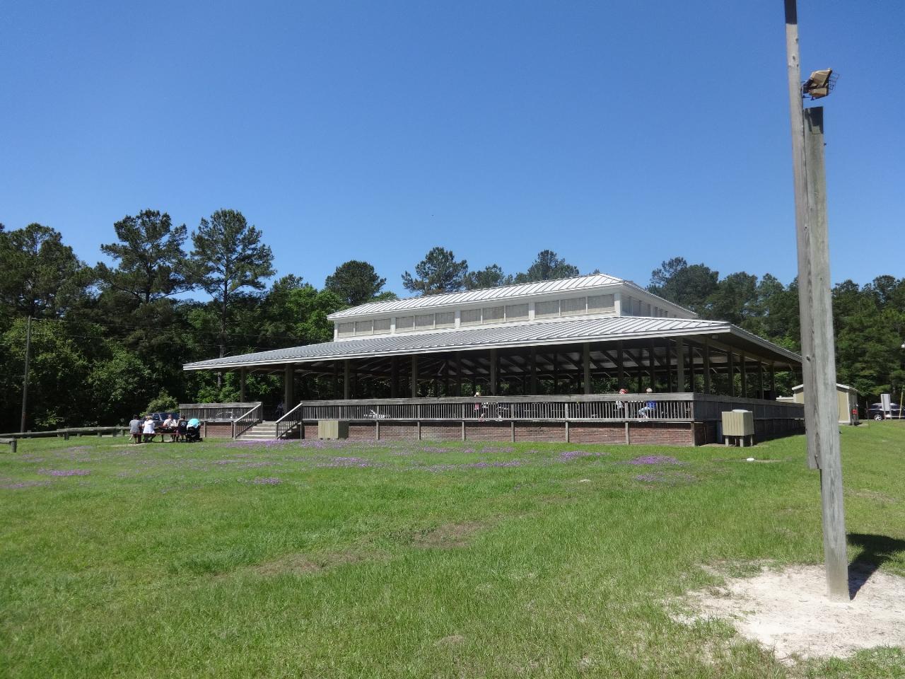
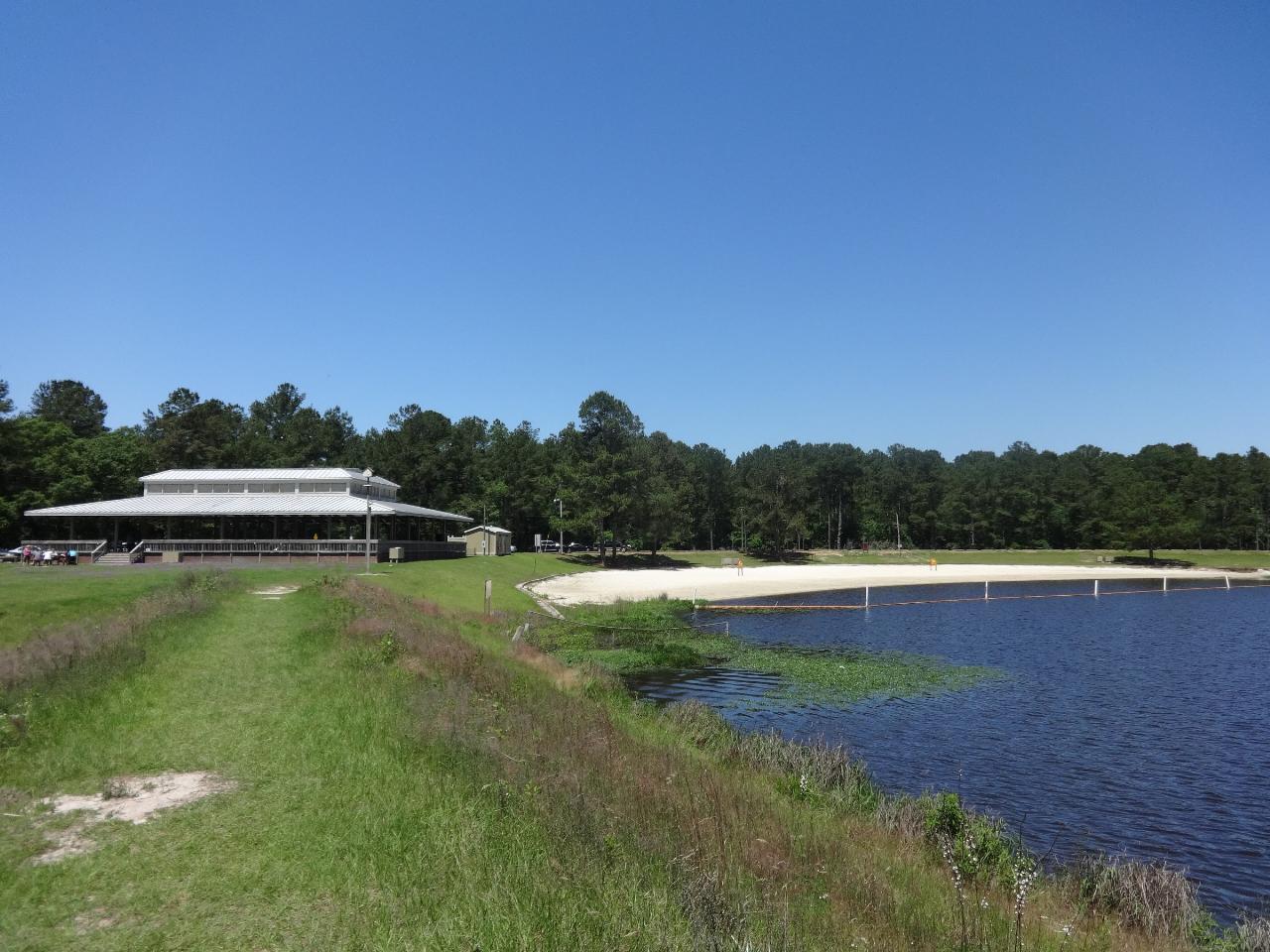
Reed Bingham State Park wraps around a 375 acre lake formed by damming the Little River between Adel and Moultrie, in the flat pine country of the Georgia coastal plain. The swim beach is on the east side near the park office, a curve of white sand with a buoyed swimming area, a covered pavilion, changing rooms and a bathhouse, and shade from the slash pines that come right down to the parking lot. It is the kind of beach that gets used hard on a July afternoon by families from Adel, Moultrie and Valdosta, and is nearly empty on a weekday morning.
Swimming is unguarded. The lake bottom inside the buoys is sand and slopes gently, and the water is the tea-colored brown of a blackwater river system, stained by tannins from cypress and pine rather than by sediment, so it looks darker than it is. Visibility is poor past a couple of feet, which matters mainly because it means you should keep to the marked area. American alligators live in this lake, as they do in every lake in south Georgia; they generally keep to the far shore and the river channel, and the park posts the standard rules about not feeding them and keeping dogs out of the water.
The park covers about 1,613 acres and has two boat ramps, a canoe and kayak launch, fishing docks, a mini golf course, picnic shelters and 46 campsites with water and electric plus a handful of cottages. A Georgia ParkPass is required to park, at five dollars a day or forty-five for an annual, and camping is a separate nightly fee. The Coastal Plain Nature Trail is the walk worth doing: a 3.5 mile loop through longleaf pine, a boardwalk over cypress swamp, and open sandhill where gopher tortoises dig their burrows. Indigo snakes and pitcher plants turn up along the same stretch.
The park's real claim to fame happens in winter. Thousands of black and turkey vultures roost in the trees along the lake from roughly December through February, an aggregation big enough that the park built a festival around it. Buzzard Day, held in early December, is exactly what it sounds like, with guided walks out to the roost, raptor demonstrations and a good deal of vulture merchandise. If you come in summer for the beach, you will not see them.
The lake itself is shallow and warm, which makes it productive water for largemouth bass, bream and crappie, and slow enough for easy paddling up the Little River arm at the north end. Boats over ten horsepower are restricted to idle speed in parts of the lake, so it never gets the ski boat chop that larger Georgia reservoirs do. Interstate 75 is six miles east at Adel, which makes this one of the easier swim stops to reach on a drive down to Florida.
More Information
Camping in Georgia State Parks | Department Of Natural Resources Division
Whether you are a first-time camper or an experienced backpacker, Georgia's state parks have a campsite for you. Forty-one parks offer more than 2,700 campsites, including tent-only areas, RV pull-thru sites, primitive camping and group camping areas. Most state parks have laundry facilities and sell camping supplies. If you've never camped before, don’t let that stop you. Several parks offer "glamping" yurts (a cross between a tent and a cabin).
https://gastateparks.org/CampingParkPass - Georgia State Parks | Department Of Natural Resources Division
An official website of the State of Georgia.
https://gastateparks.org/ParkPassBe courteous, informed, and prepared. Read trailhead guidelines, stay on the trail, and don't feed the wildlife.
Read More
- Plan Ahead and Prepare
- Travel & camp on durable surfaces
- Dispose of waste properly
- Leave what you find
- Minimize campfire impacts
- Respect wildlife
- Be considerate of other visitors
Directions
From Norman Park, Georgia
- Head north on College St toward E Broad St (361 ft)
- Turn right onto E Broad St (1.2 mi)
- Continue onto Ellenton Norman Park Rd (0.6 mi)
- Continue straight (0.1 mi)
- Continue onto Ellenton Norman Park Rd (6.0 mi)
- Continue straight (0.1 mi)
- Slight right onto Ellenton Omega Rd (1.2 mi)
- Turn left onto Rountree Brg Rd (1.4 mi)
- Turn right onto Bill Tillman Rd (0.9 mi)
- Turn left onto Buck Creek Church RdDestination will be on the left(1.2 mi)
 The sand swim beach curving down to the lake with the buoy line marking the swimming area courtesy of Michael Rivera↗ (CC BY-SA 4.0↗)
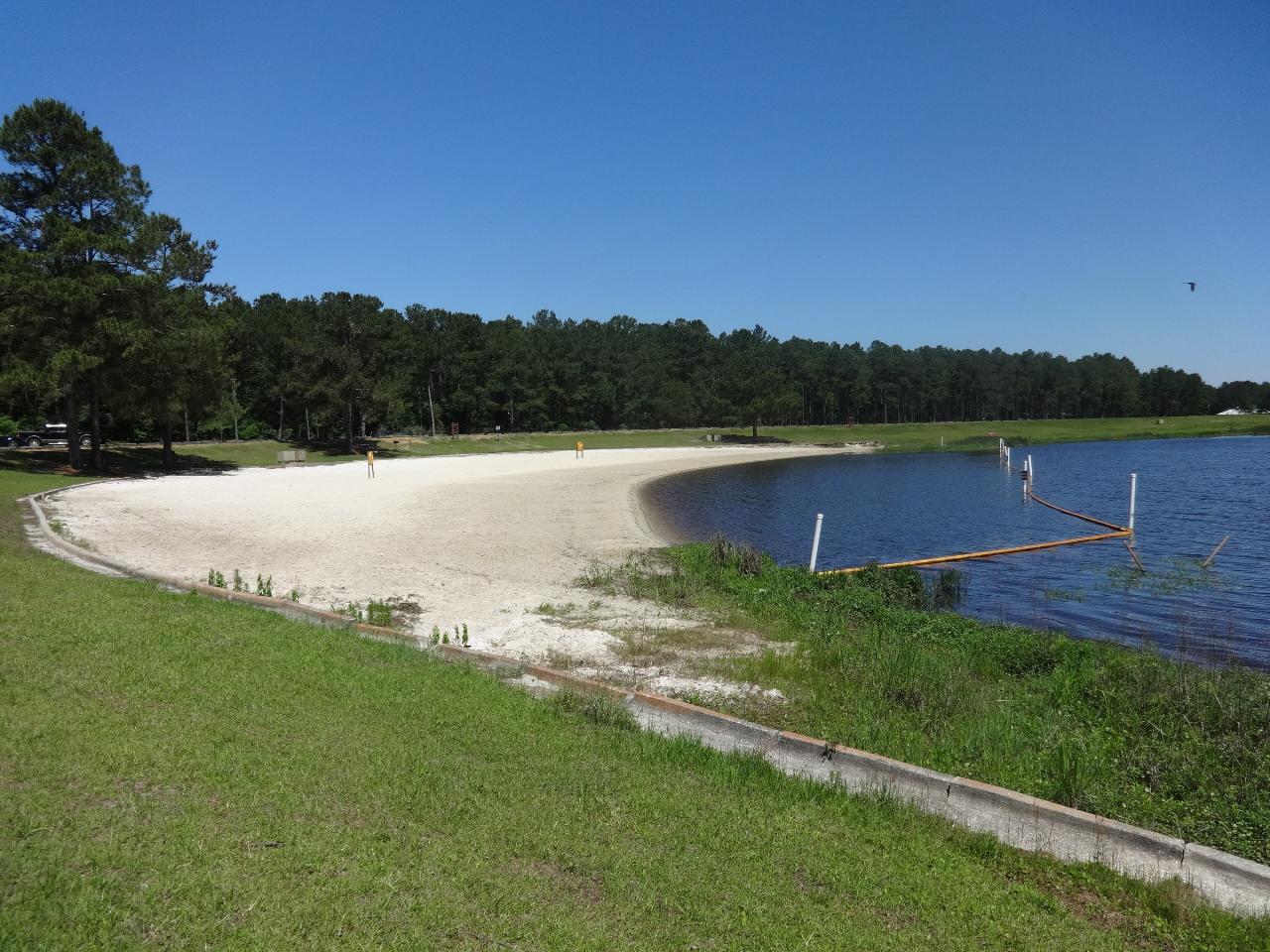
 The beach looking north along the shoreline courtesy of Michael Rivera↗ (CC BY-SA 3.0↗)
 The covered beach pavilion courtesy of Michael Rivera↗ (CC BY-SA 4.0↗)
 The pavilion and the sand beach together courtesy of Michael Rivera↗ (CC BY-SA 4.0↗)
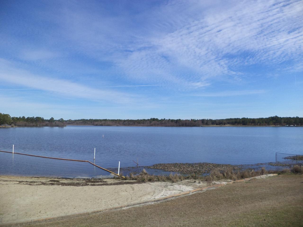
 Looking northeast across the swim area toward the far shore courtesy of Michael Rivera↗ (CC BY-SA 3.0↗)
 Pines framing the beach and the information sign from the parking area courtesy of Michael Rivera↗ (CC BY-SA 3.0↗)