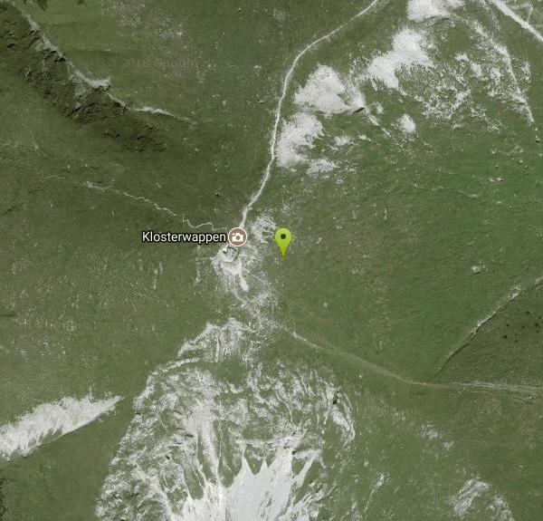
Schneeberg - Klosterwappen
Puchberg am Schneeberg, Niederösterreich
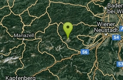
| GPS: |
47°46'0.5"N 15°48'20.0"E Maps | Directions |
| State: | Niederösterreich |
Hike and Rock Climb
Schneeberg with the summit Klosterwappen is the highest mountain of Lower Austria (Niederösterreich) and the most eastward 2000m mountain of the alps. Schneeberg is often underestimated (rapid weather changes - with snow, heavy rain, fog, strong winds) - orientation might be very difficult.
More Information
Be courteous, informed, and prepared. Read trailhead guidelines, stay on the trail, and don't feed the wildlife.
Read More- Plan Ahead and Prepare
- Travel & camp on durable surfaces
- Dispose of waste properly
- Leave what you find
- Minimize campfire impacts
- Respect wildlife
- Be considerate of other visitors
Directions
From Puchberg am Schneeberg, Niederösterreich
- Head north on Alleestraße toward Schneebergstraße (0.3 km)
- Turn right onto Puchberger Str./Schneebergstraße/B26Continue to follow Schneebergstraße/B26(0.3 km)
- Slight right onto Neunkirchner Str./B26Continue to follow B26(14.6 km)
- Turn right onto Str. des 12. Februar (0.6 km)
- At the roundabout, take the 1st exit onto Franz-Dinhobl-Straße (1.2 km)
- Continue onto Franz-Samwald-Straße (1.1 km)
- At the roundabout, take the 2nd exit onto Wimpassinger Str. (0.6 km)
- Continue onto Pottschacher Str. (0.3 km)
- Turn right onto Triester Bundesstraße/B17Continue to follow B17(6.2 km)
- Turn right onto Wr. Str.Go through 1 roundabout(1.1 km)
- Continue onto Hauptstraße (0.8 km)
- Continue straight onto Reichenauer Str./B27Continue to follow B27(20.3 km)
- Sharp right (2.5 km)
- Turn right (6.4 km)
Form Vienna on the highway (Südautobahn - A1) to Wiener Neustadt - continue via Ternitz to Puchberg am Schneeberg or (for the south side of Schneeberg) from Ternitz (continue an Semmeringschnellstraße - S6) to Gloggnitz to Reichenau an der Rax.
to add photos & videos and suggest edits
Edit Review
Delete Review