St. Croix River Area
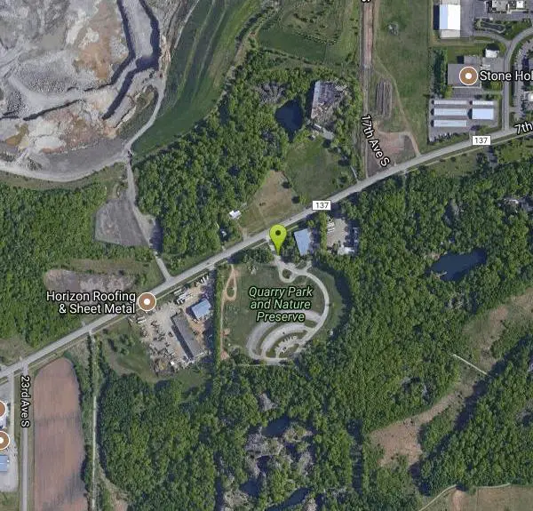
Waite Park, Minnesota
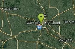
| GPS: |
45°32'14.3"N 94°14'30.9"W Maps | Directions |
| State: | Minnesota |
Swim
More Information
- Plan Ahead and Prepare
- Travel & camp on durable surfaces
- Dispose of waste properly
- Leave what you find
- Minimize campfire impacts
- Respect wildlife
- Be considerate of other visitors
Directions
From Waite Park, Minnesota
- Head south on 6th Ave N toward 2nd St N (26 ft)
- Turn right at the 1st cross street onto 2nd St N (0.2 mi)
- Turn left onto 10th Ave N (1.2 mi)
- Turn right onto Co Hwy 137/Co Rd 137/7th St SContinue to follow Co Hwy 137/Co Rd 137(0.6 mi)
- Turn leftDestination will be on the left(151 ft)
to add photos & videos and suggest edits
Edit Review
Delete Review