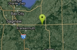
Stony Creek Metro Park
Oakland charter Township, Michigan
| Address: | ~W Branch Dr, Oakland Charter Township, MI 48306, USA |
| GPS: |
42°43'49.7"N 83°6'24.6"W Maps | Directions |
| State: | Michigan |
| Trail Length: | 14.00 miles |
| MTB Difficulty: | Intermediate |
| Trail Type: | Network |
Mountain Bike
"Hills, gravel, rocks and ruts - heaven to mountain bikers - can be conquered on the mountain bike trails at Stony Creek Metropark. Nearly 14 miles of dirt paths with tight curves and steep hills take you through deep woods and tall pine trees, and along clear streams of the west branch of Stony Creek and hidden ponds. Wildlife, including deer and wild turkeys can be seen along the trails. Open to hikers and cyclists, the trails are used for many competitive events." -- HCMAAlso a new pump track and free riding area to open in the spring of 2008. Courtesy of Singletracks.com
More Information
Add ResourceNever modify trail features. Ride trails when they're dry enough that you won't leave ruts. Speak up when you see others on the trail and always yield to hikers, horses, and others coming uphill. Always ride on the established trail.
Read More- Plan Ahead and Prepare
- Travel & camp on durable surfaces
- Dispose of waste properly
- Leave what you find
- Minimize campfire impacts
- Respect wildlife
- Be considerate of other visitors
Directions
From Oakland charter Township, Michigan
- Head east on W Buell Rd toward High Winds Ln (0.3 mi)
- Turn right onto N Rochester Rd (3.1 mi)
- Turn left onto Mead Rd (1.8 mi)
- Turn right onto Winkler Mill Rd (0.5 mi)
- Turn left onto Washington Rd (0.3 mi)
- Continue onto Mt Vernon Rd (0.3 mi)
- Continue onto 26 Mile Rd (1.2 mi)
- Slight right onto Main Park Dr (0.4 mi)
- Continue straight to stay on Main Park Dr (279 ft)
- Continue onto Park Rd (0.8 mi)
- Turn left to stay on Park Rd (0.2 mi)
- Turn right to stay on Park Rd (2.2 mi)
- Turn left onto W Branch Dr (0.1 mi)
- Turn right to stay on W Branch Dr (226 ft)
- Turn left to stay on W Branch DrDestination will be on the right(272 ft)

Other Mountain Bike Trails Nearby
Paint Creek
Rochester, Michigan
3.5 miles SVery flat easy trail that runs along the Paint creek from Rochester to Orion in Suburban Detroit area. Slight elevation from Rochester to Orion. Mostly graveled and very smooth, great...
Mountain Bike
Bloomer Park
Rochester Hills, Michigan
3.7 miles SA great free ride area you can go all day! giant logs, tight twisty riverside single track. there are tons of neat obstacles ie; picnic tables, pallets over 3' logs.If you run the trail...
Mountain Bike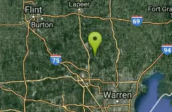
Bald Mtn Rec Area
Oakland charter Township, Michigan
5.8 miles NWDescription: There are two nice-and-narrow trails. The upper is probably best with hills, slopes, and several overlooks. Both routes get muddy and stay muddy until summer. The upper...
Mountain Bike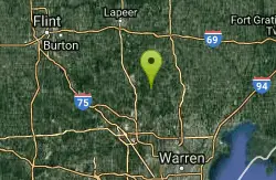
Addison Oaks County Park
Leonard, Michigan
6.0 miles NWAddison Oaks is a scenic 1,140-acre park in northeast Oakland County with two lakes and spring-fed ponds containing fast, flowing, fun mountain bike trails. Located next to Bald Mountain Recreation...
Disc Golf, Mountain Bike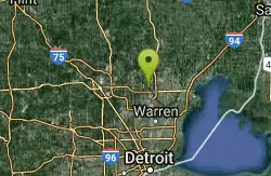
River Bends Mountain Bike Trail
Shelby charter Township, Michigan
6.6 miles SEEasy trail with mild climbs and lots of twists, making this an excellent beginners trail.
Mountain Bike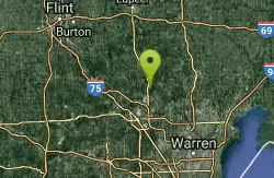
Lake Orion High School
Orion charter Township, Michigan
6.7 miles WUnmarked trails with a mixture of singletrack and doubletrack. Avoid parking at the school during school hours.
Mountain Bike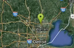
Clinton River Park
Utica, Michigan
8.1 miles SEBi-directional, multi-use trail along the Clinton River
Mountain Bike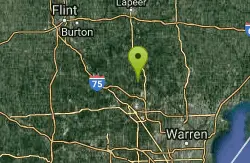
Orion Oaks
Orion charter Township, Michigan
9.5 miles WTruly a hidden gym. Five well marked bike loops, 33 sign posts, and 3 designated parking areas all inside 916 acres. Diverse terrain includes marshland, forest, a large lake, a creek,...
Mountain Bike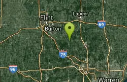
Ortonville trail
Brandon Township, Michigan
19.3 miles NWFollow the posted signs to the right all the way around to do the whole loop. Lots of signs to help navigate.
Mountain Bike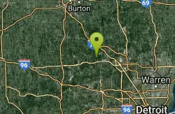
Pontiac Lake
White Lake charter Township, Michigan
19.5 miles WThere's only one trail, its an 11 mile loop. This is a fun ride. Well kept trail.added: The orignal one sentance description is an injustice - both to the trail and to unsuspecting...
Mountain Bike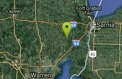
Columbus County Park
Columbus, Michigan
21.3 miles NECRAMBA-IMBA is developing trails at Columbus County Park with a 1.5 mile loop currently open for riding.
Mountain Bike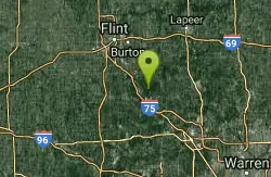
Holly Rec
Holly, Michigan
21.8 miles W6 miles of single track out and back.
Mountain Bike
Hickory Glen
Commerce Charter Township, Michigan
22.5 miles SWThe trail loop is 5.7 miles. Look for yellow arrows (some at eye level and some higher) pointing you in the correct direction of the trail loop. Carsonite-type ground markers have also...
Mountain Bike
Highland Recreation
Highland Charter Township, Michigan
24.7 miles WDescription: This is the trail everyone wants kept secret. 16.2 total available miles of winding, climbing, narrow singletrack built by mountain bikers for mountain bikers. Ride the A...
Mountain Bike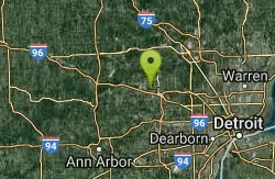
Novi Tree Farm (Lakeshore Park)
Novi, Michigan
24.9 miles SWStarts on right hand side and is all pure sweet single track. It is technical and has many manmade stunts(rockgardens, log jumps) with bypass at each. The main feature is "THE CRATER"....
Mountain Bike
Holly Holdridge Lakes State Recreation Area
Holly, Michigan
25.3 miles WLocated in Northern Oakland County with the feel of being up north, Holdridge Lakes offers something for everyone! There are plenty of fun and flowing sections along with climbs that will make you...
Mountain Bike
Highland Oaks
Holly, Michigan
26.0 miles WGreat area for mountain biking.
Mountain Bike
Proud Lake
Milford Charter Township, Michigan
27.2 miles SWLoops 3 and 4 are the best. Some steepish ups and downs. Pretty good for a after-work trail ride. Watch out for horse are they share the trail.
Mountain Bike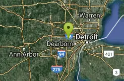
Rouge Park
Detroit, Michigan
27.2 miles SStarting at the trailhead, the trail proceeds clockwise: heading north parallel to Outer Drive with some switchbacks. Near the corner where Outer Drive crosses over Joy Rd, the trail...
Mountain Bike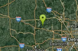
Kensington To Proud Lake Connector
Milford Charter Township, Michigan
28.6 miles SWThe trail is approx 2 miles long and connects the Kensington paved trails with the Proud Lake Recreational area crossing both South Hill Rd and Old Plank Rd. When you cross Old Plank...
Mountain Bike