


Sylvan Lake
Custer
Camp, Canoe, Hike, Kayak, and Swim
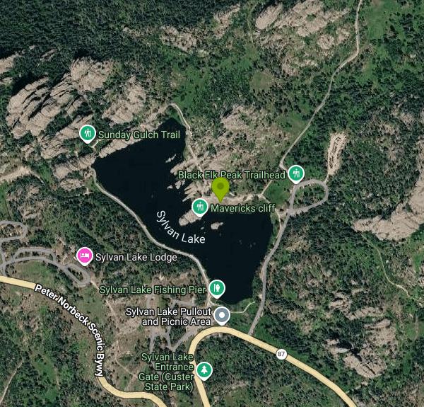
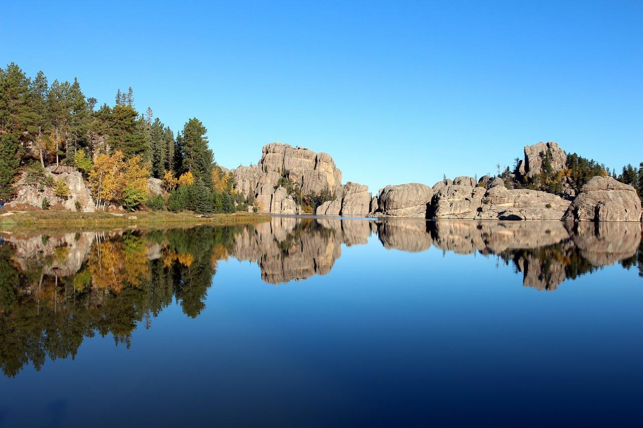
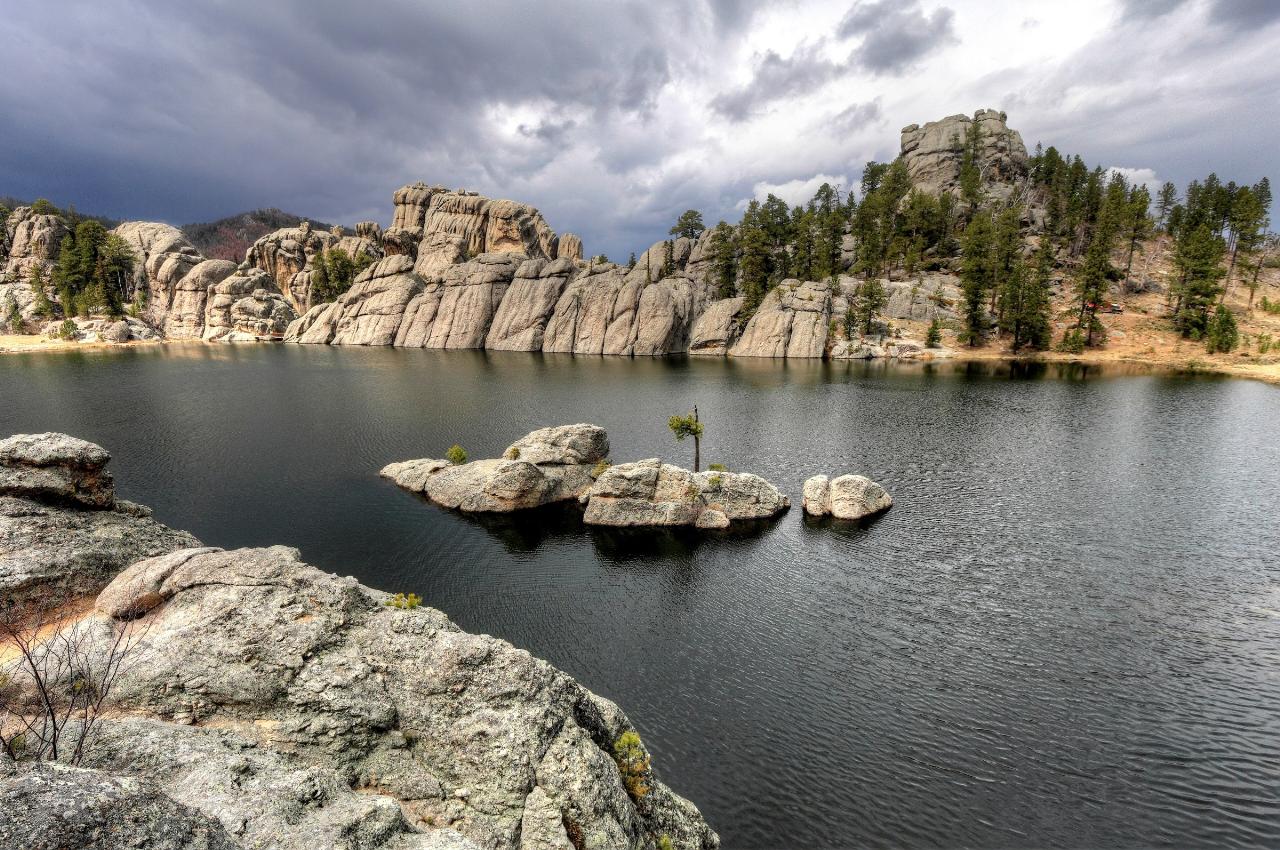
Sylvan Lake sits at 6,145 feet in the northwest corner of Custer State Park, roughly six miles northeast of the town of Custer in the Black Hills. It is small water, about 17 acres with a mile of shoreline and a maximum depth near 30 feet, but it is almost certainly the most photographed lake in South Dakota. The reason is the rock. Fins and slabs of Precambrian granite rise straight out of the surface along the north and west sides, some of them tall enough to swim under in shadow, and the lake bends around and between them instead of sitting in an open bowl. (Some listings file this lake under a place label of East Custer. That comes from old geotagged photo metadata, not from a real town.)
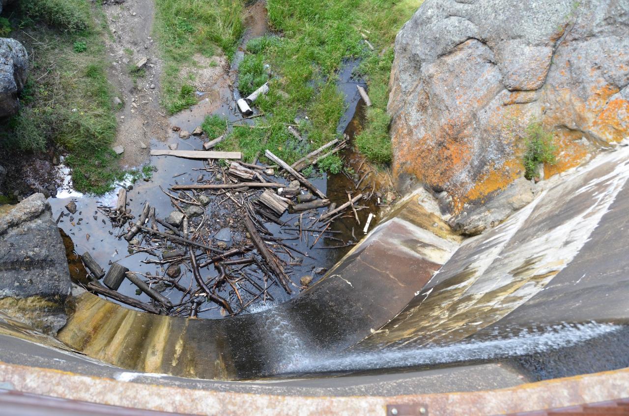
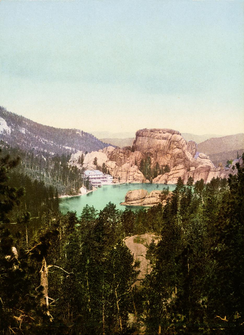
The lake is man made. Theodore Reder dammed Sunday Gulch here in 1881, and the low dam at the west end is still the outlet, with the creek dropping away below it into the gulch. Reder's wife Elizabeth designed a hotel on the shore in 1893. It burned on 30 June 1935. The park board approached Frank Lloyd Wright about a replacement, lost patience with him, and hired Sioux Falls architect Harold Spitznagel instead. The Sylvan Lake Lodge finished in 1937 with Public Works Administration money still stands above the south shore.
Getting in costs money, and the charge is not for the swimming. South Dakota Game, Fish and Parks requires a park entrance license on every motorized vehicle, bought at an entrance gate before you park. The ordinary daily license is not sold at Custer State Park at all, so most visitors end up with the Custer State Park temporary license at 25 dollars per vehicle, good for seven days and expiring at 6 p.m. on the seventh day. An annual license is 40 dollars per vehicle for South Dakota residents and 60 for nonresidents. Buses pay 4 dollars per person. There is no separate beach fee.
Two roads reach the lake. Needles Highway (State Highway 87) climbs in from the east, finished in 1922 under Peter Norbeck, and threads three tunnels blasted through granite on the way, which is why it closes for the winter. Highway 89 comes up from Custer to the south and stays open. Parking is the real constraint in July and August. The day use lot on the east shore is the busiest single spot in the park and it fills by mid morning, so arrive before nine or come back after five rather than circling.
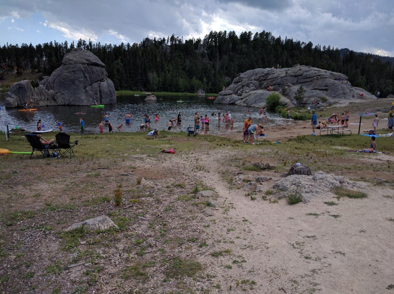
The swimming beach is a strip of sand on the east shore, reached over a footbridge from the day use area. Entry is gradual and shallow at first, which suits small children, then the bottom falls away. Nobody lifeguards it. Jumping or diving from the surrounding rock formations is prohibited, and the granite is slick where it meets the water. At this elevation the lake warms slowly, stays genuinely cold well into June, and is at its most comfortable from mid July through late August before cooling off fast in September. Afternoon thunderstorms build over the Black Hills in summer, so watch the sky and get out early rather than late.
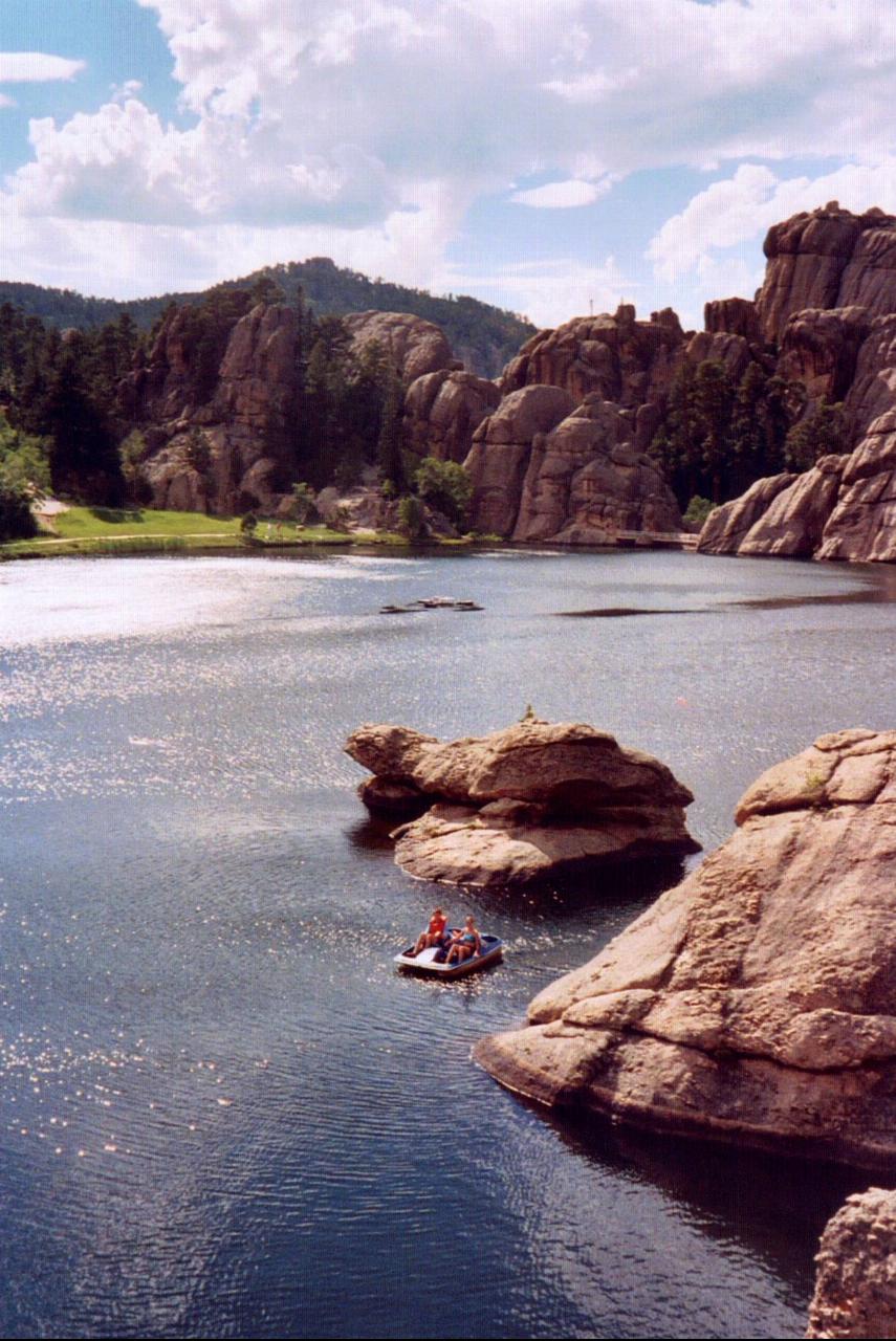
Around the lake there is a good deal more. The Lake Shore Trail is a one mile easy loop right at the water. Sunday Gulch Trail drops behind the dam for a strenuous 2.8 mile loop with handrails bolted into the rock in the steep sections. Trail 9, the shortest and most travelled route to Black Elk Peak at 7,242 feet, starts just across the footbridge by the swimming beach and runs 3.3 miles one way. Kayaks, canoes and paddleboats rent from the boathouse, there is a general store, and Sylvan Lake Campground, the highest in Custer State Park, sits a short distance south.
More Information
Campgrounds in Custer State Park | South Dakota Game, Fish, and Parks
Hunting, Fishing or Camping in South Dakota? The South Dakota Game, Fish and Parks
https://gfp.sd.gov/csp-campgrounds/Custer State Park | South Dakota Game, Fish, and Parks
Hunting, Fishing or Camping in South Dakota? The South Dakota Game, Fish and Parks
https://gfp.sd.gov/parks/detail/custer-state-park/Home | Black Hills National Forest | Forest Service
Described as an “Island in the Plains,” the multiple-use Black Hills National Forest has an activity for everyone.
https://www.fs.usda.gov/r02/blackhillsLearn more about Custer State Park and start planning your South Dakota adventure. | South Dakota Ga
Hunting, Fishing or Camping in South Dakota? The South Dakota Game, Fish and Parks
https://gfp.sd.gov/custer-state-park/Park Entrance License | South Dakota Game, Fish, and Parks
Hunting, Fishing or Camping in South Dakota? The South Dakota Game, Fish and Parks
https://gfp.sd.gov/pel/Be courteous, informed, and prepared. Read trailhead guidelines, stay on the trail, and don't feed the wildlife.
Read More
- Plan Ahead and Prepare
- Travel & camp on durable surfaces
- Dispose of waste properly
- Leave what you find
- Minimize campfire impacts
- Respect wildlife
- Be considerate of other visitors
Directions
From Custer
- Head east on US-16A E/
Custer St/ Mt Rushmore Rd toward Custer St/ Mt Rushmore Rd (0.7 mi) - Turn left onto SD-89 N (6.0 mi)
- Turn right onto SD-87 S (0.3 mi)
- Turn left (0.2 mi)
 Granite fins rising straight out of Sylvan Lake in Custer State Park. courtesy of Pahcal123↗ (CC BY-SA 4.0↗)
 Swimmers in the shallows at Sylvan Lake in the Black Hills. courtesy of Runner1928↗ (CC BY-SA 4.0↗)
 The rock wall bordering the northeast side of the lake. courtesy of Epsota24↗ (CC BY-SA 3.0↗)
 Looking down from the Sylvan Lake dam to Sunday Gulch Creek below. courtesy of Wusel007↗ (CC0↗)
 A rental paddleboat working between the granite outcrops. courtesy of Runner1928 at English Wikipedia↗ (CC BY-SA 3.0↗)
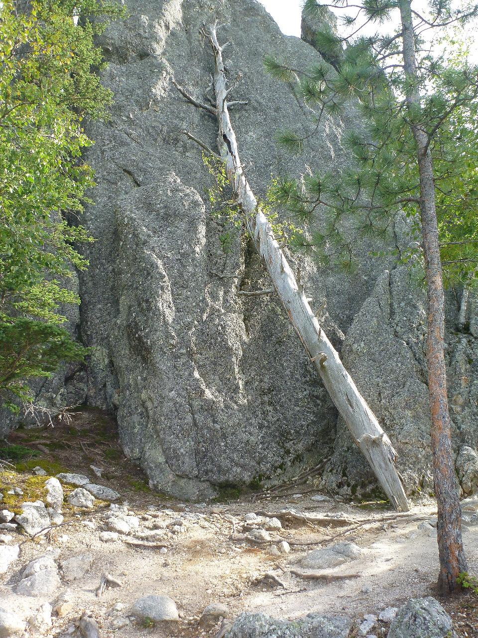
 An old dead tree leaning against rock on the Sylvan Lake shoreline. courtesy of Wusel007↗ (CC BY-SA 4.0↗)
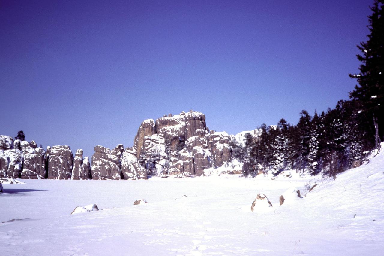
 Sylvan Lake in winter, showing the Precambrian granite that forms its rim. courtesy of Dexter Perkins↗ (CC0↗)
 The original Sylvan Lake Hotel photographed in 1901, thirty-four years before it burned. courtesy of Detroit Publishing Co.↗ (Public domain↗)
Other Swimming Holes, Hiking Trails, Canoeing Areas, and Kayaking Areas Nearby

Horsethief Lake
Keystone, South Dakota
5.2 miles NETowering ponderosa and lodgepole pines frame this Black Hills campground just two miles from Mount Rushmore and steps from the shores of Horsethief Lake.
Camp, Canoe, Swim
Stockade Lake
Custer
6.0 miles SECuster State Park's largest lake has a designated swim beach on its east shore along Stockade Lake Drive. No lifeguards, and a park entrance license ($25 per vehicle for 1-7 days) is required.
Camp, Canoe, Hike, Kayak, Swim
Sheridan Lake North Swim Beach
Hill City
10.2 miles NESandy Forest Service swim beach on the north shore of Sheridan Lake in the Black Hills National Forest, next to the marina and picnic area, about 6 miles from Hill City. Per-vehicle day-use fee.
Camp, Canoe, Hike, Kayak, Swim
Rapid City Area
Lugos, Aquitaine Limousin Poitou-Charentes
19.8 miles NESwim near Lugos, Aquitaine Limousin Poitou-Charentes
SwimNearby Campsites
Horsethief Lake
Keystone, South Dakota
5.2 miles NETowering ponderosa and lodgepole pines frame this Black Hills campground just two miles from Mount Rushmore and steps from the shores of Horsethief Lake.
Camp, Canoe, Swim
Stockade Lake
Custer
6.0 miles SECuster State Park's largest lake has a designated swim beach on its east shore along Stockade Lake Drive. No lifeguards, and a park entrance license ($25 per vehicle for 1-7 days) is required.
Camp, Canoe, Hike, Kayak, Swim
Sheridan Lake North Swim Beach
Hill City
10.2 miles NESandy Forest Service swim beach on the north shore of Sheridan Lake in the Black Hills National Forest, next to the marina and picnic area, about 6 miles from Hill City. Per-vehicle day-use fee.
Camp, Canoe, Hike, Kayak, Swim


