Trail of Tears State Park
Jackson
Camp, Canoe, Hike, and Swim
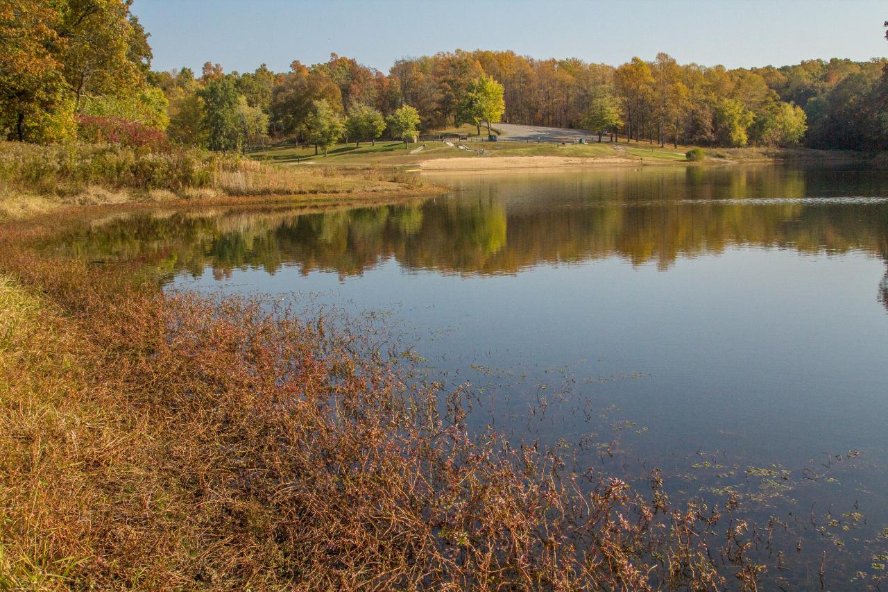
Trail of Tears State Park is a Missouri state park on the bluffs above the Mississippi River in Cape Girardeau County, run by the Missouri Department of Natural Resources' Division of State Parks. The swimming spot is the designated sand beach on Lake Boutin, a small dammed lake in a wooded hollow inside the park. State pages put the lake at anywhere from 15 to 24 acres. It is named for Charles Boutin, who sat on the State Park Board in the 1950s, and it is a long-time summer favorite for families from Jackson and Cape Girardeau.
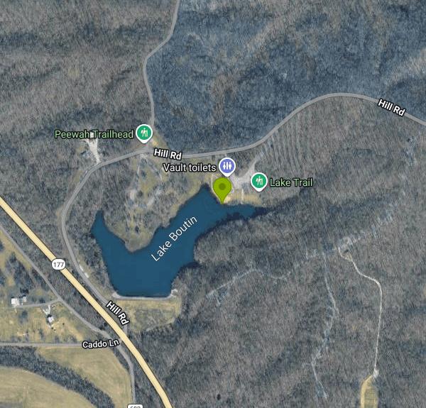
The park's mailing address is 429 Moccasin Springs, Jackson, MO 63755, and the beach sits on the north shore of the lake. Park in the beach lot; a paved, accessible ramp and sidewalk run from the lot down to the sand, and there is a restroom and changing building beside the beach. The park office is at 573-290-5284 and the visitor center is at 573-290-5268.
The swim area is a roped section off the sand beach. The rest of the lake is deep (the park superintendent described it as about 25 feet deep in 1996) and its bottom holds old fishing line, hooks and sunken brush, which is why swimming outside the buoys is prohibited. Two people drowned in roughly 10 feet of water in the 1990s, one of them outside the marked area. There are no lifeguards and the state's own wording is swim at your own risk, so keep children close. The lake was drawn down and closed to swimmers in 2008 after a 12-inch rain stressed the dam; the dam was lowered and strengthened, the beach was regraded with new sand and a gentler slope, and swimming returned in 2011.
Admission is free. Missouri charges no entrance or day-use fee at any state park, so the beach costs nothing; only camping and a few tours carry fees. Park grounds are open 7 a.m. to 10 p.m. from April through October and 7 a.m. to 6 p.m. from November through March. The beach runs only in the summer swim season. As of early October 2026 the state lists it as closed for the season, so check the park's hours page before planning a swim.
Water quality is tested by the state. The Department of Natural Resources samples every designated state park beach weekly from Memorial Day weekend to Labor Day weekend and posts signs advising against swimming when E. coli levels run high, which usually follows heavy rain. Results are on the department's beaches page. Only electric trolling motors are allowed on Lake Boutin, so boat traffic near the beach is light, and anglers fish the lake for bass, bluegill, crappie and catfish.
There is plenty to do once you're dry. The visitor center covers the 1838-1839 forced removal of the Cherokee, part of which crossed the Mississippi here, along with the area's natural history. The trails include the 9-mile Peewah Trail through the Indian Creek Wild Area, the Lake Trail around Boutin's shoreline, and a short climb to an overlook above the river. The Lake Boutin Campground offers basic sites from May through October, and the Mississippi River Campground has electric and full-hookup sites year-round.
More Information
Be courteous, informed, and prepared. Read trailhead guidelines, stay on the trail, and don't feed the wildlife.
Read More
- Plan Ahead and Prepare
- Travel & camp on durable surfaces
- Dispose of waste properly
- Leave what you find
- Minimize campfire impacts
- Respect wildlife
- Be considerate of other visitors
Directions
From Jackson
- Head south on State St toward E Pascagoula St (377 ft)
- Turn left onto E Pascagoula St (0.6 mi)
- Merge onto I-55 N via the ramp to Grenada/
Memphis Entering Tennessee(202 mi) - Take the exit on the left to stay on I-55 N toward St LouisEntering Arkansas(13.7 mi)
- Keep right to stay on I-55 N, follow signs for Blytheville (7.9 mi)
- Continue onto US-61 N/
US-78 (6.8 mi) - Continue onto I-55 NEntering Missouri(156 mi)
- Take exit 105 for US-61 toward Fruitland/
Jackson (0.2 mi) - Turn right onto US-61 NPass by Casey's (on the left in 0.8 mi)(0.9 mi)
- Turn right onto MO-177 S (7.4 mi)
- Turn right to stay on MO-177 S (2.9 mi)
- Turn left onto Caddo Ln/
Hill Rd Continue to follow Hill Rd(0.6 mi) - Turn right (295 ft)