


Union Village Dam Recreation Area
Thetford Center
Hike and Swim
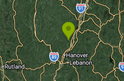
Union Village Dam Recreation Area is the public land around Union Village Dam, a U.S. Army Corps of Engineers flood control dam on the Ompompanoosuc River in Thetford, Vermont. The Corps finished the earthen dam in 1950 and manages several thousand acres of river corridor, woods and fields upstream of it. The swimming spot is Sandy Beach, a small sand beach on an inside bend of the river about half a mile south of Thetford Center. The dam only holds water back during floods, so what you swim in here is the free-flowing river, not a lake.
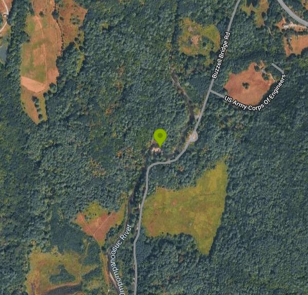
To reach the beach, take VT Route 113 to Thetford Center (it's a few miles west of I-91 exit 14) and turn south onto Buzzell Bridge Road, the Corps' east access road. Sandy Beach has its own sign and a dirt parking lot on the right about half a mile in, a short walk from the sand. The road keeps going south through the project to more picnic areas, the dam and the main day-use area on Main Street in Union Village. That southern end has the group pavilion, a playground, a sand volleyball court and flush toilets. The sand beach is up at the north end, so start from Thetford Center if you came to swim.
The beach faces a wide, slow pool. A 2016 Valley News guide to Upper Valley swimming holes called it calm enough to pass for a pond and big enough to swim laps. You walk in from sand, and no one publishes depth soundings for the pool. The Ompompanoosuc runs cold well into summer, and temperature and depth both change with rainfall, so wade in first and check the depth before you jump. There are no lifeguards. The Corps posts the rules at the site: swim at your own risk, keep pets on a 6-foot leash, and no pets on the beach. Portable toilets are put out at the beach area during the season.
There's no entrance fee. The Corps says fees apply to some facilities at the dam, but it lists no charge for swimming or for parking, and the beach lots are mapped as free. The Corps doesn't publish beach hours on Recreation.gov. OpenStreetMap data has vehicle access on Buzzell Bridge Road open roughly 8 a.m. to 8 p.m. from Memorial Day weekend to Labor Day weekend, so call the project office at (802) 649-1606 to confirm before a trip outside that window.
Union Village Dam is a flood control site, and the Corps warns the area can close when severe storms bring flooding. Heavy rain makes the river fast and muddy within hours. After a July 2017 storm dropped about 4.5 inches of rain, the Corps closed Buzzell Bridge Road for the rest of that season and asked people not to walk, bike or swim in the damaged area. Stay out after big storms. About 0.6 miles downstream are the Chutes, where the river pours over ledges and a short drop. It's a popular jumping spot, but the current there is much stronger than at Sandy Beach, and a sign there has prohibited nude bathing.
The rest of the project is good for an afternoon off the beach. The Corps lists more than a mile of trails, and the Thetford Trails Team maintains a larger network of walking, biking and skiing trails around the dam. In September 2026 the group bought a 93-acre parcel at the center of that network. Anglers fish the river for stocked brown and rainbow trout and for wild brook trout.
More Information
Ompompanoosuc River - Wikipedia
From Wikipedia, the free encyclopedia
https://en.wikipedia.org/wiki/Ompompanoosuc_RiverSummer Is For Swimming: A Guide to Upper Valley Swimming Holes - Valley News
The Upper Valley in summer is a paradise for fresh water swimmers. Fresh water — lots of it — flows everywhere: the Connecticut River, the White River, the Ompompanoosuc, the Ottauquechee, Trues Brook, Silver Lake, Canaan Street Lake, Storrs…
https://vnews.com/2016/07/22/summer-guide-upper-valley-swimming-holes-2637291/Thetford Trails Team buys 93 acres at Union Village Dam - Valley News
The Thetford Trails Team purchased a 93-acre parcel at the Union Village Dam trail network for $50,000 thanks to community donations.
https://vnews.com/2026/10/05/thetford-trails-team-purchases-land/Union Village Dam - Camping | Vermont | Recreation.gov
Reserve camping, permits & activities at Union Village Dam, Vermont. 1 campgrounds. Book official reservations on Recreation.gov.
https://www.recreation.gov/gateways/226Union Village Dam Picnic Area (VT), Union Village Dam - Recreation.gov
Explore Union Village Dam Picnic Area (VT) in Union Village Dam, Vermont with Recreation.gov. Union Village Dam is a US Army Corps of Engineers facility located on the Ompompanoosuc River in Thetford, VT. Close to the towns of Hanover, New Hampshire, and
https://www.recreation.gov/camping/poi/251045Union Village Dam to Remain Closed - Valley News
Thetford — A popular access point to the Union Village Dam will remain closed for the rest of the recreational season, the U.S. Army Corps of Engineers said this week.Because of damage caused by 4.5 inches of rain that pummeled the area on July 1,…
https://vnews.com/2017/07/22/union-village-dam-swimming-access-closed-11418387/Be courteous, informed, and prepared. Read trailhead guidelines, stay on the trail, and don't feed the wildlife.
Read More
- Plan Ahead and Prepare
- Travel & camp on durable surfaces
- Dispose of waste properly
- Leave what you find
- Minimize campfire impacts
- Respect wildlife
- Be considerate of other visitors
Directions
From Thetford Center
- Head west toward Panther Wy (371 ft)
- Turn left onto Panther WyRestricted usage road(0.1 mi)
- Turn left onto Academy Rd (0.3 mi)
- Turn left onto VT-113 W (1.1 mi)
- Turn left onto Buzzell Bridge RdRestricted usage road(0.4 mi)
- Continue straightRestricted usage roadDestination will be on the right(463 ft)
Other Swimming Holes and Hiking Trails Nearby

Sculptured Rocks
Hebron, New Hampshire
21.3 miles ESwim near Hebron, New Hampshire
Swim
Swiftwater Bridge
Bath, New Hampshire
26.1 miles NESwim near Bath, New Hampshire
Swim
Weare
Bath, New Hampshire
26.1 miles NESwimmable river pools up to 4 feet deep along a Weare, New Hampshire roadside, including a 30-foot-wide section with a rope swing — rocky terrain means caution is advised, especially for small children.
Swim
Horseshoe Falls
Lincoln, New Hampshire
35.9 miles NECLOSED. Private Property. Closed to the public due to vandalism. Please take better care of areas we're permitted to use.
Swim
Falling Waters
Lincoln, New Hampshire
35.9 miles NESwim near Lincoln, New Hampshire
Swim
Lincoln Area
Lincoln, New Hampshire
35.9 miles NEA cluster of swimming options near the busy tourist town of Lincoln, New Hampshire — some spots clothing-optional; see local listings for details.
Swim
Kancamagus Area
Lincoln, New Hampshire
38.7 miles NESwim near Lincoln, New Hampshire
Swim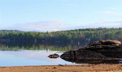
Waukewan Beach
Meredith
39.1 miles EMeredith's free town beach on Lake Waukewan, with about 20 parking spots and no resident sticker required, unlike Leavitt Beach across town. Because the lake is Meredith's drinking water supply, swimming is fine but flotation devices, pets in the water an
Canoe, Kayak, Swim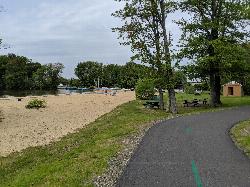
Bartlett Beach
Laconia
44.0 miles SEFree city beach on the north shore of Lake Winnisquam in Laconia, with a sandy swim area, free parking, a playground and the WOW Trail running through. No lifeguards, so swim at your own risk.
Swim
Sawyer Area
Hinsdale, New Hampshire
48.7 miles ESwim near Hinsdale, New Hampshire
SwimNearby Campsites

Maple Haven Campground
Woodstock, New Hampshire
27.4 miles NEA private 28-acre campground tucked in the heart of New Hampshire's White Mountains with breathtaking views, untouched nature, and both indoor and outdoor camping options.
Camp
Squam Lake Camping
Center Harbor, New Hampshire
37.4 miles EA conservation organization that maintains over 50 miles of hiking trails around the Squam Lakes in New Hampshire, with camping available on Moon and Bowman Islands.
Camp, Canoe, Kayak


