


Bucket List by figment
first prev 1 next last
1 locations
Add Location
0.2-9.7 mi
 Full Listing
Hike, Horseback, Mountain Bike
Added on 28 Feb 2022
Full Listing
Hike, Horseback, Mountain Bike
Added on 28 Feb 2022
City Creek
Pocatello, Idaho
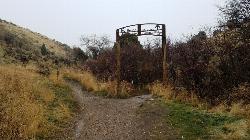
1.3 miles S of Pocatello, IdahoThe City Creek Management Area (CCMA) Trail System is a vast network of trails maintained by the City of Pocatello. There are trails to go up and others to come down. Most trails come back to the parking lot, making it much like a ski-hill setup, only without the lift and expense.
Trails
- City Creek Trail: (2.75 miles)
Main single track trail which meanders along City Creek. Total elevation gain for the Trail is 930 feet. - Lower City Creek Trail: (1.21 miles)
Lower portion of the City Creek Trail from the Grant Street Parking Lot to Bridge 10. Some rocks and obstacles are present as well as a few small steep grades. This section recommended as a Biker-One-Way-Uphill from bridge 1 to bridge 10. Use special caution at bridges 7, 8,& 9. - Upper City Creek Trail: (1.54 miles)
Upper portion of the City Creek Trail from Bridge 10 to the connection to Kinport Road. Some rocks, roots and obstacles are present as well as a few steep grades. Use caution for the hill section between bridges 10 & 11. - 911 & Lifeflight: (0.76 miles)
911 is a downhill only, classic CCMA roller coaster ride for skilled bikers. The adjacent Lifeflight trail is an escape route for 911, is less challenging, and bi-directional. - Bench Trail: (1.21 miles)
Alternate to the “up the gut” section of the City Creek Trail, this trail can be rocky and rutty. - Black Cairn: (1.37 miles)
Fast single track leading from the top of the Outlaw Trail towards the “old dairy”. Check your brakes! - Bump Trail: (0.65 miles)
Main single track connector to Cusick Creek. - Burrito: (0.71 miles)
Single track “side loop” around Death Valley. - Cusick Creek Road: (3.72 miles)
This is an alternate route to Kinport Peak, although the upper reach is very rocky and technical. Only the lower 2.13 mile section is within the CCMA. - Death Valley: (1.08 miles)
Challenging single track up a small ravine. - City Creek/Kinport Road: (5.38 miles)
The longest road/trail in the CCMA which accesses Kinport Peak. Only the lower 3.4 mile stretch is within the CCMA. - The Grove: (0.90 miles)
This serpentine, technical single track travels through an aspen grove and is a great alternative to the North Fork road for hikers/bikers. - Lichen: (0.39 miles)
Anice single track for hiking and biking, this trail winds through a shallow draw filled with flowers. - Mushroom: (0.87 miles)
Tough, single track alternative to the last mile of the Upper City Creek Trail. - North Fork: (1.92 miles)
Main motorized route north of City Creek. The majority of this route travels through BLM land which begins a short distance east of the cattle guard crossing. - Over the Top: (3.77 miles)
Challenging climb with switchbacks and views. - Prison Trail: (0.69 miles)
One of the original biking “loops”, this single track provides the most direct access to Cusick Creek via the Bump Trail. Although most of the trail is easy, watch for the steep section through Death Valley. - Serengeti: (1.23 miles)
This combination of single and double track provides motorized access to the southern portion of the CCMA. Tread lightly here as it travels through sensitive wildlife habitat. The length of South Serengeti is approximately 1.18 miles. - Sullivan’s: (1.20 miles)
Arguably the CCMA’s most scenic trail, this carefully carved, technical single track connects Serengeti to Mushroom and the main City Creek Trail. - Switchback: (1.55 miles)
This great climbing run connects Black Cairn to - White Cairn: (1.43 miles)
White Cairn: Fun, single track connector to Bridge 11.
City of Pocatello CCMA Trail Maps
- CCMA Trail Map (PDF) - Basic map with trail key (8 1/2 x 11)
- Alternative Satellite CCMA Trail Map (PDF) - Basic map with trail key (8 1/2 x 11)
- CCMA Trail Map Brochure (PDF) - Map with major trail descriptions and CCMA facts, trail designations and hints on how to get the most out of your trail experience (8 1/2 x 14)


